Fairway elevation
Fairway (Kansas, Johnson County), United States elevation is 297 meters and Fairway elevation in feet is 974 ft above sea level [src 1]. Fairway is a populated place (feature code) with elevation that is 18 meters (59 ft) bigger than average city elevation in United States.
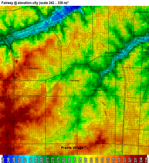
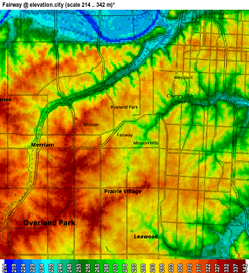
Below is the Elevation map of Fairway, which displays elevation range with different colors. Scale of the first map is from 242 to 338 m (794 to 1109 ft) with average elevation of 298.3 meters (=979 ft) [note 1]
These maps also provides idea of topography and contour of this city, they are displayed at different zoom levels. More info about maps, scale and edge coordinates you can find below images.
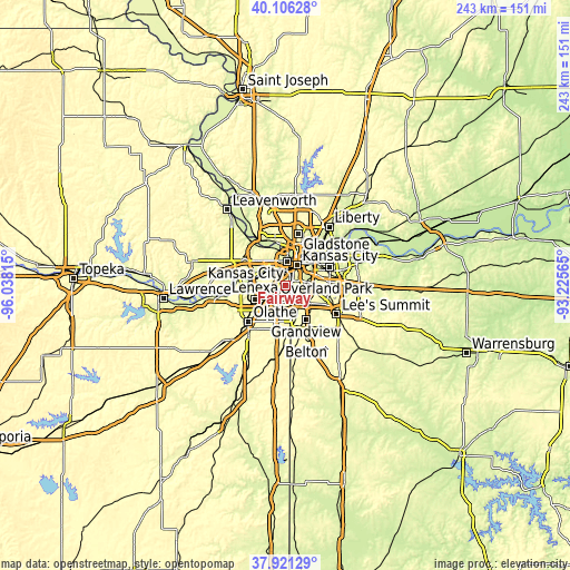
| \ | Map #1 | Map #2 | Topo.Map |
| Scale [m] | 242..338 m | 214..342 m | × |
| Scale [ft] | 794..1109 ft | 702..1122 ft | × |
| Average | 298.3 m = 979 ft | 288.9 m = 948 ft | × |
| Width | 7.59 km = 4.7 mi | 15.18 km = 9.4 mi | 242.9 km = 150.9 mi |
| Height | 7.59 km = 4.7 mi | 15.18 km = 9.4 mi | 242.9 km = 150.9 mi |
| ↑Max Latitude | 39.056363° | 39.090479° | 40.10628° |
| Latitude at center | 39.02223° | 39.02223° | 39.02223° |
| ↓Min Latitude | 38.988081° | 38.953915° | 37.92129° |
| ← Min Longitude | -94.675845° | -94.719791° | -96.03815° |
| Longitude center | -94.6319° | -94.6319° | -94.6319° |
| →Max Longitude | -94.587955° | -94.544009° | -93.22565° |
Nearby cities:
Cities around Fairway sort by population:
• Kansas City elevation 290 m
9.8 km,  28°
28°
• Overland Park 335 m
5.6 km,  217°
217°
• Kansas City 272 m
10.2 km,  2°
2°
• Shawnee 328 m
7.9 km,  285°
285°
• Lenexa 318 m
11.6 km,  229°
229°
• Leawood 293 m
6.3 km,  168°
168°
• Prairie Village 304 m
3.4 km,  182°
182°
• Merriam 279 m
5.3 km,  271°
271°
• Mission 315 m
2.2 km, 286°
• Roeland Park 308 m
1.7 km,  359°
359°
• Mission Hills 293 m
1.4 km,  110°
110°
• Westwood 294 m
2.4 km, 32°
Multilingual:
 En español:
Fairway elevación 297 m.
 En France:
Fairway élévation 297 m.


Sources and notes:
- [note 1] Map square and city borders are not equal. Map elevation data is calculated only from area inside that square.
- [src 1] Elevation data from geonames database provided with same terms of usage.
- [src 2] The elevation map of Fairway is generated using elevation data from NASA's 3 arcsec (90m) resolution SRTM data.
- [src 3] Base (background) map © OpenStreetMap contributors tiles are generated by Geofabrik and OpenTopoMap.
Copyright & License:
This Fairway Elevation Map is licensed under CC BY-SA. You may reuse any part from this page, if you give a proper credit by linking to this URL:
 More info on terms of use page.