Beech Grove elevation
Beech Grove (Indiana, Marion County), United States elevation is 246 meters and Beech Grove elevation in feet is 807 ft above sea level [src 1]. Beech Grove is a populated place (feature code) with elevation that is 33 meters (108 ft) smaller than average city elevation in United States.
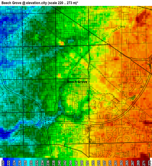
Below is the Elevation map of Beech Grove, which displays elevation range with different colors. Scale of the first map is from 220 to 273 m (722 to 896 ft) with average elevation of 246 meters (=807 ft) [note 1]
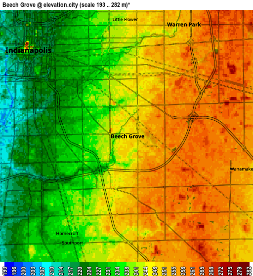
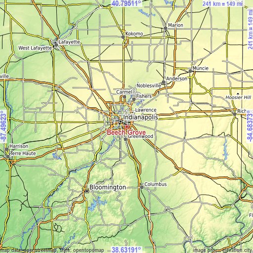
These maps also provides idea of topography and contour of this city, they are displayed at different zoom levels. More info about maps, scale and edge coordinates you can find below images.
| \ | Map #1 | Map #2 | Topo.Map |
| Scale [m] | 220..273 m | 193..282 m | × |
| Scale [ft] | 722..896 ft | 633..925 ft | × |
| Average | 246 m = 807 ft | 243.5 m = 799 ft | × |
| Width | 7.52 km = 4.7 mi | 15.03 km = 9.3 mi | 240.5 km = 149.4 mi |
| Height | 7.52 km = 4.7 mi | 15.03 km = 9.3 mi | 240.5 km = 149.4 mi |
| ↑Max Latitude | 39.755782° | 39.789558° | 40.79511° |
| Latitude at center | 39.72199° | 39.72199° | 39.72199° |
| ↓Min Latitude | 39.688181° | 39.654355° | 38.63191° |
| ← Min Longitude | -86.133925° | -86.177871° | -87.49623° |
| Longitude center | -86.08998° | -86.08998° | -86.08998° |
| →Max Longitude | -86.046035° | -86.002089° | -84.68373° |
Nearby cities:
Cities around Beech Grove sort by population:
• Indianapolis elevation 248 m
7.8 km,  311°
311°
• Greenwood 246 m
12.1 km,  186°
186°
• Lawrence 266 m
14.1 km,  23°
23°
• Broad Ripple 222 m
16.7 km,  344°
344°
• Speedway 231 m
17.6 km,  300°
300°
• New Whiteland 245 m
18.2 km,  181°
181°
• Cumberland 263 m
12.8 km,  62°
62°
• Whiteland 243 m
19.1 km, 177°
• New Palestine 258 m
17.2 km,  90°
90°
• Southport 230 m
7.1 km,  207°
207°
• Meridian Hills 246 m
19.5 km, 342°
• Warren Park 254 m
7.5 km,  26°
26°
Multilingual:
 En español:
Beech Grove elevación 246 m.
 En France:
Beech Grove élévation 246 m.
 Auf Deutsch:
Beech Grove höhe über dem Meeresspiegel ist 246 m.

Sources and notes:
- [note 1] Map square and city borders are not equal. Map elevation data is calculated only from area inside that square.
- [src 1] Elevation data from geonames database provided with same terms of usage.
- [src 2] The elevation map of Beech Grove is generated using elevation data from NASA's 3 arcsec (90m) resolution SRTM data.
- [src 3] Base (background) map © OpenStreetMap contributors tiles are generated by Geofabrik and OpenTopoMap.
Copyright & License:
This Beech Grove Elevation Map is licensed under CC BY-SA. You may reuse any part from this page, if you give a proper credit by linking to this URL:
 More info on terms of use page.