Herrin elevation
Herrin (Illinois, Williamson County), United States elevation is 127 meters and Herrin elevation in feet is 417 ft above sea level [src 1]. Herrin is a populated place (feature code) with elevation that is 152 meters (499 ft) smaller than average city elevation in United States.
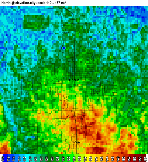
Below is the Elevation map of Herrin, which displays elevation range with different colors. Scale of the first map is from 110 to 157 m (361 to 515 ft) with average elevation of 127.2 meters (=417 ft) [note 1]
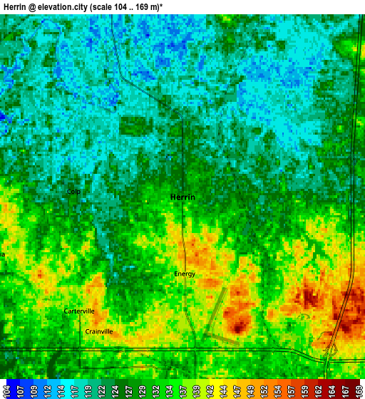
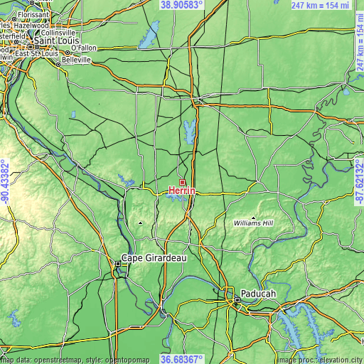
These maps also provides idea of topography and contour of this city, they are displayed at different zoom levels. More info about maps, scale and edge coordinates you can find below images.
| \ | Map #1 | Map #2 | Topo.Map |
| Scale [m] | 110..157 m | 104..169 m | × |
| Scale [ft] | 361..515 ft | 341..554 ft | × |
| Average | 127.2 m = 417 ft | 127.7 m = 419 ft | × |
| Width | 7.72 km = 4.8 mi | 15.44 km = 9.6 mi | 247.1 km = 153.5 mi |
| Height | 7.72 km = 4.8 mi | 15.44 km = 9.6 mi | 247.1 km = 153.5 mi |
| ↑Max Latitude | 37.837824° | 37.872522° | 38.90583° |
| Latitude at center | 37.80311° | 37.80311° | 37.80311° |
| ↓Min Latitude | 37.76838° | 37.733633° | 36.68367° |
| ← Min Longitude | -89.071515° | -89.115461° | -90.43382° |
| Longitude center | -89.02757° | -89.02757° | -89.02757° |
| →Max Longitude | -88.983625° | -88.939679° | -87.62132° |
Nearby cities:
Cities around Herrin sort by population:
• Carbondale elevation 128 m
18.6 km,  243°
243°
• Marion 128 m
11.6 km,  134°
134°
• West Frankfort 123 m
13.5 km,  38°
38°
• Carterville 140 m
6.5 km,  222°
222°
• Johnston City 133 m
9 km,  77°
77°
• Christopher 131 m
19 km,  353°
353°
• Zeigler 128 m
10.9 km, 348°
• De Soto 122 m
17.7 km,  275°
275°
• Crainville 143 m
6.7 km,  211°
211°
• Cambria 129 m
8.4 km,  253°
253°
• Energy 142 m
3.2 km,  178°
178°
• Royalton 120 m
11.2 km,  317°
317°
Multilingual:
 En español:
Herrin elevación 127 m.
 En France:
Herrin élévation 127 m.


Sources and notes:
- [note 1] Map square and city borders are not equal. Map elevation data is calculated only from area inside that square.
- [src 1] Elevation data from geonames database provided with same terms of usage.
- [src 2] The elevation map of Herrin is generated using elevation data from NASA's 3 arcsec (90m) resolution SRTM data.
- [src 3] Base (background) map © OpenStreetMap contributors tiles are generated by Geofabrik and OpenTopoMap.
Copyright & License:
This Herrin Elevation Map is licensed under CC BY-SA. You may reuse any part from this page, if you give a proper credit by linking to this URL:
 More info on terms of use page.