Harrisburg elevation
Harrisburg (Illinois, Saline County), United States elevation is 122 meters and Harrisburg elevation in feet is 400 ft above sea level [src 1]. Harrisburg is a seat of a second-order administrative division (feature code) with elevation that is 157 meters (515 ft) smaller than average city elevation in United States.
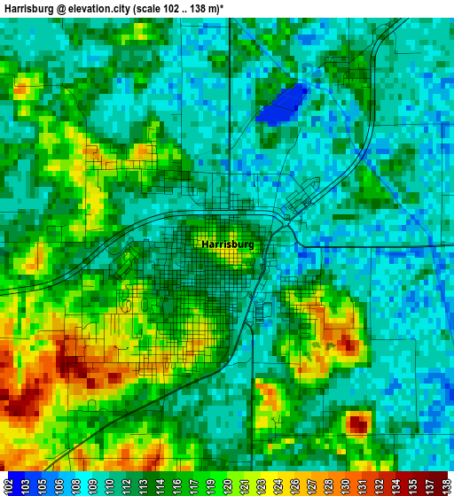
Below is the Elevation map of Harrisburg, which displays elevation range with different colors. Scale of the first map is from 102 to 138 m (335 to 453 ft) with average elevation of 113.9 meters (=374 ft) [note 1]
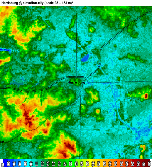
These maps also provides idea of topography and contour of this city, they are displayed at different zoom levels. More info about maps, scale and edge coordinates you can find below images.
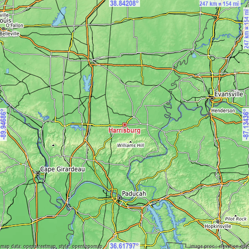
| \ | Map #1 | Map #2 | Topo.Map |
| Scale [m] | 102..138 m | 98..153 m | × |
| Scale [ft] | 335..453 ft | 322..502 ft | × |
| Average | 113.9 m = 374 ft | 115.9 m = 380 ft | × |
| Width | 7.73 km = 4.8 mi | 15.46 km = 9.6 mi | 247.3 km = 153.7 mi |
| Height | 7.73 km = 4.8 mi | 15.46 km = 9.6 mi | 247.3 km = 153.7 mi |
| ↑Max Latitude | 37.773124° | 37.807852° | 38.84208° |
| Latitude at center | 37.73838° | 37.73838° | 37.73838° |
| ↓Min Latitude | 37.703619° | 37.668842° | 36.61797° |
| ← Min Longitude | -88.584555° | -88.628501° | -89.94686° |
| Longitude center | -88.54061° | -88.54061° | -88.54061° |
| →Max Longitude | -88.496665° | -88.452719° | -87.13436° |
Nearby cities:
Cities around Harrisburg sort by population:
• Marion elevation 128 m
34.5 km,  268°
268°
• West Frankfort 123 m
38.6 km,  297°
297°
• Eldorado 118 m
12.3 km,  47°
47°
• Johnston City 133 m
35.2 km,  285°
285°
• McLeansboro 150 m
39.5 km,  0°
0°
• Carrier Mills 122 m
10.1 km,  233°
233°
• Norris City 129 m
32.8 km,  34°
34°
• Shawneetown 120 m
31.3 km,  95°
95°
• Energy 142 m
42.9 km,  275°
275°
• Rosiclare 111 m
39 km,  153°
153°
• Golconda 108 m
41.5 km,  173°
173°
• Elizabethtown 111 m
38.6 km, 147°
Multilingual:
 En español:
Harrisburg elevación 122 m.
 En France:
Harrisburg élévation 122 m.
 Auf Deutsch:
Harrisburg höhe über dem Meeresspiegel ist 122 m.

Sources and notes:
- [note 1] Map square and city borders are not equal. Map elevation data is calculated only from area inside that square.
- [src 1] Elevation data from geonames database provided with same terms of usage.
- [src 2] The elevation map of Harrisburg is generated using elevation data from NASA's 3 arcsec (90m) resolution SRTM data.
- [src 3] Base (background) map © OpenStreetMap contributors tiles are generated by Geofabrik and OpenTopoMap.
Copyright & License:
This Harrisburg Elevation Map is licensed under CC BY-SA. You may reuse any part from this page, if you give a proper credit by linking to this URL:
 More info on terms of use page.