East Saint Louis elevation
East Saint Louis (Illinois, Saint Clair County), United States elevation is 127 meters and East Saint Louis elevation in feet is 417 ft above sea level [src 1]. East Saint Louis is a populated place (feature code) with elevation that is 152 meters (499 ft) smaller than average city elevation in United States.
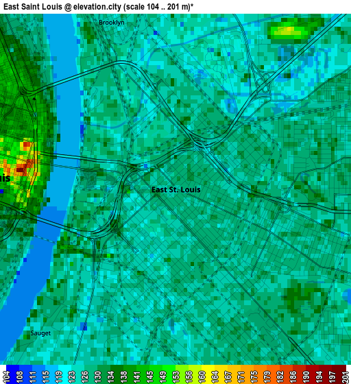
Below is the Elevation map of East Saint Louis, which displays elevation range with different colors. Scale of the first map is from 104 to 201 m (341 to 659 ft) with average elevation of 127.3 meters (=418 ft) [note 1]
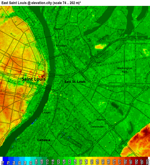
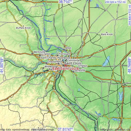
These maps also provides idea of topography and contour of this city, they are displayed at different zoom levels. More info about maps, scale and edge coordinates you can find below images.
| \ | Map #1 | Map #2 | Topo.Map |
| Scale [m] | 104..201 m | 74..202 m | × |
| Scale [ft] | 341..659 ft | 243..663 ft | × |
| Average | 127.3 m = 418 ft | 132.1 m = 433 ft | × |
| Width | 7.63 km = 4.7 mi | 15.27 km = 9.5 mi | 244.3 km = 151.8 mi |
| Height | 7.63 km = 4.7 mi | 15.27 km = 9.5 mi | 244.3 km = 151.8 mi |
| ↑Max Latitude | 38.658824° | 38.693132° | 39.7147° |
| Latitude at center | 38.6245° | 38.6245° | 38.6245° |
| ↓Min Latitude | 38.590159° | 38.555802° | 37.51747° |
| ← Min Longitude | -90.194885° | -90.238831° | -91.55719° |
| Longitude center | -90.15094° | -90.15094° | -90.15094° |
| →Max Longitude | -90.106995° | -90.063049° | -88.74469° |
Nearby cities:
Cities around East Saint Louis sort by population:
• St. Louis elevation 149 m
4.1 km,  274°
274°
• Granite City 130 m
8.6 km,  1°
1°
• Cahokia 124 m
6.9 km,  209°
209°
• Centreville 124 m
5.1 km,  153°
153°
• Caseyville 141 m
11 km,  82°
82°
• Washington Park 130 m
5.2 km, 76°
• Dupo 129 m
13.1 km,  203°
203°
• Madison 127 m
6.5 km,  355°
355°
• Fairmont City 126 m
5.8 km,  60°
60°
• Alorton 127 m
4.7 km, 145°
• Venice 124 m
5.6 km,  342°
342°
• Hillsdale 172 m
13.3 km,  299°
299°
Multilingual:
 En español:
East Saint Louis elevación 127 m.
 En France:
East Saint Louis élévation 127 m.
 Auf Deutsch:
East Saint Louis höhe über dem Meeresspiegel ist 127 m.

Sources and notes:
- [note 1] Map square and city borders are not equal. Map elevation data is calculated only from area inside that square.
- [src 1] Elevation data from geonames database provided with same terms of usage.
- [src 2] The elevation map of East Saint Louis is generated using elevation data from NASA's 3 arcsec (90m) resolution SRTM data.
- [src 3] Base (background) map © OpenStreetMap contributors tiles are generated by Geofabrik and OpenTopoMap.
Copyright & License:
This East Saint Louis Elevation Map is licensed under CC BY-SA. You may reuse any part from this page, if you give a proper credit by linking to this URL:
 More info on terms of use page.