Anna elevation
Anna (Illinois, Union County), United States elevation is 189 meters and Anna elevation in feet is 620 ft above sea level [src 1]. Anna is a populated place (feature code) with elevation that is 90 meters (295 ft) smaller than average city elevation in United States.
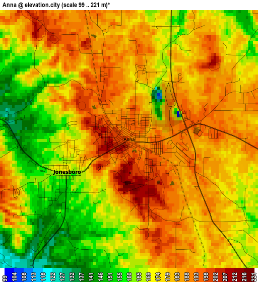
Below is the Elevation map of Anna, which displays elevation range with different colors. Scale of the first map is from 99 to 221 m (325 to 725 ft) with average elevation of 176.3 meters (=578 ft) [note 1]
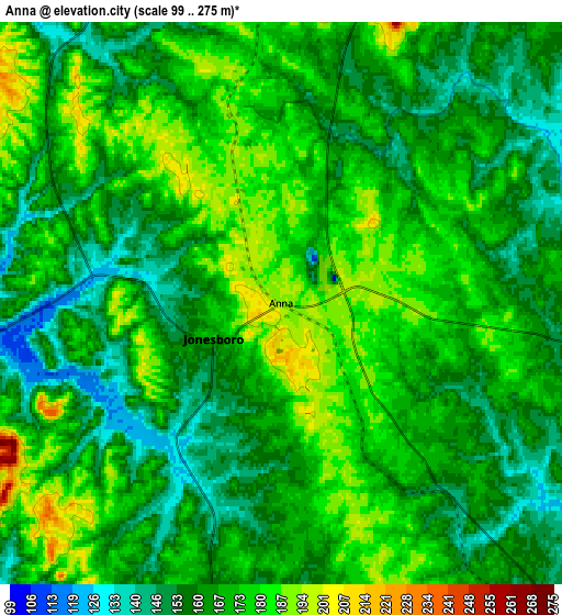
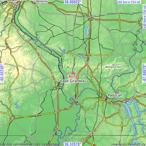
These maps also provides idea of topography and contour of this city, they are displayed at different zoom levels. More info about maps, scale and edge coordinates you can find below images.
| \ | Map #1 | Map #2 | Topo.Map |
| Scale [m] | 99..221 m | 99..275 m | × |
| Scale [ft] | 325..725 ft | 325..902 ft | × |
| Average | 176.3 m = 578 ft | 167.3 m = 549 ft | × |
| Width | 7.76 km = 4.8 mi | 15.51 km = 9.6 mi | 248.2 km = 154.2 mi |
| Height | 7.76 km = 4.8 mi | 15.51 km = 9.6 mi | 248.2 km = 154.2 mi |
| ↑Max Latitude | 37.495205° | 37.530063° | 38.56822° |
| Latitude at center | 37.46033° | 37.46033° | 37.46033° |
| ↓Min Latitude | 37.425439° | 37.390532° | 36.33578° |
| ← Min Longitude | -89.290975° | -89.334921° | -90.65328° |
| Longitude center | -89.24703° | -89.24703° | -89.24703° |
| →Max Longitude | -89.203085° | -89.159139° | -87.84078° |
Nearby cities:
Cities around Anna sort by population:
• Cape Girardeau elevation 108 m
29.5 km,  234°
234°
• Carbondale 128 m
29.8 km,  5°
5°
• Jackson 142 m
38 km,  256°
256°
• Murphysboro 126 m
34.7 km,  347°
347°
• Carterville 140 m
36.5 km,  24°
24°
• Scott City 112 m
36.5 km,  222°
222°
• Jonesboro 175 m
2.1 km,  242°
242°
• Vienna 124 m
31.2 km,  99°
99°
• Crainville 143 m
36.1 km,  25°
25°
• Cambria 129 m
37.4 km, 17°
• Cobden 177 m
7.9 km,  355°
355°
• Goreville 222 m
26.4 km,  66°
66°
Multilingual:
 En español:
Anna elevación 189 m.
 En France:
Anna élévation 189 m.


Sources and notes:
- [note 1] Map square and city borders are not equal. Map elevation data is calculated only from area inside that square.
- [src 1] Elevation data from geonames database provided with same terms of usage.
- [src 2] The elevation map of Anna is generated using elevation data from NASA's 3 arcsec (90m) resolution SRTM data.
- [src 3] Base (background) map © OpenStreetMap contributors tiles are generated by Geofabrik and OpenTopoMap.
Copyright & License:
This Anna Elevation Map is licensed under CC BY-SA. You may reuse any part from this page, if you give a proper credit by linking to this URL:
 More info on terms of use page.