Sandy Springs elevation
Sandy Springs (Georgia, Fulton County), United States elevation is 333 meters and Sandy Springs elevation in feet is 1093 ft above sea level [src 1]. Sandy Springs is a populated place (feature code) with elevation that is 54 meters (177 ft) bigger than average city elevation in United States.
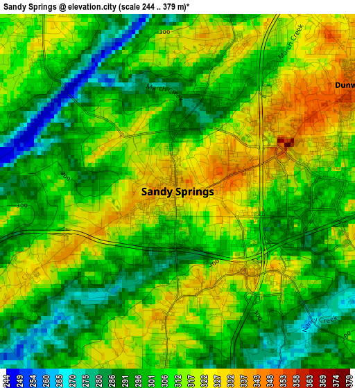
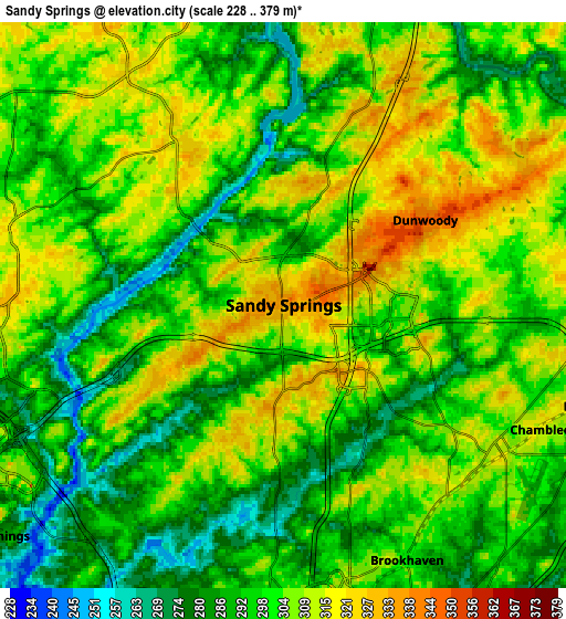
Below is the Elevation map of Sandy Springs, which displays elevation range with different colors. Scale of the first map is from 244 to 379 m (801 to 1243 ft) with average elevation of 307.5 meters (=1009 ft) [note 1]
These maps also provides idea of topography and contour of this city, they are displayed at different zoom levels. More info about maps, scale and edge coordinates you can find below images.
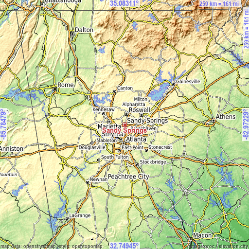
| \ | Map #1 | Map #2 | Topo.Map |
| Scale [m] | 244..379 m | 228..379 m | × |
| Scale [ft] | 801..1243 ft | 748..1243 ft | × |
| Average | 307.5 m = 1009 ft | 300.6 m = 986 ft | × |
| Width | 8.11 km = 5 mi | 16.22 km = 10.1 mi | 259.5 km = 161.2 mi |
| Height | 8.11 km = 5 mi | 16.22 km = 10.1 mi | 259.5 km = 161.2 mi |
| ↑Max Latitude | 33.960727° | 33.997168° | 35.08311° |
| Latitude at center | 33.92427° | 33.92427° | 33.92427° |
| ↓Min Latitude | 33.887797° | 33.851309° | 32.74945° |
| ← Min Longitude | -84.422485° | -84.466431° | -85.78479° |
| Longitude center | -84.37854° | -84.37854° | -84.37854° |
| →Max Longitude | -84.334595° | -84.290649° | -82.97229° |
Nearby cities:
Cities around Sandy Springs sort by population:
• Roswell elevation 333 m
11.1 km,  8°
8°
• Smyrna 326 m
13.3 km,  250°
250°
• Brookhaven 298 m
8.1 km,  154°
154°
• Dunwoody 349 m
4.7 km,  58°
58°
• Peachtree Corners 320 m
15.3 km,  70°
70°
• North Atlanta 305 m
7.6 km, 149°
• Chamblee 311 m
8.2 km,  115°
115°
• North Druid Hills 305 m
13.4 km, 153°
• Norcross 322 m
15.3 km,  82°
82°
• Doraville 327 m
9.3 km,  108°
108°
• Vinings 283 m
10.3 km,  230°
230°
• Fair Oaks 343 m
15.4 km,  266°
266°
Multilingual:
 En español:
Sandy Springs elevación 333 m.
 En France:
Sandy Springs élévation 333 m.
 Auf Deutsch:
Sandy Springs höhe über dem Meeresspiegel ist 333 m.

Sources and notes:
- [note 1] Map square and city borders are not equal. Map elevation data is calculated only from area inside that square.
- [src 1] Elevation data from geonames database provided with same terms of usage.
- [src 2] The elevation map of Sandy Springs is generated using elevation data from NASA's 3 arcsec (90m) resolution SRTM data.
- [src 3] Base (background) map © OpenStreetMap contributors tiles are generated by Geofabrik and OpenTopoMap.
Copyright & License:
This Sandy Springs Elevation Map is licensed under CC BY-SA. You may reuse any part from this page, if you give a proper credit by linking to this URL:
 More info on terms of use page.