Morrow elevation
Morrow (Georgia, Clayton County), United States elevation is 281 meters and Morrow elevation in feet is 922 ft above sea level [src 1]. Morrow is a populated place (feature code) with elevation that is 2 meters (7 ft) bigger than average city elevation in United States.
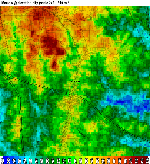
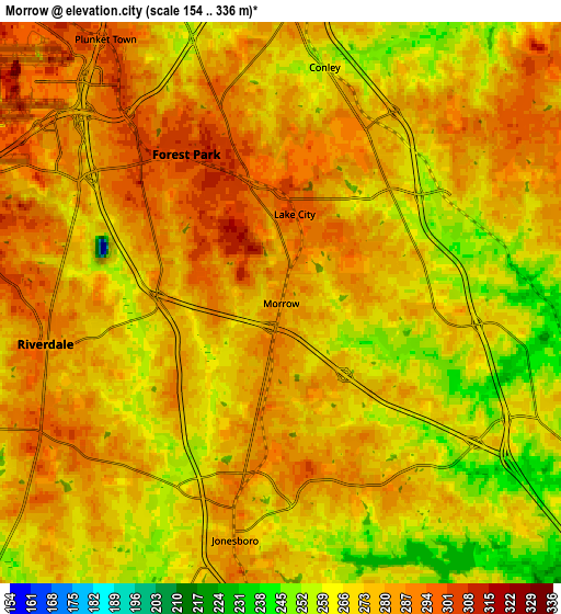
Below is the Elevation map of Morrow, which displays elevation range with different colors. Scale of the first map is from 242 to 319 m (794 to 1047 ft) with average elevation of 278.2 meters (=913 ft) [note 1]
These maps also provides idea of topography and contour of this city, they are displayed at different zoom levels. More info about maps, scale and edge coordinates you can find below images.
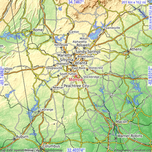
| \ | Map #1 | Map #2 | Topo.Map |
| Scale [m] | 242..319 m | 154..336 m | × |
| Scale [ft] | 794..1047 ft | 505..1102 ft | × |
| Average | 278.2 m = 913 ft | 274 m = 899 ft | × |
| Width | 8.14 km = 5.1 mi | 16.28 km = 10.1 mi | 260.5 km = 161.9 mi |
| Height | 8.14 km = 5.1 mi | 16.28 km = 10.1 mi | 260.5 km = 161.9 mi |
| ↑Max Latitude | 33.619772° | 33.656359° | 34.7467° |
| Latitude at center | 33.58317° | 33.58317° | 33.58317° |
| ↓Min Latitude | 33.546552° | 33.509919° | 32.40374° |
| ← Min Longitude | -84.383315° | -84.427261° | -85.74562° |
| Longitude center | -84.33937° | -84.33937° | -84.33937° |
| →Max Longitude | -84.295425° | -84.251479° | -82.93312° |
Nearby cities:
Cities around Morrow sort by population:
• East Point elevation 323 m
14.2 km,  319°
319°
• Stockbridge 247 m
10.7 km,  113°
113°
• Forest Park 303 m
5.1 km,  327°
327°
• Riverdale 285 m
6.9 km,  260°
260°
• College Park 321 m
12.8 km,  307°
307°
• Irondale 263 m
11.5 km,  188°
188°
• Gresham Park 287 m
13.6 km,  9°
9°
• Hapeville 306 m
10.8 km, 322°
• Conley 259 m
7 km, 10°
• Jonesboro 284 m
7 km, 191°
• Bonanza 273 m
13.1 km,  178°
178°
• Lake City 297 m
2.6 km, 8°
Multilingual:
 En español:
Morrow elevación 281 m.
 En France:
Morrow élévation 281 m.


Sources and notes:
- [note 1] Map square and city borders are not equal. Map elevation data is calculated only from area inside that square.
- [src 1] Elevation data from geonames database provided with same terms of usage.
- [src 2] The elevation map of Morrow is generated using elevation data from NASA's 3 arcsec (90m) resolution SRTM data.
- [src 3] Base (background) map © OpenStreetMap contributors tiles are generated by Geofabrik and OpenTopoMap.
Copyright & License:
This Morrow Elevation Map is licensed under CC BY-SA. You may reuse any part from this page, if you give a proper credit by linking to this URL:
 More info on terms of use page.