Springfield elevation
Springfield (Florida, Bay County), United States elevation is 16 meters and Springfield elevation in feet is 52 ft above sea level [src 1]. Springfield is a populated place (feature code) with elevation that is 263 meters (863 ft) smaller than average city elevation in United States.
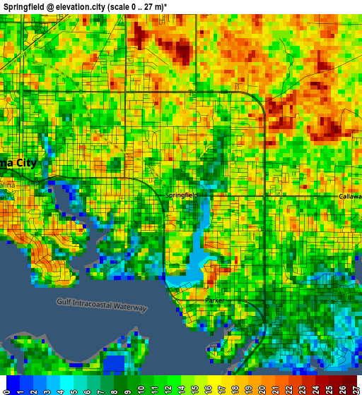
Below is the Elevation map of Springfield, which displays elevation range with different colors. Scale of the first map is from 0 to 27 m (0 to 89 ft) with average elevation of 13.8 meters (=45 ft) [note 1]
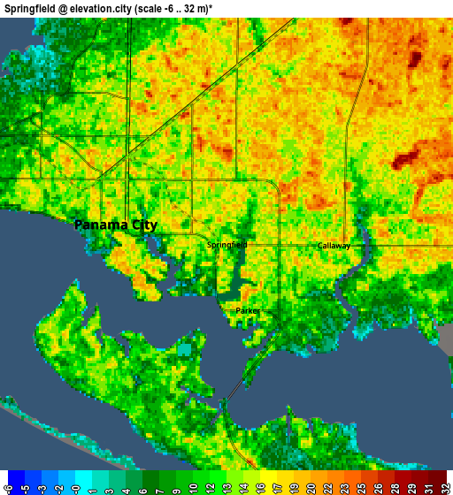
These maps also provides idea of topography and contour of this city, they are displayed at different zoom levels. More info about maps, scale and edge coordinates you can find below images.
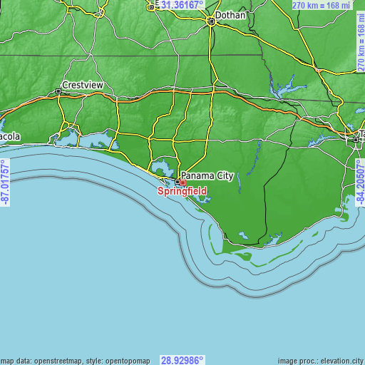
| \ | Map #1 | Map #2 | Topo.Map |
| Scale [m] | 0..27 m | -6..32 m | × |
| Scale [ft] | 0..89 ft | -20..105 ft | × |
| Average | 13.8 m = 45 ft | 13.7 m = 45 ft | × |
| Width | 8.45 km = 5.3 mi | 16.9 km = 10.5 mi | 270.4 km = 168 mi |
| Height | 8.45 km = 5.3 mi | 16.9 km = 10.5 mi | 270.4 km = 168 mi |
| ↑Max Latitude | 30.191252° | 30.229228° | 31.36167° |
| Latitude at center | 30.15326° | 30.15326° | 30.15326° |
| ↓Min Latitude | 30.115254° | 30.077233° | 28.92986° |
| ← Min Longitude | -85.655265° | -85.699211° | -87.01757° |
| Longitude center | -85.61132° | -85.61132° | -85.61132° |
| →Max Longitude | -85.567375° | -85.523429° | -84.20507° |
Nearby cities:
Cities around Springfield sort by population:
• Panama City elevation 13 m
4.7 km,  278°
278°
• Lynn Haven 7 m
10.9 km,  340°
340°
• Callaway 15 m
4 km,  90°
90°
• Upper Grand Lagoon 0 m
12.5 km, 275°
• Panama City Beach 8 m
18.8 km, 277°
• Parker 12 m
2.6 km,  162°
162°
• Youngstown 32 m
28.8 km,  35°
35°
• Lower Grand Lagoon 6 m
13.4 km,  265°
265°
• Cedar Grove 15 m
2.4 km,  325°
325°
• Pretty Bayou 9 m
9.5 km,  300°
300°
• Tyndall Air Force Base 19 m
7.6 km,  177°
177°
• Hiland Park 17 m
5.5 km, 344°
Multilingual:
 En español:
Springfield elevación 16 m.
 En France:
Springfield élévation 16 m.
 Auf Deutsch:
Springfield höhe über dem Meeresspiegel ist 16 m.

Sources and notes:
- [note 1] Map square and city borders are not equal. Map elevation data is calculated only from area inside that square.
- [src 1] Elevation data from geonames database provided with same terms of usage.
- [src 2] The elevation map of Springfield is generated using elevation data from NASA's 3 arcsec (90m) resolution SRTM data.
- [src 3] Base (background) map © OpenStreetMap contributors tiles are generated by Geofabrik and OpenTopoMap.
Copyright & License:
This Springfield Elevation Map is licensed under CC BY-SA. You may reuse any part from this page, if you give a proper credit by linking to this URL:
 More info on terms of use page.