Pine Hills elevation
Pine Hills (Florida, Orange County), United States elevation is 41 meters and Pine Hills elevation in feet is 135 ft above sea level [src 1]. Pine Hills is a populated place (feature code) with elevation that is 238 meters (781 ft) smaller than average city elevation in United States.
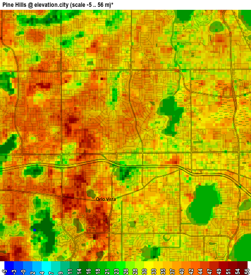
Below is the Elevation map of Pine Hills, which displays elevation range with different colors. Scale of the first map is from -5 to 56 m (-16 to 184 ft) with average elevation of 34.5 meters (=113 ft) [note 1]
These maps also provides idea of topography and contour of this city, they are displayed at different zoom levels. More info about maps, scale and edge coordinates you can find below images.
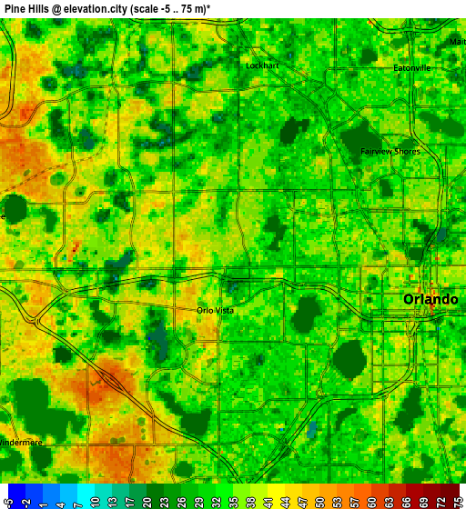
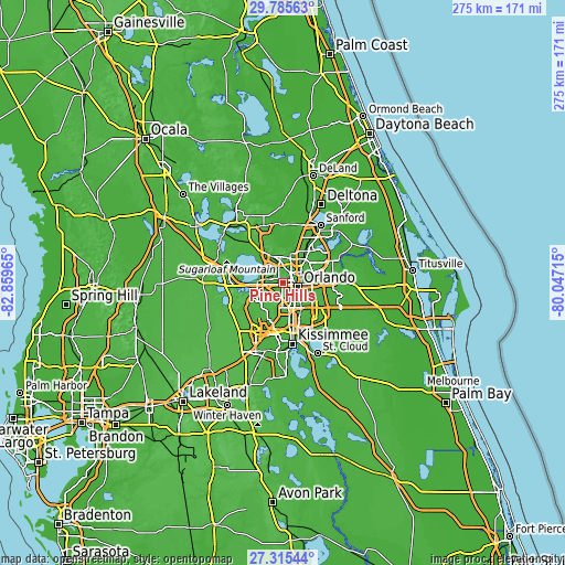
| \ | Map #1 | Map #2 | Topo.Map |
| Scale [m] | -5..56 m | -5..75 m | × |
| Scale [ft] | -16..184 ft | -16..246 ft | × |
| Average | 34.5 m = 113 ft | 35.4 m = 116 ft | × |
| Width | 8.58 km = 5.3 mi | 17.17 km = 10.7 mi | 274.7 km = 170.7 mi |
| Height | 8.58 km = 5.3 mi | 17.17 km = 10.7 mi | 274.7 km = 170.7 mi |
| ↑Max Latitude | 28.596372° | 28.634949° | 29.78563° |
| Latitude at center | 28.55778° | 28.55778° | 28.55778° |
| ↓Min Latitude | 28.519174° | 28.480554° | 27.31544° |
| ← Min Longitude | -81.497345° | -81.541291° | -82.85965° |
| Longitude center | -81.4534° | -81.4534° | -81.4534° |
| →Max Longitude | -81.409455° | -81.365509° | -80.04715° |
Nearby cities:
Cities around Pine Hills sort by population:
• Orlando elevation 54 m
7.6 km,  106°
106°
• Ocoee 43 m
8.9 km,  278°
278°
• Oak Ridge 33 m
10 km,  163°
163°
• Lake Butler 29 m
10.6 km,  233°
233°
• Lockhart 33 m
6.9 km,  8°
8°
• Fairview Shores 39 m
6.9 km,  57°
57°
• Orlovista 40 m
2.3 km,  197°
197°
• Holden Heights 33 m
9.3 km,  136°
136°
• Windermere 43 m
10.5 km, 228°
• Clarcona 33 m
7.5 km,  324°
324°
• Eatonville 38 m
9.5 km,  48°
48°
• Gotha 45 m
7.6 km,  243°
243°
Multilingual:
 En español:
Pine Hills elevación 41 m.
 En France:
Pine Hills élévation 41 m.
 Auf Deutsch:
Pine Hills höhe über dem Meeresspiegel ist 41 m.

Sources and notes:
- [note 1] Map square and city borders are not equal. Map elevation data is calculated only from area inside that square.
- [src 1] Elevation data from geonames database provided with same terms of usage.
- [src 2] The elevation map of Pine Hills is generated using elevation data from NASA's 3 arcsec (90m) resolution SRTM data.
- [src 3] Base (background) map © OpenStreetMap contributors tiles are generated by Geofabrik and OpenTopoMap.
Copyright & License:
This Pine Hills Elevation Map is licensed under CC BY-SA. You may reuse any part from this page, if you give a proper credit by linking to this URL:
 More info on terms of use page.