Ojus elevation
Ojus (Florida, Miami-Dade County), United States elevation is 10 meters and Ojus elevation in feet is 33 ft above sea level [src 1]. Ojus is a populated place (feature code) with elevation that is 269 meters (883 ft) smaller than average city elevation in United States.
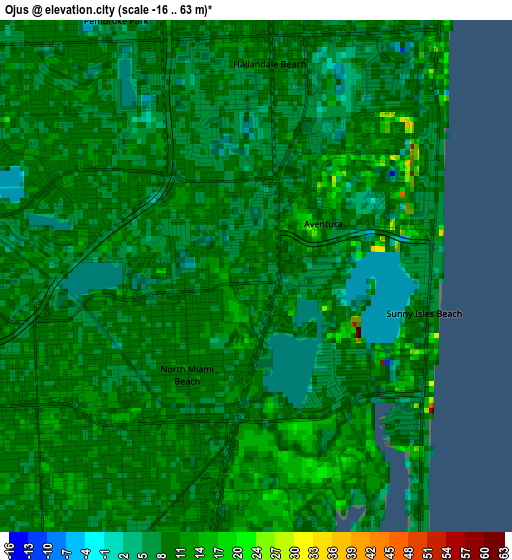
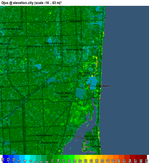
Below is the Elevation map of Ojus, which displays elevation range with different colors. Scale of the first map is from -16 to 63 m (-52 to 207 ft) with average elevation of 9.7 meters (=32 ft) [note 1]
These maps also provides idea of topography and contour of this city, they are displayed at different zoom levels. More info about maps, scale and edge coordinates you can find below images.
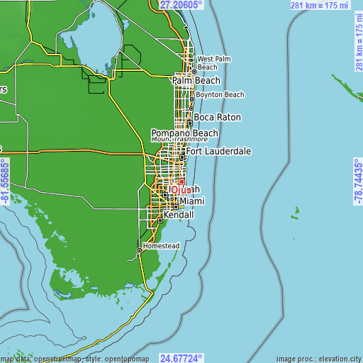
| \ | Map #1 | Map #2 | Topo.Map |
| Scale [m] | -16..63 m | -16..63 m | × |
| Scale [ft] | -52..207 ft | -52..207 ft | × |
| Average | 9.7 m = 32 ft | 9.6 m = 31 ft | × |
| Width | 8.79 km = 5.5 mi | 17.57 km = 10.9 mi | 281.2 km = 174.7 mi |
| Height | 8.79 km = 5.5 mi | 17.57 km = 10.9 mi | 281.2 km = 174.7 mi |
| ↑Max Latitude | 25.987938° | 26.027434° | 27.20605° |
| Latitude at center | 25.94843° | 25.94843° | 25.94843° |
| ↓Min Latitude | 25.908908° | 25.869373° | 24.67724° |
| ← Min Longitude | -80.194545° | -80.238491° | -81.55685° |
| Longitude center | -80.1506° | -80.1506° | -80.1506° |
| →Max Longitude | -80.106655° | -80.062709° | -78.74435° |
Nearby cities:
Cities around Ojus sort by population:
• North Miami Beach elevation 11 m
2.1 km,  215°
215°
• Hallandale Beach 11 m
3.7 km,  3°
3°
• Aventura 13 m
1.4 km,  51°
51°
• Golden Glades 7 m
6.4 km,  230°
230°
• Norland 10 m
6.2 km,  270°
270°
• Sunny Isles Beach 7 m
2.8 km,  84°
84°
• Ives Estates 11 m
3 km,  300°
300°
• West Park 7 m
6.3 km,  309°
309°
• Pembroke Park 7 m
5 km,  331°
331°
• Lake Forest 8 m
4.6 km, 314°
• Carver Ranches 10 m
6.1 km,  316°
316°
• Miami Gardens 9 m
6.3 km, 303°
Multilingual:
 En español:
Ojus elevación 10 m.
 En France:
Ojus élévation 10 m.


Sources and notes:
- [note 1] Map square and city borders are not equal. Map elevation data is calculated only from area inside that square.
- [src 1] Elevation data from geonames database provided with same terms of usage.
- [src 2] The elevation map of Ojus is generated using elevation data from NASA's 3 arcsec (90m) resolution SRTM data.
- [src 3] Base (background) map © OpenStreetMap contributors tiles are generated by Geofabrik and OpenTopoMap.
Copyright & License:
This Ojus Elevation Map is licensed under CC BY-SA. You may reuse any part from this page, if you give a proper credit by linking to this URL:
 More info on terms of use page.