Ocala elevation
Ocala (Florida, Marion County), United States elevation is 24 meters and Ocala elevation in feet is 79 ft above sea level [src 1]. Ocala is a seat of a second-order administrative division (feature code) with elevation that is 255 meters (837 ft) smaller than average city elevation in United States.
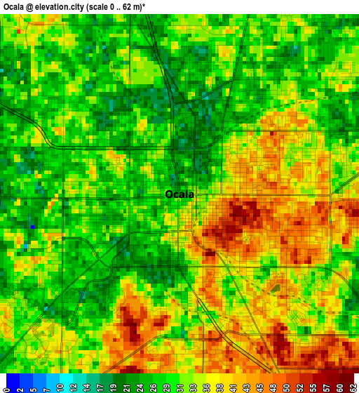
Below is the Elevation map of Ocala, which displays elevation range with different colors. Scale of the first map is from 0 to 62 m (0 to 203 ft) with average elevation of 32.5 meters (=107 ft) [note 1]
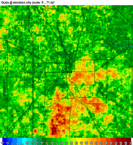
These maps also provides idea of topography and contour of this city, they are displayed at different zoom levels. More info about maps, scale and edge coordinates you can find below images.
| \ | Map #1 | Map #2 | Topo.Map |
| Scale [m] | 0..62 m | -5..71 m | × |
| Scale [ft] | 0..203 ft | -16..233 ft | × |
| Average | 32.5 m = 107 ft | 31.2 m = 102 ft | × |
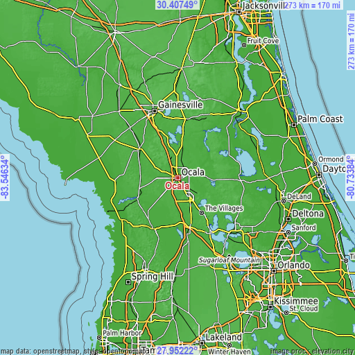
| Width | 8.53 km = 5.3 mi | 17.06 km = 10.6 mi | 273 km = 169.6 mi |
| Height | 8.53 km = 5.3 mi | 17.06 km = 10.6 mi | 273 km = 169.6 mi |
| ↑Max Latitude | 29.225558° | 29.263903° | 30.40749° |
| Latitude at center | 29.1872° | 29.1872° | 29.1872° |
| ↓Min Latitude | 29.148827° | 29.11044° | 27.95222° |
| ← Min Longitude | -82.184035° | -82.227981° | -83.54634° |
| Longitude center | -82.14009° | -82.14009° | -82.14009° |
| →Max Longitude | -82.096145° | -82.052199° | -80.73384° |
Nearby cities:
Cities around Ocala sort by population:
• The Villages elevation 28 m
33.1 km,  148°
148°
• Lady Lake 35 m
36.7 km,  144°
144°
• Silver Springs 16 m
8.7 km,  67°
67°
• Hernando 20 m
39.2 km,  215°
215°
• Citrus Springs 35 m
38.4 km,  236°
236°
• Wildwood 23 m
37.1 km,  164°
164°
• Silver Springs Shores 33 m
14.8 km,  128°
128°
• Citra 31 m
25.2 km,  6°
6°
• Belleview 28 m
16.5 km, 152°
• Williston 22 m
37.2 km,  306°
306°
• Williston Highlands 31 m
42.5 km,  293°
293°
• Dunnellon 19 m
34.7 km, 243°
Multilingual:
 En español:
Ocala elevación 24 m.
 En France:
Ocala élévation 24 m.


Sources and notes:
- [note 1] Map square and city borders are not equal. Map elevation data is calculated only from area inside that square.
- [src 1] Elevation data from geonames database provided with same terms of usage.
- [src 2] The elevation map of Ocala is generated using elevation data from NASA's 3 arcsec (90m) resolution SRTM data.
- [src 3] Base (background) map © OpenStreetMap contributors tiles are generated by Geofabrik and OpenTopoMap.
Copyright & License:
This Ocala Elevation Map is licensed under CC BY-SA. You may reuse any part from this page, if you give a proper credit by linking to this URL:
 More info on terms of use page.