Minneola elevation
Minneola (Florida, Lake County), United States elevation is 40 meters and Minneola elevation in feet is 131 ft above sea level [src 1]. Minneola is a populated place (feature code) with elevation that is 239 meters (784 ft) smaller than average city elevation in United States.
Below is the Elevation map of Minneola, which displays elevation range with different colors. Scale of the first map is from 7 to 104 m (23 to 341 ft) with average elevation of 44.3 meters (=145 ft) [note 1]
These maps also provides idea of topography and contour of this city, they are displayed at different zoom levels. More info about maps, scale and edge coordinates you can find below images.
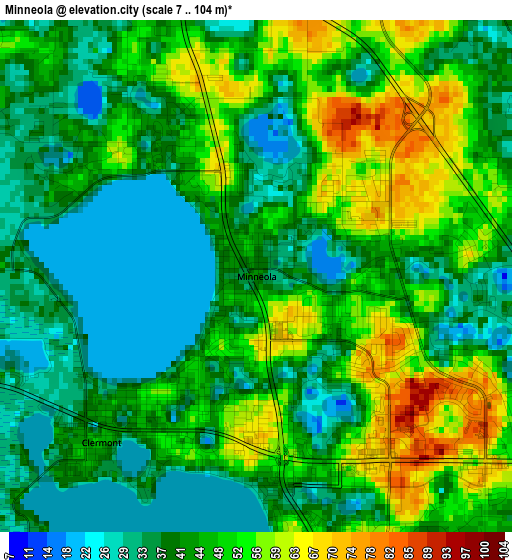
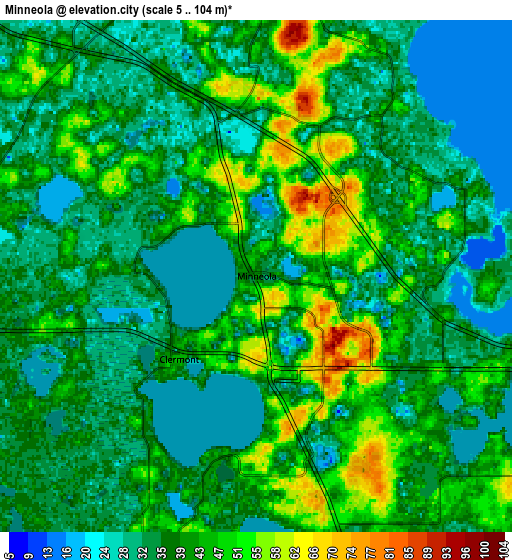
| \ | Map #1 | Map #2 | Topo.Map |
| Scale [m] | 7..104 m | 5..104 m | × |
| Scale [ft] | 23..341 ft | 16..341 ft | × |
| Average | 44.3 m = 145 ft | 38.6 m = 127 ft | × |
| Width | 8.58 km = 5.3 mi | 17.16 km = 10.7 mi | 274.6 km = 170.6 mi |
| Height | 8.58 km = 5.3 mi | 17.16 km = 10.7 mi | 274.6 km = 170.6 mi |
| ↑Max Latitude | 28.613026° | 28.651597° | 29.80209° |
| Latitude at center | 28.57444° | 28.57444° | 28.57444° |
| ↓Min Latitude | 28.53584° | 28.497226° | 27.3323° |
| ← Min Longitude | -81.790135° | -81.834081° | -83.15244° |
| Longitude center | -81.74619° | -81.74619° | -81.74619° |
| →Max Longitude | -81.702245° | -81.658299° | -80.33994° |
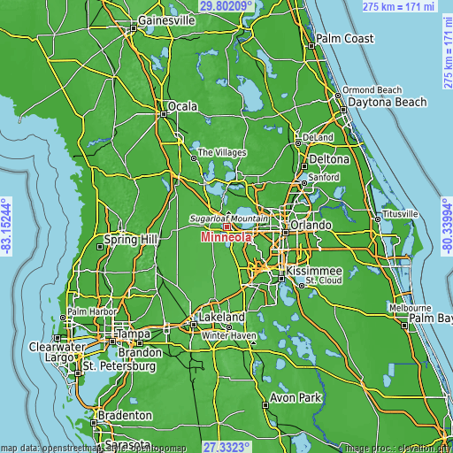
Nearby cities:
Cities around Minneola sort by population:
• Ocoee elevation 43 m
19.8 km,  91°
91°
• Winter Garden 42 m
15.7 km, 93°
• Clermont 46 m
3.8 km,  223°
223°
• Horizon West 49 m
19.7 km,  142°
142°
• Groveland 33 m
10.4 km,  259°
259°
• Mascotte 50 m
13.7 km,  271°
271°
• Oakland 39 m
11.3 km,  101°
101°
• Astatula 31 m
15.1 km,  4°
4°
• Montverde 37 m
7.6 km,  67°
67°
• Yalaha 26 m
19.2 km,  341°
341°
• Paradise Heights 39 m
20.5 km, 74°
• Howey-in-the-Hills 42 m
16.1 km,  350°
350°
Multilingual:
 En español:
Minneola elevación 40 m.
 En France:
Minneola élévation 40 m.


Sources and notes:
- [note 1] Map square and city borders are not equal. Map elevation data is calculated only from area inside that square.
- [src 1] Elevation data from geonames database provided with same terms of usage.
- [src 2] The elevation map of Minneola is generated using elevation data from NASA's 3 arcsec (90m) resolution SRTM data.
- [src 3] Base (background) map © OpenStreetMap contributors tiles are generated by Geofabrik and OpenTopoMap.
Copyright & License:
This Minneola Elevation Map is licensed under CC BY-SA. You may reuse any part from this page, if you give a proper credit by linking to this URL:
 More info on terms of use page.