Mango elevation
Mango (Florida, Hillsborough County), United States elevation is 26 meters and Mango elevation in feet is 85 ft above sea level [src 1]. Mango is a populated place (feature code) with elevation that is 253 meters (830 ft) smaller than average city elevation in United States.
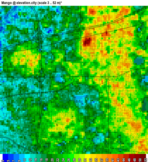
Below is the Elevation map of Mango, which displays elevation range with different colors. Scale of the first map is from 3 to 52 m (10 to 171 ft) with average elevation of 23 meters (=75 ft) [note 1]
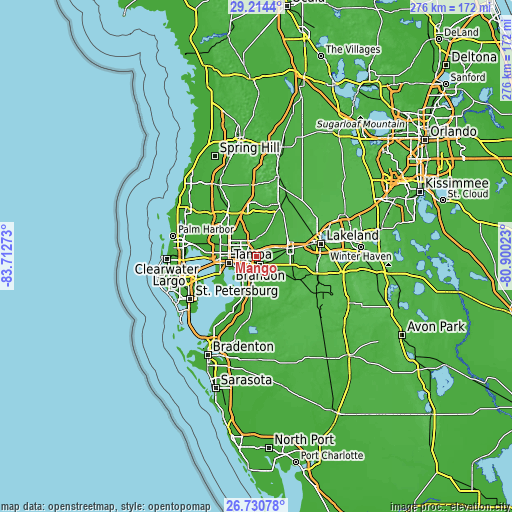
These maps also provides idea of topography and contour of this city, they are displayed at different zoom levels. More info about maps, scale and edge coordinates you can find below images.
| \ | Map #1 | Map #2 | Topo.Map |
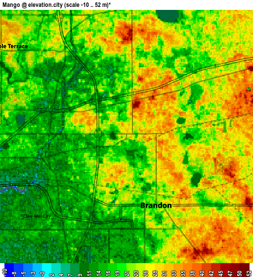
| Scale [m] | 3..52 m | -10..52 m | × |
| Scale [ft] | 10..171 ft | -33..171 ft | × |
| Average | 23 m = 75 ft | 21.9 m = 72 ft | × |
| Width | 8.63 km = 5.4 mi | 17.26 km = 10.7 mi | 276.2 km = 171.6 mi |
| Height | 8.63 km = 5.4 mi | 17.26 km = 10.7 mi | 276.2 km = 171.6 mi |
| ↑Max Latitude | 28.018542° | 28.057329° | 29.2144° |
| Latitude at center | 27.97974° | 27.97974° | 27.97974° |
| ↓Min Latitude | 27.940924° | 27.902095° | 26.73078° |
| ← Min Longitude | -82.350425° | -82.394371° | -83.71273° |
| Longitude center | -82.30648° | -82.30648° | -82.30648° |
| →Max Longitude | -82.262535° | -82.218589° | -80.90023° |
Nearby cities:
Cities around Mango sort by population:
• Tampa elevation 41 m
15.3 km,  256°
256°
• Brandon 20 m
5.1 km,  156°
156°
• Riverview 9 m
12.8 km,  188°
188°
• Valrico 22 m
8.3 km,  124°
124°
• Temple Terrace 28 m
10.2 km,  307°
307°
• East Lake-Orient Park 16 m
7.1 km,  272°
272°
• Bloomingdale 25 m
11.6 km,  145°
145°
• Palm River-Clair Mel 15 m
9.5 km,  229°
229°
• Thonotosassa 19 m
9.1 km,  2°
2°
• Seffner 29 m
3.1 km,  81°
81°
• Progress Village 10 m
10.5 km,  212°
212°
• Dover 36 m
8.7 km, 79°
Multilingual:
 En español:
Mango elevación 26 m.
 En France:
Mango élévation 26 m.


Sources and notes:
- [note 1] Map square and city borders are not equal. Map elevation data is calculated only from area inside that square.
- [src 1] Elevation data from geonames database provided with same terms of usage.
- [src 2] The elevation map of Mango is generated using elevation data from NASA's 3 arcsec (90m) resolution SRTM data.
- [src 3] Base (background) map © OpenStreetMap contributors tiles are generated by Geofabrik and OpenTopoMap.
Copyright & License:
This Mango Elevation Map is licensed under CC BY-SA. You may reuse any part from this page, if you give a proper credit by linking to this URL:
 More info on terms of use page.