Loughman elevation
Loughman (Florida, Polk County), United States elevation is 39 meters and Loughman elevation in feet is 128 ft above sea level [src 1]. Loughman is a populated place (feature code) with elevation that is 240 meters (787 ft) smaller than average city elevation in United States.
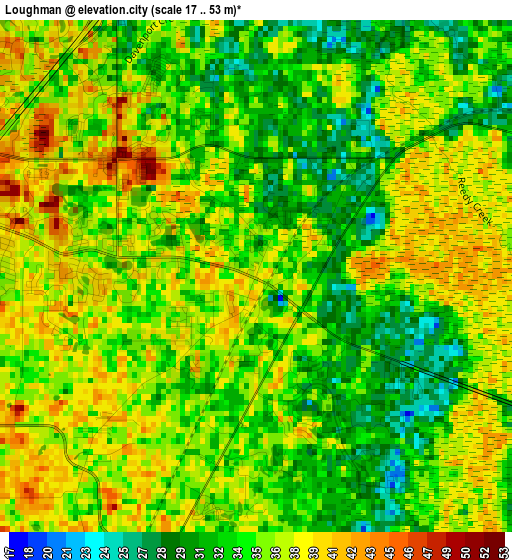
Below is the Elevation map of Loughman, which displays elevation range with different colors. Scale of the first map is from 17 to 53 m (56 to 174 ft) with average elevation of 35.3 meters (=116 ft) [note 1]
These maps also provides idea of topography and contour of this city, they are displayed at different zoom levels. More info about maps, scale and edge coordinates you can find below images.
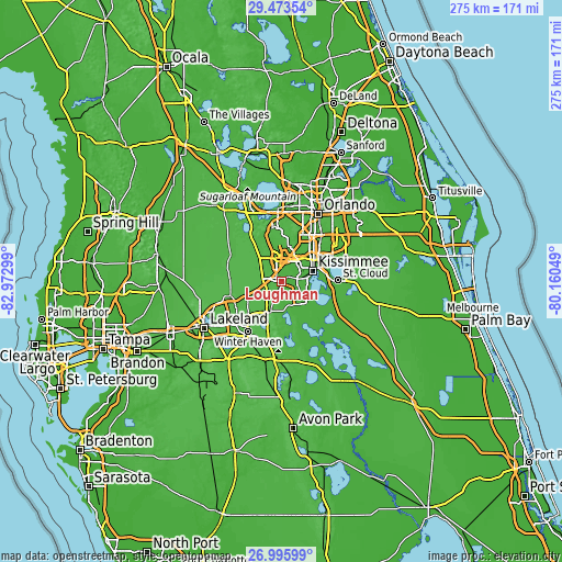
| \ | Map #1 | Topo.Map |
| Scale [m] | 17..53 m | × |
| Scale [ft] | 56..174 ft | × |
| Average | 35.3 m = 116 ft | × |
| Width | 8.61 km = 5.3 mi | 275.5 km = 171.2 mi |
| Height | 8.61 km = 5.3 mi | 275.5 km = 171.2 mi |
| ↑Max Latitude | 28.280667° | 29.47354° |
| Latitude at center | 28.24196° | 28.24196° |
| ↓Min Latitude | 28.203239° | 26.99599° |
| ← Min Longitude | -81.610685° | -82.97299° |
| Longitude center | -81.56674° | -81.56674° |
| →Max Longitude | -81.522795° | -80.16049° |
Nearby cities:
Cities around Loughman sort by population:
• Kissimmee elevation 23 m
16.3 km,  64°
64°
• Poinciana 22 m
15.5 km,  136°
136°
• Four Corners 39 m
12.8 km,  322°
322°
• Haines City 61 m
15.1 km,  200°
200°
• Hunters Creek 31 m
19.3 km,  47°
47°
• Horizon West 49 m
22 km,  345°
345°
• Citrus Ridge 34 m
12.6 km, 324°
• Williamsburg 28 m
22.7 km,  32°
32°
• Celebration 26 m
9.8 km,  19°
19°
• Lake Alfred 57 m
22.7 km,  222°
222°
• Davenport 47 m
9.6 km, 200°
• Campbell 29 m
11 km,  80°
80°
Multilingual:
 En español:
Loughman elevación 39 m.
 En France:
Loughman élévation 39 m.


Sources and notes:
- [note 1] Map square and city borders are not equal. Map elevation data is calculated only from area inside that square.
- [src 1] Elevation data from geonames database provided with same terms of usage.
- [src 2] The elevation map of Loughman is generated using elevation data from NASA's 3 arcsec (90m) resolution SRTM data.
- [src 3] Base (background) map © OpenStreetMap contributors tiles are generated by Geofabrik and OpenTopoMap.
Copyright & License:
This Loughman Elevation Map is licensed under CC BY-SA. You may reuse any part from this page, if you give a proper credit by linking to this URL:
 More info on terms of use page.