Dade City elevation
Dade City (Florida, Pasco County), United States elevation is 43 meters and Dade City elevation in feet is 141 ft above sea level [src 1]. Dade City is a seat of a second-order administrative division (feature code) with elevation that is 236 meters (774 ft) smaller than average city elevation in United States.
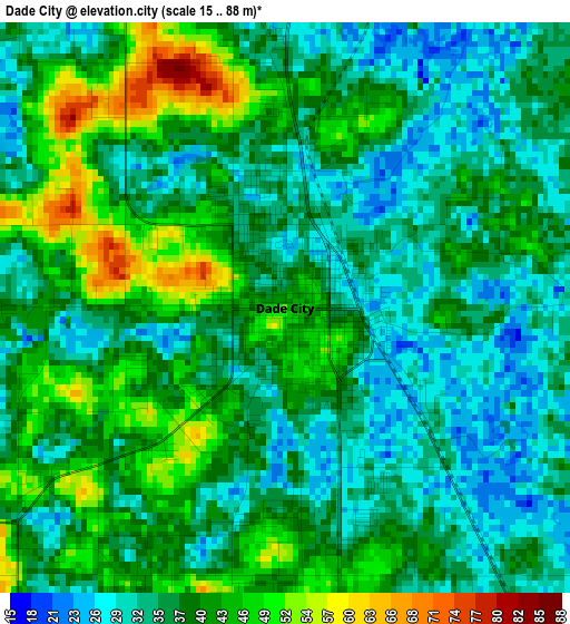
Below is the Elevation map of Dade City, which displays elevation range with different colors. Scale of the first map is from 15 to 88 m (49 to 289 ft) with average elevation of 38.2 meters (=125 ft) [note 1]
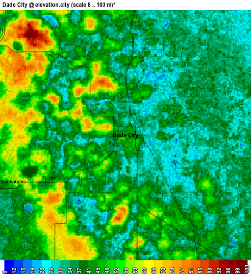
These maps also provides idea of topography and contour of this city, they are displayed at different zoom levels. More info about maps, scale and edge coordinates you can find below images.
| \ | Map #1 | Map #2 | Topo.Map |
| Scale [m] | 15..88 m | 8..103 m | × |
| Scale [ft] | 49..289 ft | 26..338 ft | × |
| Average | 38.2 m = 125 ft | 41.6 m = 136 ft | × |
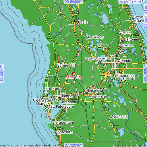
| Width | 8.6 km = 5.3 mi | 17.2 km = 10.7 mi | 275.2 km = 171 mi |
| Height | 8.6 km = 5.3 mi | 17.2 km = 10.7 mi | 275.2 km = 171 mi |
| ↑Max Latitude | 28.403382° | 28.44203° | 29.59486° |
| Latitude at center | 28.36472° | 28.36472° | 28.36472° |
| ↓Min Latitude | 28.326044° | 28.287353° | 27.12016° |
| ← Min Longitude | -82.239865° | -82.283811° | -83.60217° |
| Longitude center | -82.19592° | -82.19592° | -82.19592° |
| →Max Longitude | -82.151975° | -82.108029° | -80.78967° |
Nearby cities:
Cities around Dade City sort by population:
• Wesley Chapel elevation 36 m
19 km,  222°
222°
• Zephyrhills 36 m
14.6 km,  174°
174°
• Pasadena Hills 67 m
9.8 km,  196°
196°
• Zephyrhills West 36 m
14.9 km,  183°
183°
• Zephyrhills South 34 m
16.7 km, 177°
• Ridge Manor 24 m
16.1 km,  8°
8°
• Dade City North 26 m
2.1 km, 5°
• Zephyrhills North 35 m
12.9 km, 166°
• Hill 'n Dale 43 m
20 km,  329°
329°
• Lacoochee 24 m
11.5 km, 11°
• Saint Leo 63 m
6.8 km,  243°
243°
• San Antonio 56 m
8.3 km,  247°
247°
Multilingual:
 En español:
Dade City elevación 43 m.
 En France:
Dade City élévation 43 m.
 Auf Deutsch:
Dade City höhe über dem Meeresspiegel ist 43 m.

Sources and notes:
- [note 1] Map square and city borders are not equal. Map elevation data is calculated only from area inside that square.
- [src 1] Elevation data from geonames database provided with same terms of usage.
- [src 2] The elevation map of Dade City is generated using elevation data from NASA's 3 arcsec (90m) resolution SRTM data.
- [src 3] Base (background) map © OpenStreetMap contributors tiles are generated by Geofabrik and OpenTopoMap.
Copyright & License:
This Dade City Elevation Map is licensed under CC BY-SA. You may reuse any part from this page, if you give a proper credit by linking to this URL:
 More info on terms of use page.