Crawfordville elevation
Crawfordville (Florida, Wakulla County), United States elevation is 16 meters and Crawfordville elevation in feet is 52 ft above sea level [src 1]. Crawfordville is a seat of a second-order administrative division (feature code) with elevation that is 263 meters (863 ft) smaller than average city elevation in United States.
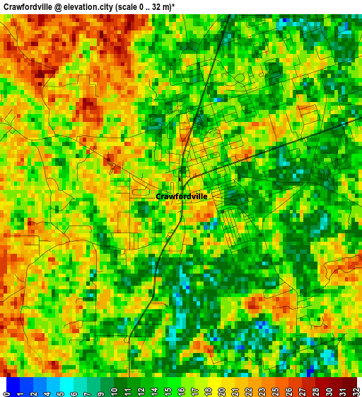
Below is the Elevation map of Crawfordville, which displays elevation range with different colors. Scale of the first map is from 0 to 32 m (0 to 105 ft) with average elevation of 16.6 meters (=54 ft) [note 1]
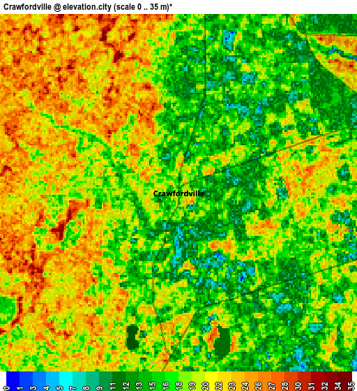
These maps also provides idea of topography and contour of this city, they are displayed at different zoom levels. More info about maps, scale and edge coordinates you can find below images.
| \ | Map #1 | Map #2 | Topo.Map |
| Scale [m] | 0..32 m | 0..35 m | × |
| Scale [ft] | 0..105 ft | 0..115 ft | × |
| Average | 16.6 m = 54 ft | 18.5 m = 61 ft | × |
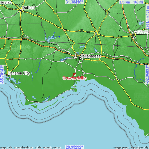
| Width | 8.45 km = 5.3 mi | 16.9 km = 10.5 mi | 270.3 km = 168 mi |
| Height | 8.45 km = 5.3 mi | 16.9 km = 10.5 mi | 270.3 km = 168 mi |
| ↑Max Latitude | 30.214023° | 30.251991° | 31.38416° |
| Latitude at center | 30.17604° | 30.17604° | 30.17604° |
| ↓Min Latitude | 30.138043° | 30.100031° | 28.95292° |
| ← Min Longitude | -84.419125° | -84.463071° | -85.78143° |
| Longitude center | -84.37518° | -84.37518° | -84.37518° |
| →Max Longitude | -84.331235° | -84.287289° | -82.96893° |
Nearby cities:
Cities around Crawfordville sort by population:
• Tallahassee elevation 71 m
30.5 km,  17°
17°
• Quincy 69 m
49.9 km,  336°
336°
• Midway 66 m
36.3 km,  347°
347°
• Chattahoochee 80 m
74.2 km,  322°
322°
• Woodville 22 m
19.7 km,  38°
38°
• Carrabelle 16 m
45.4 km,  217°
217°
• Blountstown 23 m
71.1 km,  294°
294°
• Monticello 76 m
63.4 km,  49°
49°
• Eastpoint 6 m
68.8 km, 224°
• Havana 81 m
49.9 km,  355°
355°
• Gretna 98 m
56.1 km,  330°
330°
• Bristol 56 m
64.4 km,  296°
296°
Multilingual:
 En español:
Crawfordville elevación 16 m.
 En France:
Crawfordville élévation 16 m.
 Auf Deutsch:
Crawfordville höhe über dem Meeresspiegel ist 16 m.

Sources and notes:
- [note 1] Map square and city borders are not equal. Map elevation data is calculated only from area inside that square.
- [src 1] Elevation data from geonames database provided with same terms of usage.
- [src 2] The elevation map of Crawfordville is generated using elevation data from NASA's 3 arcsec (90m) resolution SRTM data.
- [src 3] Base (background) map © OpenStreetMap contributors tiles are generated by Geofabrik and OpenTopoMap.
Copyright & License:
This Crawfordville Elevation Map is licensed under CC BY-SA. You may reuse any part from this page, if you give a proper credit by linking to this URL:
 More info on terms of use page.