Brent elevation
Brent (Florida, Escambia County), United States elevation is 35 meters and Brent elevation in feet is 115 ft above sea level [src 1]. Brent is a populated place (feature code) with elevation that is 244 meters (801 ft) smaller than average city elevation in United States.
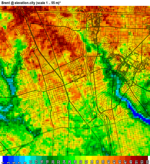
Below is the Elevation map of Brent, which displays elevation range with different colors. Scale of the first map is from 1 to 55 m (3 to 180 ft) with average elevation of 33.8 meters (=111 ft) [note 1]
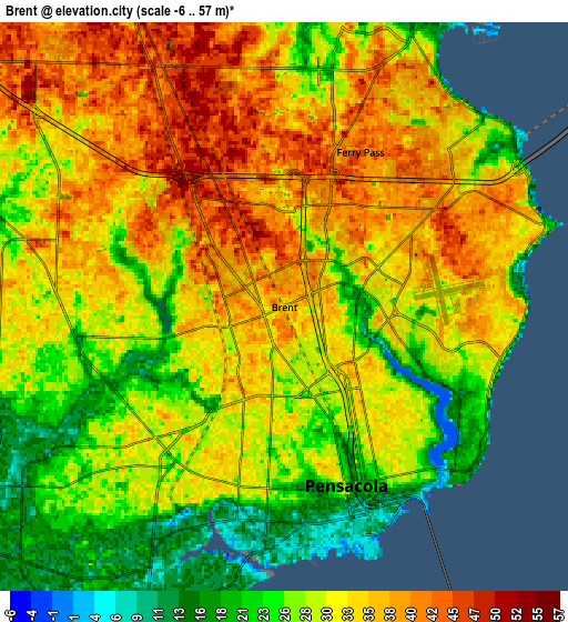
These maps also provides idea of topography and contour of this city, they are displayed at different zoom levels. More info about maps, scale and edge coordinates you can find below images.
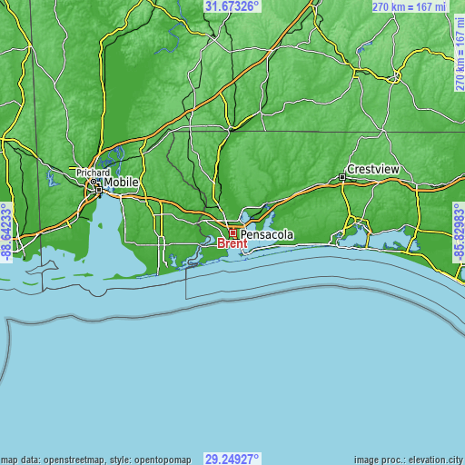
| \ | Map #1 | Map #2 | Topo.Map |
| Scale [m] | 1..55 m | -6..57 m | × |
| Scale [ft] | 3..180 ft | -20..187 ft | × |
| Average | 33.8 m = 111 ft | 31 m = 102 ft | × |
| Width | 8.42 km = 5.2 mi | 16.85 km = 10.5 mi | 269.5 km = 167.5 mi |
| Height | 8.42 km = 5.2 mi | 16.85 km = 10.5 mi | 269.5 km = 167.5 mi |
| ↑Max Latitude | 30.506679° | 30.544534° | 31.67326° |
| Latitude at center | 30.46881° | 30.46881° | 30.46881° |
| ↓Min Latitude | 30.430926° | 30.393027° | 29.24927° |
| ← Min Longitude | -87.280025° | -87.323971° | -88.64233° |
| Longitude center | -87.23608° | -87.23608° | -87.23608° |
| →Max Longitude | -87.192135° | -87.148189° | -85.82983° |
Nearby cities:
Cities around Brent sort by population:
• East Pensacola Heights elevation 21 m
7 km,  129°
129°
• Pensacola 24 m
5.6 km,  160°
160°
• Ferry Pass 45 m
5.1 km,  26°
26°
• Bellview 34 m
7.6 km,  263°
263°
• West Pensacola 29 m
6.3 km,  221°
221°
• Ensley 45 m
6.6 km,  327°
327°
• Pace 24 m
16.2 km, 26°
• Myrtle Grove 24 m
8.7 km,  232°
232°
• Warrington 11 m
10.1 km,  201°
201°
• Gonzalez 57 m
13.6 km,  337°
337°
• Gulf Breeze 8 m
14.2 km,  150°
150°
• Goulding 28 m
3.2 km, 155°
Multilingual:
 En español:
Brent elevación 35 m.
 En France:
Brent élévation 35 m.


Sources and notes:
- [note 1] Map square and city borders are not equal. Map elevation data is calculated only from area inside that square.
- [src 1] Elevation data from geonames database provided with same terms of usage.
- [src 2] The elevation map of Brent is generated using elevation data from NASA's 3 arcsec (90m) resolution SRTM data.
- [src 3] Base (background) map © OpenStreetMap contributors tiles are generated by Geofabrik and OpenTopoMap.
Copyright & License:
This Brent Elevation Map is licensed under CC BY-SA. You may reuse any part from this page, if you give a proper credit by linking to this URL:
 More info on terms of use page.