Pike Creek elevation
Pike Creek (Delaware, New Castle County), United States elevation is 44 meters and Pike Creek elevation in feet is 144 ft above sea level [src 1]. Pike Creek is a populated place (feature code) with elevation that is 235 meters (771 ft) smaller than average city elevation in United States.
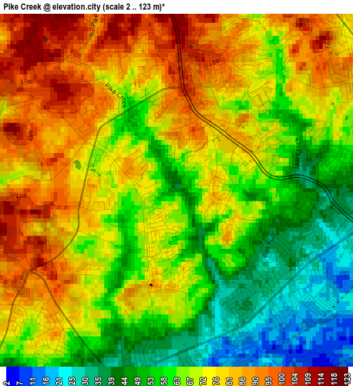
Below is the Elevation map of Pike Creek, which displays elevation range with different colors. Scale of the first map is from 2 to 123 m (7 to 404 ft) with average elevation of 68.8 meters (=226 ft) [note 1]
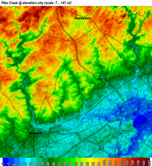
These maps also provides idea of topography and contour of this city, they are displayed at different zoom levels. More info about maps, scale and edge coordinates you can find below images.
| \ | Map #1 | Map #2 | Topo.Map |
| Scale [m] | 2..123 m | -7..147 m | × |
| Scale [ft] | 7..404 ft | -23..482 ft | × |
| Average | 68.8 m = 226 ft | 61.9 m = 203 ft | × |
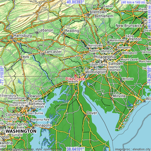
| Width | 7.52 km = 4.7 mi | 15.03 km = 9.3 mi | 240.5 km = 149.4 mi |
| Height | 7.52 km = 4.7 mi | 15.03 km = 9.3 mi | 240.5 km = 149.4 mi |
| ↑Max Latitude | 39.764738° | 39.79851° | 40.80393° |
| Latitude at center | 39.73095° | 39.73095° | 39.73095° |
| ↓Min Latitude | 39.697145° | 39.663324° | 38.64101° |
| ← Min Longitude | -75.748045° | -75.791991° | -77.11035° |
| Longitude center | -75.7041° | -75.7041° | -75.7041° |
| →Max Longitude | -75.660155° | -75.616209° | -74.29785° |
Nearby cities:
Cities around Pike Creek sort by population:
• Newark elevation 39 m
6.5 km,  216°
216°
• Bear 19 m
12 km,  160°
160°
• Brookside 25 m
7.4 km,  195°
195°
• Hockessin 79 m
6.3 km,  5°
5°
• Pike Creek Valley 74 m
0.8 km,  40°
40°
• North Star 112 m
3.6 km,  339°
339°
• Wilmington Manor 21 m
11.4 km,  115°
115°
• Elsmere 36 m
9.1 km,  84°
84°
• Greenville 79 m
10.5 km,  59°
59°
• Toughkenamon 105 m
12.1 km, 337°
• Avondale 86 m
12.3 km,  326°
326°
• Newport 8 m
8.3 km,  103°
103°
Multilingual:
 En español:
Pike Creek elevación 44 m.
 En France:
Pike Creek élévation 44 m.
 Auf Deutsch:
Pike Creek höhe über dem Meeresspiegel ist 44 m.

Sources and notes:
- [note 1] Map square and city borders are not equal. Map elevation data is calculated only from area inside that square.
- [src 1] Elevation data from geonames database provided with same terms of usage.
- [src 2] The elevation map of Pike Creek is generated using elevation data from NASA's 3 arcsec (90m) resolution SRTM data.
- [src 3] Base (background) map © OpenStreetMap contributors tiles are generated by Geofabrik and OpenTopoMap.
Copyright & License:
This Pike Creek Elevation Map is licensed under CC BY-SA. You may reuse any part from this page, if you give a proper credit by linking to this URL:
 More info on terms of use page.