Jonesboro elevation
Jonesboro (Arkansas, Craighead County), United States elevation is 96 meters and Jonesboro elevation in feet is 315 ft above sea level [src 1]. Jonesboro is a populated place (feature code) with elevation that is 183 meters (600 ft) smaller than average city elevation in United States.
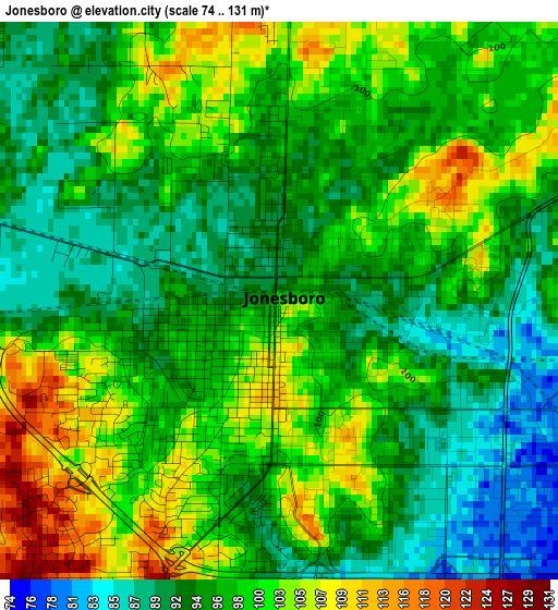
Below is the Elevation map of Jonesboro, which displays elevation range with different colors. Scale of the first map is from 74 to 131 m (243 to 430 ft) with average elevation of 97.2 meters (=319 ft) [note 1]
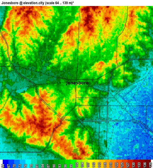
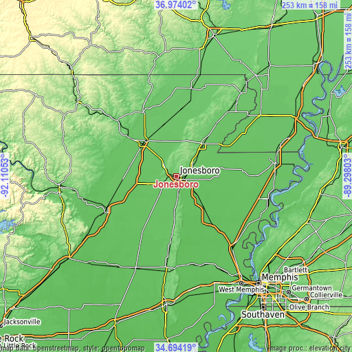
These maps also provides idea of topography and contour of this city, they are displayed at different zoom levels. More info about maps, scale and edge coordinates you can find below images.
| \ | Map #1 | Map #2 | Topo.Map |
| Scale [m] | 74..131 m | 64..139 m | × |
| Scale [ft] | 243..430 ft | 210..456 ft | × |
| Average | 97.2 m = 319 ft | 97.1 m = 319 ft | × |
| Width | 7.92 km = 4.9 mi | 15.84 km = 9.8 mi | 253.5 km = 157.5 mi |
| Height | 7.92 km = 4.9 mi | 15.84 km = 9.8 mi | 253.5 km = 157.5 mi |
| ↑Max Latitude | 35.877915° | 35.913515° | 36.97402° |
| Latitude at center | 35.8423° | 35.8423° | 35.8423° |
| ↓Min Latitude | 35.806669° | 35.771021° | 34.69419° |
| ← Min Longitude | -90.748225° | -90.792171° | -92.11053° |
| Longitude center | -90.70428° | -90.70428° | -90.70428° |
| →Max Longitude | -90.660335° | -90.616389° | -89.29803° |
Nearby cities:
Cities around Jonesboro sort by population:
• Paragould elevation 96 m
30.4 km,  37°
37°
• Trumann 66 m
25.8 km,  136°
136°
• Walnut Ridge 82 m
33.8 km,  317°
317°
• Brookland 80 m
12.7 km,  59°
59°
• Hoxie 79 m
33.6 km,  313°
313°
• Lake City 70 m
24.5 km,  96°
96°
• Harrisburg 94 m
30.9 km,  182°
182°
• Bono 79 m
11.5 km, 309°
• Leachville 73 m
41.5 km,  75°
75°
• Bay 68 m
17 km,  130°
130°
• Monette 73 m
32.9 km, 80°
• Caraway 69 m
35.7 km,  105°
105°
Multilingual:
 En español:
Jonesboro elevación 96 m.
 En France:
Jonesboro élévation 96 m.
 Auf Deutsch:
Jonesboro höhe über dem Meeresspiegel ist 96 m.

Sources and notes:
- [note 1] Map square and city borders are not equal. Map elevation data is calculated only from area inside that square.
- [src 1] Elevation data from geonames database provided with same terms of usage.
- [src 2] The elevation map of Jonesboro is generated using elevation data from NASA's 3 arcsec (90m) resolution SRTM data.
- [src 3] Base (background) map © OpenStreetMap contributors tiles are generated by Geofabrik and OpenTopoMap.
Copyright & License:
This Jonesboro Elevation Map is licensed under CC BY-SA. You may reuse any part from this page, if you give a proper credit by linking to this URL:
 More info on terms of use page.