East End elevation
East End (Arkansas, Saline County), United States elevation is 113 meters and East End elevation in feet is 371 ft above sea level [src 1]. East End is a populated place (feature code) with elevation that is 166 meters (545 ft) smaller than average city elevation in United States.
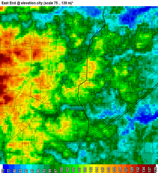
Below is the Elevation map of East End, which displays elevation range with different colors. Scale of the first map is from 75 to 139 m (246 to 456 ft) with average elevation of 100.7 meters (=330 ft) [note 1]
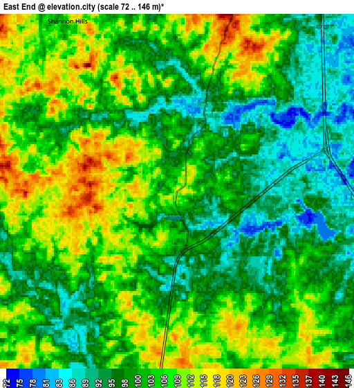
These maps also provides idea of topography and contour of this city, they are displayed at different zoom levels. More info about maps, scale and edge coordinates you can find below images.
| \ | Map #1 | Map #2 | Topo.Map |
| Scale [m] | 75..139 m | 72..146 m | × |
| Scale [ft] | 246..456 ft | 236..479 ft | × |
| Average | 100.7 m = 330 ft | 102.5 m = 336 ft | × |
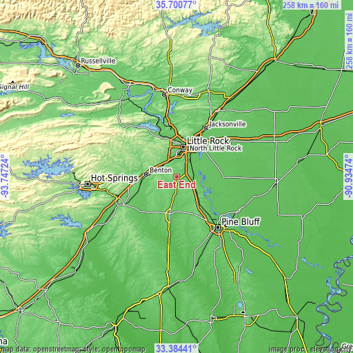
| Width | 8.05 km = 5 mi | 16.1 km = 10 mi | 257.6 km = 160.1 mi |
| Height | 8.05 km = 5 mi | 16.1 km = 10 mi | 257.6 km = 160.1 mi |
| ↑Max Latitude | 34.586837° | 34.623007° | 35.70077° |
| Latitude at center | 34.55065° | 34.55065° | 34.55065° |
| ↓Min Latitude | 34.514448° | 34.47823° | 33.38441° |
| ← Min Longitude | -92.384935° | -92.428881° | -93.74724° |
| Longitude center | -92.34099° | -92.34099° | -92.34099° |
| →Max Longitude | -92.297045° | -92.253099° | -90.93474° |
Nearby cities:
Cities around East End sort by population:
• Little Rock elevation 105 m
22.3 km,  12°
12°
• North Little Rock 83 m
25.3 km,  15°
15°
• Benton 131 m
22.6 km,  273°
273°
• Bryant 127 m
14.5 km,  290°
290°
• Sheridan 89 m
27.6 km,  191°
191°
• Haskell 99 m
27.6 km,  258°
258°
• Shannon Hills 110 m
9.2 km,  327°
327°
• Landmark 127 m
7 km, 16°
• Alexander 113 m
12.7 km,  313°
313°
• Salem 150 m
21.7 km, 293°
• Wrightsville 81 m
12.7 km,  63°
63°
• Redfield 92 m
18.6 km,  129°
129°
Multilingual:
 En español:
East End elevación 113 m.
 En France:
East End élévation 113 m.
 Auf Deutsch:
East End höhe über dem Meeresspiegel ist 113 m.

Sources and notes:
- [note 1] Map square and city borders are not equal. Map elevation data is calculated only from area inside that square.
- [src 1] Elevation data from geonames database provided with same terms of usage.
- [src 2] The elevation map of East End is generated using elevation data from NASA's 3 arcsec (90m) resolution SRTM data.
- [src 3] Base (background) map © OpenStreetMap contributors tiles are generated by Geofabrik and OpenTopoMap.
Copyright & License:
This East End Elevation Map is licensed under CC BY-SA. You may reuse any part from this page, if you give a proper credit by linking to this URL:
 More info on terms of use page.