Vestavia Hills elevation
Vestavia Hills (Alabama, Jefferson County), United States elevation is 297 meters and Vestavia Hills elevation in feet is 974 ft above sea level [src 1]. Vestavia Hills is a populated place (feature code) with elevation that is 18 meters (59 ft) bigger than average city elevation in United States.
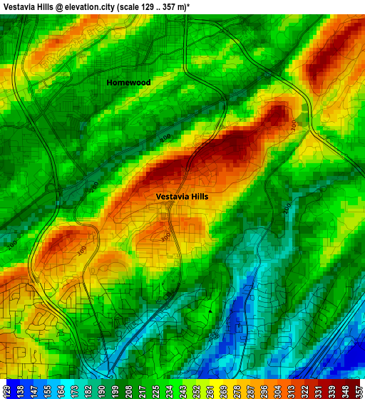
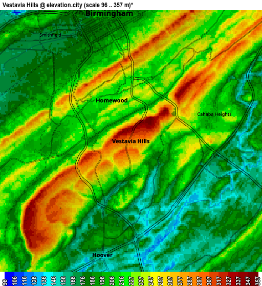
Below is the Elevation map of Vestavia Hills, which displays elevation range with different colors. Scale of the first map is from 129 to 357 m (423 to 1171 ft) with average elevation of 234.5 meters (=769 ft) [note 1]
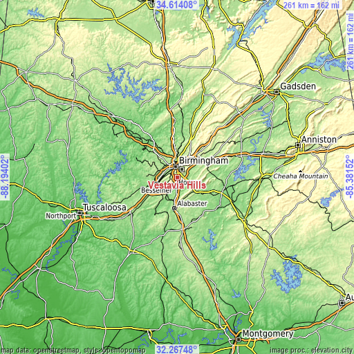
These maps also provides idea of topography and contour of this city, they are displayed at different zoom levels. More info about maps, scale and edge coordinates you can find below images.
| \ | Map #1 | Map #2 | Topo.Map |
| Scale [m] | 129..357 m | 96..357 m | × |
| Scale [ft] | 423..1171 ft | 315..1171 ft | × |
| Average | 234.5 m = 769 ft | 211.9 m = 695 ft | × |
| Width | 8.15 km = 5.1 mi | 16.31 km = 10.1 mi | 260.9 km = 162.1 mi |
| Height | 8.15 km = 5.1 mi | 16.31 km = 10.1 mi | 260.9 km = 162.1 mi |
| ↑Max Latitude | 33.485379° | 33.522023° | 34.61408° |
| Latitude at center | 33.44872° | 33.44872° | 33.44872° |
| ↓Min Latitude | 33.412045° | 33.375355° | 32.26748° |
| ← Min Longitude | -86.831715° | -86.875661° | -88.19402° |
| Longitude center | -86.78777° | -86.78777° | -86.78777° |
| →Max Longitude | -86.743825° | -86.699879° | -85.38152° |
Nearby cities:
Cities around Vestavia Hills sort by population:
• Birmingham elevation 187 m
8.1 km,  350°
350°
• Hoover 185 m
5.3 km,  204°
204°
• Homewood 212 m
2.8 km,  334°
334°
• Mountain Brook 237 m
6.7 km,  29°
29°
• Irondale 228 m
12.4 km,  36°
36°
• Fairfield 182 m
12.2 km,  289°
289°
• Meadowbrook 195 m
9.9 km,  121°
121°
• Lake Purdy 202 m
10.2 km,  101°
101°
• Brook Highland 189 m
10.7 km, 97°
• Cahaba Heights 201 m
5.5 km,  71°
71°
• Midfield 160 m
11.3 km,  277°
277°
• Indian Springs Village 156 m
10.8 km,  163°
163°
Multilingual:
 En español:
Vestavia Hills elevación 297 m.
 En France:
Vestavia Hills élévation 297 m.
 Auf Deutsch:
Vestavia Hills höhe über dem Meeresspiegel ist 297 m.

Sources and notes:
- [note 1] Map square and city borders are not equal. Map elevation data is calculated only from area inside that square.
- [src 1] Elevation data from geonames database provided with same terms of usage.
- [src 2] The elevation map of Vestavia Hills is generated using elevation data from NASA's 3 arcsec (90m) resolution SRTM data.
- [src 3] Base (background) map © OpenStreetMap contributors tiles are generated by Geofabrik and OpenTopoMap.
Copyright & License:
This Vestavia Hills Elevation Map is licensed under CC BY-SA. You may reuse any part from this page, if you give a proper credit by linking to this URL:
 More info on terms of use page.