Moores Mill elevation
Moores Mill (Alabama, Madison County), United States elevation is 206 meters and Moores Mill elevation in feet is 676 ft above sea level [src 1]. Moores Mill is a populated place (feature code) with elevation that is 73 meters (240 ft) smaller than average city elevation in United States.
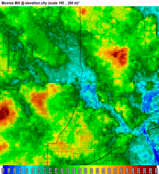
Below is the Elevation map of Moores Mill, which displays elevation range with different colors. Scale of the first map is from 195 to 260 m (640 to 853 ft) with average elevation of 221.7 meters (=727 ft) [note 1]
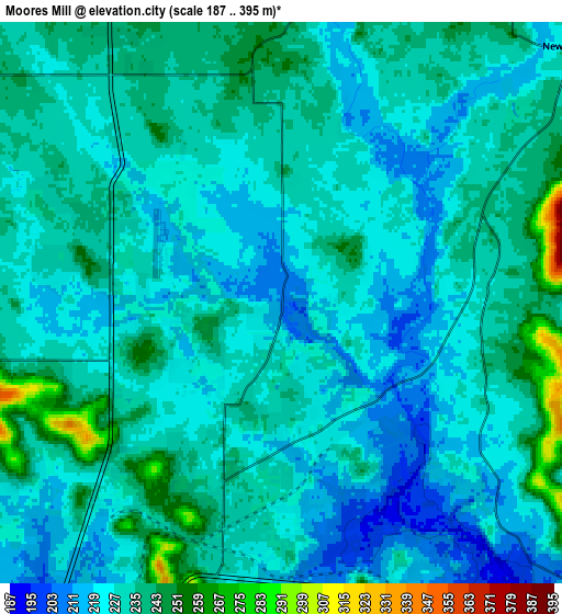
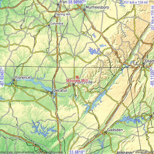
These maps also provides idea of topography and contour of this city, they are displayed at different zoom levels. More info about maps, scale and edge coordinates you can find below images.
| \ | Map #1 | Map #2 | Topo.Map |
| Scale [m] | 195..260 m | 187..395 m | × |
| Scale [ft] | 640..853 ft | 614..1296 ft | × |
| Average | 221.7 m = 727 ft | 229 m = 751 ft | × |
| Width | 8.02 km = 5 mi | 16.04 km = 10 mi | 256.6 km = 159.4 mi |
| Height | 8.02 km = 5 mi | 16.04 km = 10 mi | 256.6 km = 159.4 mi |
| ↑Max Latitude | 34.880038° | 34.916081° | 35.98997° |
| Latitude at center | 34.84398° | 34.84398° | 34.84398° |
| ↓Min Latitude | 34.807906° | 34.771816° | 33.6818° |
| ← Min Longitude | -86.562265° | -86.606211° | -87.92457° |
| Longitude center | -86.51832° | -86.51832° | -86.51832° |
| →Max Longitude | -86.474375° | -86.430429° | -85.11207° |
Nearby cities:
Cities around Moores Mill sort by population:
• Huntsville elevation 200 m
14.1 km,  206°
206°
• Madison 217 m
26.5 km,  232°
232°
• Fayetteville 216 m
34.6 km,  352°
352°
• Meridianville 238 m
5 km,  279°
279°
• Harvest 253 m
21.3 km,  273°
273°
• Hazel Green 240 m
11 km,  333°
333°
• Park City 305 m
26.9 km, 349°
• Brighton 290 m
27.2 km,  15°
15°
• Redstone Arsenal 316 m
21.4 km, 213°
• Owens Cross Roads 179 m
29 km,  169°
169°
• New Market 230 m
11.1 km,  48°
48°
• Ardmore 271 m
34.2 km,  298°
298°
Multilingual:
 En español:
Moores Mill elevación 206 m.
 En France:
Moores Mill élévation 206 m.
 Auf Deutsch:
Moores Mill höhe über dem Meeresspiegel ist 206 m.

Sources and notes:
- [note 1] Map square and city borders are not equal. Map elevation data is calculated only from area inside that square.
- [src 1] Elevation data from geonames database provided with same terms of usage.
- [src 2] The elevation map of Moores Mill is generated using elevation data from NASA's 3 arcsec (90m) resolution SRTM data.
- [src 3] Base (background) map © OpenStreetMap contributors tiles are generated by Geofabrik and OpenTopoMap.
Copyright & License:
This Moores Mill Elevation Map is licensed under CC BY-SA. You may reuse any part from this page, if you give a proper credit by linking to this URL:
 More info on terms of use page.