Jacksonville elevation
Jacksonville (Alabama, Calhoun County), United States elevation is 218 meters and Jacksonville elevation in feet is 715 ft above sea level [src 1]. Jacksonville is a populated place (feature code) with elevation that is 61 meters (200 ft) smaller than average city elevation in United States.
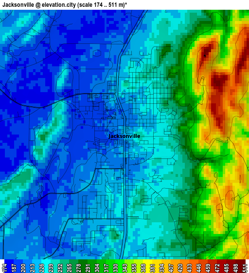
Below is the Elevation map of Jacksonville, which displays elevation range with different colors. Scale of the first map is from 174 to 511 m (571 to 1677 ft) with average elevation of 252.6 meters (=829 ft) [note 1]
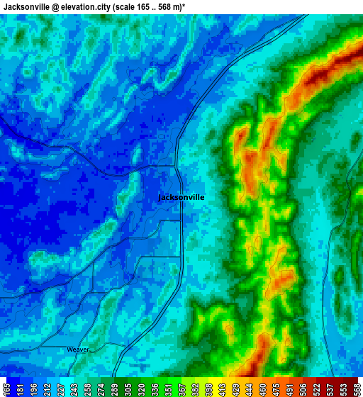
These maps also provides idea of topography and contour of this city, they are displayed at different zoom levels. More info about maps, scale and edge coordinates you can find below images.
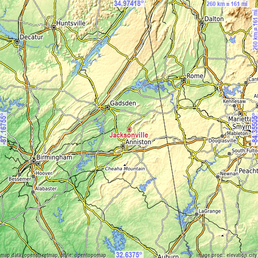
| \ | Map #1 | Map #2 | Topo.Map |
| Scale [m] | 174..511 m | 165..568 m | × |
| Scale [ft] | 571..1677 ft | 541..1864 ft | × |
| Average | 252.6 m = 829 ft | 252.9 m = 830 ft | × |
| Width | 8.12 km = 5 mi | 16.24 km = 10.1 mi | 259.8 km = 161.4 mi |
| Height | 8.12 km = 5 mi | 16.24 km = 10.1 mi | 259.8 km = 161.4 mi |
| ↑Max Latitude | 33.850324° | 33.886813° | 34.97418° |
| Latitude at center | 33.81382° | 33.81382° | 33.81382° |
| ↓Min Latitude | 33.7773° | 33.740765° | 32.6375° |
| ← Min Longitude | -85.805245° | -85.849191° | -87.16755° |
| Longitude center | -85.7613° | -85.7613° | -85.7613° |
| →Max Longitude | -85.717355° | -85.673409° | -84.35505° |
Nearby cities:
Cities around Jacksonville sort by population:
• Anniston elevation 215 m
18.3 km,  200°
200°
• Oxford 201 m
23.2 km, 197°
• Saks 252 m
14.7 km,  209°
209°
• Glencoe 165 m
22.4 km,  315°
315°
• Piedmont 213 m
18.5 km,  48°
48°
• Hokes Bluff 177 m
22.7 km,  334°
334°
• Alexandria 174 m
12.3 km,  248°
248°
• Heflin 293 m
24.4 km,  138°
138°
• West End-Cobb Town 228 m
20.8 km, 210°
• Weaver 226 m
8.3 km, 213°
• Choccolocco 207 m
18 km,  162°
162°
• Ohatchee 158 m
22.5 km,  261°
261°
Multilingual:
 En español:
Jacksonville elevación 218 m.
 En France:
Jacksonville élévation 218 m.
 Auf Deutsch:
Jacksonville höhe über dem Meeresspiegel ist 218 m.

Sources and notes:
- [note 1] Map square and city borders are not equal. Map elevation data is calculated only from area inside that square.
- [src 1] Elevation data from geonames database provided with same terms of usage.
- [src 2] The elevation map of Jacksonville is generated using elevation data from NASA's 3 arcsec (90m) resolution SRTM data.
- [src 3] Base (background) map © OpenStreetMap contributors tiles are generated by Geofabrik and OpenTopoMap.
Copyright & License:
This Jacksonville Elevation Map is licensed under CC BY-SA. You may reuse any part from this page, if you give a proper credit by linking to this URL:
 More info on terms of use page.