Red Chute elevation
Red Chute (Louisiana, Bossier Parish), United States elevation is 67 meters and Red Chute elevation in feet is 220 ft above sea level [src 1]. Red Chute is a populated place (feature code) with elevation that is 212 meters (696 ft) smaller than average city elevation in United States.
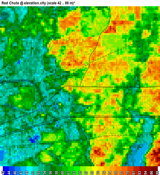
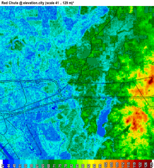
Below is the Elevation map of Red Chute, which displays elevation range with different colors. Scale of the first map is from 42 to 88 m (138 to 289 ft) with average elevation of 61.8 meters (=203 ft) [note 1]
These maps also provides idea of topography and contour of this city, they are displayed at different zoom levels. More info about maps, scale and edge coordinates you can find below images.
| \ | Map #1 | Map #2 | Topo.Map |
| Scale [m] | 42..88 m | 41..129 m | × |
| Scale [ft] | 138..289 ft | 135..423 ft | × |
| Average | 61.8 m = 203 ft | 64.2 m = 211 ft | × |
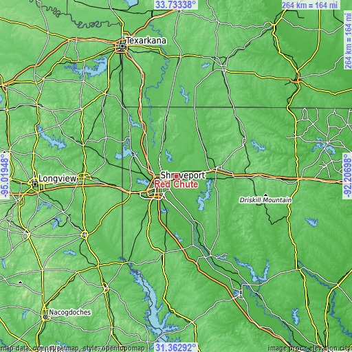
| Width | 8.24 km = 5.1 mi | 16.47 km = 10.2 mi | 263.6 km = 163.8 mi |
| Height | 8.24 km = 5.1 mi | 16.47 km = 10.2 mi | 263.6 km = 163.8 mi |
| ↑Max Latitude | 32.593012° | 32.630029° | 33.73338° |
| Latitude at center | 32.55598° | 32.55598° | 32.55598° |
| ↓Min Latitude | 32.518932° | 32.481869° | 31.36292° |
| ← Min Longitude | -93.657175° | -93.701121° | -95.01948° |
| Longitude center | -93.61323° | -93.61323° | -93.61323° |
| →Max Longitude | -93.569285° | -93.525339° | -92.20698° |
Nearby cities:
Cities around Red Chute sort by population:
• Shreveport elevation 50 m
13.3 km,  255°
255°
• Bossier City 53 m
12 km,  248°
248°
• Minden 82 m
31.3 km,  77°
77°
• Eastwood 76 m
4.3 km,  89°
89°
• Haughton 77 m
10.6 km,  104°
104°
• Greenwood 81 m
36 km, 249°
• Blanchard 71 m
26.3 km,  276°
276°
• Waskom 89 m
42.7 km, 258°
• Stonewall 74 m
36.3 km,  212°
212°
• Benton 66 m
19.6 km,  322°
322°
• Ringgold 88 m
40.2 km,  128°
128°
• Sibley 68 m
29.8 km, 93°
Multilingual:
 En español:
Red Chute elevación 67 m.
 En France:
Red Chute élévation 67 m.
 Auf Deutsch:
Red Chute höhe über dem Meeresspiegel ist 67 m.

Sources and notes:
- [note 1] Map square and city borders are not equal. Map elevation data is calculated only from area inside that square.
- [src 1] Elevation data from geonames database provided with same terms of usage.
- [src 2] The elevation map of Red Chute is generated using elevation data from NASA's 3 arcsec (90m) resolution SRTM data.
- [src 3] Base (background) map © OpenStreetMap contributors tiles are generated by Geofabrik and OpenTopoMap.
Copyright & License:
This Red Chute Elevation Map is licensed under CC BY-SA. You may reuse any part from this page, if you give a proper credit by linking to this URL:
 More info on terms of use page.