Namasuba elevation
Namasuba (Central Region, Nakaseke District), Uganda elevation is 1246 meters and Namasuba elevation in feet is 4088 ft above sea level [src 1]. Namasuba is a populated place (feature code) with elevation that is 13 meters (43 ft) smaller than average city elevation in Uganda.
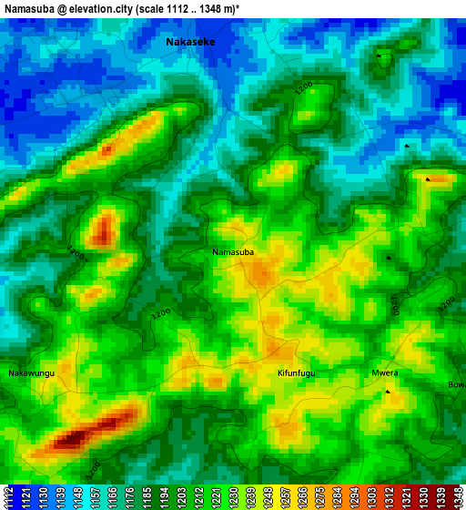
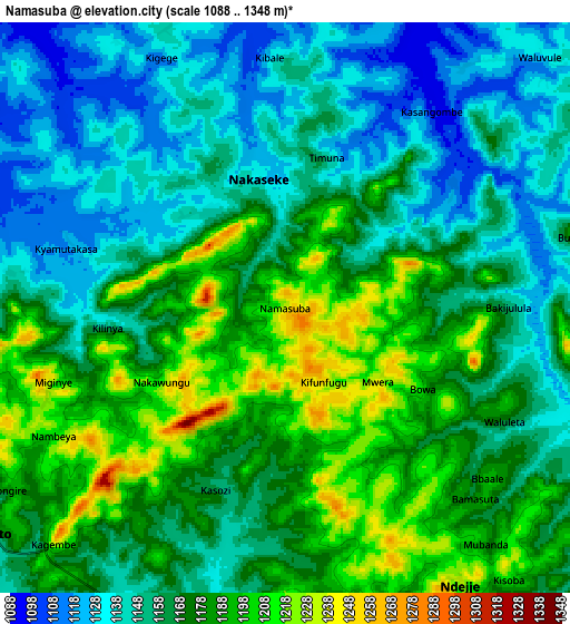
Below is the Elevation map of Namasuba, which displays elevation range with different colors. Scale of the first map is from 1112 to 1348 m (3648 to 4423 ft) with average elevation of 1197.1 meters (=3927 ft) [note 1]
These maps also provides idea of topography and contour of this city, they are displayed at different zoom levels. More info about maps, scale and edge coordinates you can find below images.
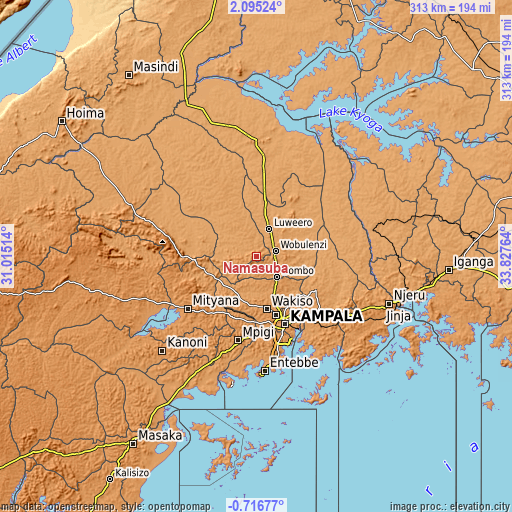
| \ | Map #1 | Map #2 | Topo.Map |
| Scale [m] | 1112..1348 m | 1088..1348 m | × |
| Scale [ft] | 3648..4423 ft | 3570..4423 ft | × |
| Average | 1197.1 m = 3927 ft | 1166.4 m = 3827 ft | × |
| Width | 9.77 km = 6.1 mi | 19.54 km = 12.1 mi | 312.7 km = 194.3 mi |
| Height | 9.77 km = 6.1 mi | 19.54 km = 12.1 mi | 312.7 km = 194.3 mi |
| ↑Max Latitude | 0.733382° | 0.777323° | 2.09524° |
| Latitude at center | 0.68944° | 0.68944° | 0.68944° |
| ↓Min Latitude | 0.645498° | 0.601555° | -0.71677° |
| ← Min Longitude | 32.377445° | 32.333499° | 31.01514° |
| Longitude center | 32.42139° | 32.42139° | 32.42139° |
| →Max Longitude | 32.465335° | 32.509281° | 33.82764° |
Nearby cities:
Cities around Namasuba sort by population:
• Kampala elevation 1223 m
45.2 km,  156°
156°
• Mukono 1188 m
52.7 km,  135°
135°
• Mityana 1199 m
53.7 km,  235°
235°
• Luwero 1108 m
18.7 km,  17°
17°
• Wobulenzi 1155 m
11 km,  66°
66°
• Kayunga 1071 m
52 km,  88°
88°
• Wakiso 1204 m
32 km,  172°
172°
• Kireka 1181 m
45.7 km,  146°
146°
• Bweyogerere 1194 m
45.6 km, 143°
• Mpigi 1265 m
53 km,  193°
193°
• Kampala Central Division 1199 m
44 km, 157°
• Nakaseke 1126 m
8 km,  329°
329°
Multilingual:
 En español:
Namasuba elevación 1246 m.
 En France:
Namasuba élévation 1246 m.
 Auf Deutsch:
Namasuba höhe über dem Meeresspiegel ist 1246 m.

Sources and notes:
- [note 1] Map square and city borders are not equal. Map elevation data is calculated only from area inside that square.
- [src 1] Elevation data from geonames database provided with same terms of usage.
- [src 2] The elevation map of Namasuba is generated using elevation data from NASA's 3 arcsec (90m) resolution SRTM data.
- [src 3] Base (background) map © OpenStreetMap contributors tiles are generated by Geofabrik and OpenTopoMap.
Copyright & License:
This Namasuba Elevation Map is licensed under CC BY-SA. You may reuse any part from this page, if you give a proper credit by linking to this URL:
 More info on terms of use page.