Bohorodchany elevation
Bohorodchany (Ivano-Frankivsk), Ukraine elevation is 334 meters and Bohorodchany elevation in feet is 1096 ft above sea level [src 1]. Bohorodchany is a seat of a second-order administrative division (feature code) with elevation that is 177 meters (581 ft) bigger than average city elevation in Ukraine.
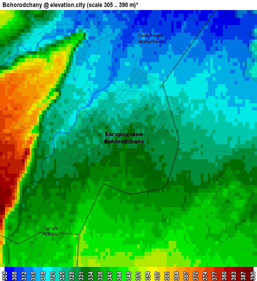
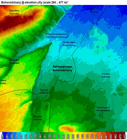
Below is the Elevation map of Bohorodchany, which displays elevation range with different colors. Scale of the first map is from 305 to 390 m (1001 to 1280 ft) with average elevation of 332.6 meters (=1091 ft) [note 1]
These maps also provides idea of topography and contour of this city, they are displayed at different zoom levels. More info about maps, scale and edge coordinates you can find below images.
| \ | Map #1 | Map #2 | Topo.Map |
| Scale [m] | 305..390 m | 284..477 m | × |
| Scale [ft] | 1001..1280 ft | 932..1565 ft | × |
| Average | 332.6 m = 1091 ft | 347.6 m = 1140 ft | × |
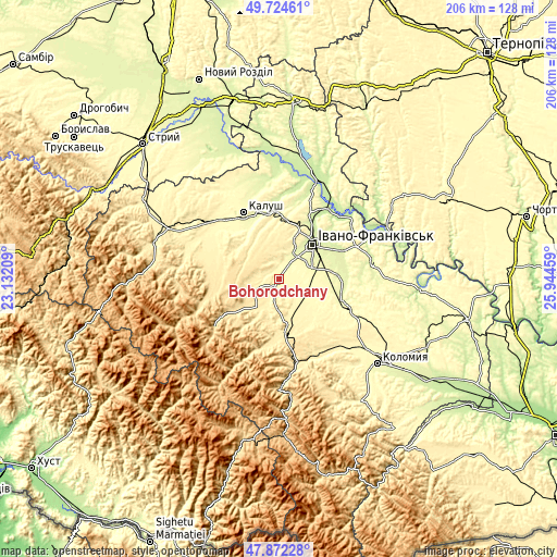
| Width | 6.44 km = 4 mi | 12.87 km = 8 mi | 206 km = 128 mi |
| Height | 6.44 km = 4 mi | 12.87 km = 8 mi | 205.9 km = 127.9 mi |
| ↑Max Latitude | 48.835934° | 48.864851° | 49.72461° |
| Latitude at center | 48.807° | 48.807° | 48.807° |
| ↓Min Latitude | 48.778049° | 48.749082° | 47.87228° |
| ← Min Longitude | 24.494395° | 24.450449° | 23.13209° |
| Longitude center | 24.53834° | 24.53834° | 24.53834° |
| →Max Longitude | 24.582285° | 24.626231° | 25.94459° |
Nearby cities:
Cities around Bohorodchany sort by population:
• Ivano-Frankivsk elevation 259 m
17.9 km,  44°
44°
• Nadvirna 428 m
19.3 km,  173°
173°
• Kosmach 479 m
14 km,  243°
243°
• Solotvyn 428 m
14.4 km,  216°
216°
• Cherniyiv 272 m
14 km,  66°
66°
• Zahvizdya 261 m
14.9 km,  34°
34°
• Stari Bohorodchany 312 m
3.1 km,  340°
340°
• Hvizd 399 m
13.6 km,  176°
176°
• Uhryniv 265 m
20 km, 34°
• Tysmenychany 316 m
10.2 km,  112°
112°
• Radcha 287 m
9.8 km,  60°
60°
• Markova 461 m
17.2 km,  212°
212°
Multilingual:
 En español:
Bohorodchany elevación 334 m.
 En France:
Bohorodchany élévation 334 m.
 Auf Deutsch:
Bohorodchany höhe über dem Meeresspiegel ist 334 m.

Sources and notes:
- [note 1] Map square and city borders are not equal. Map elevation data is calculated only from area inside that square.
- [src 1] Elevation data from geonames database provided with same terms of usage.
- [src 2] The elevation map of Bohorodchany is generated using elevation data from NASA's 3 arcsec (90m) resolution SRTM data.
- [src 3] Base (background) map © OpenStreetMap contributors tiles are generated by Geofabrik and OpenTopoMap.
Copyright & License:
This Bohorodchany Elevation Map is licensed under CC BY-SA. You may reuse any part from this page, if you give a proper credit by linking to this URL:
 More info on terms of use page.