Zahvizdya elevation
Zahvizdya (Ivano-Frankivsk), Ukraine elevation is 261 meters and Zahvizdya elevation in feet is 856 ft above sea level [src 1]. Zahvizdya is a populated place (feature code) with elevation that is 104 meters (341 ft) bigger than average city elevation in Ukraine.
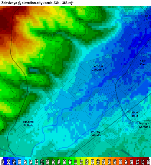
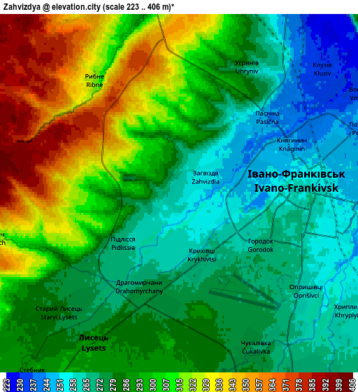
Below is the Elevation map of Zahvizdya, which displays elevation range with different colors. Scale of the first map is from 239 to 383 m (784 to 1257 ft) with average elevation of 278.7 meters (=914 ft) [note 1]
These maps also provides idea of topography and contour of this city, they are displayed at different zoom levels. More info about maps, scale and edge coordinates you can find below images.
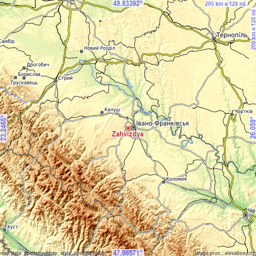
| \ | Map #1 | Map #2 | Topo.Map |
| Scale [m] | 239..383 m | 223..406 m | × |
| Scale [ft] | 784..1257 ft | 732..1332 ft | × |
| Average | 278.7 m = 914 ft | 292.3 m = 959 ft | × |
| Width | 6.42 km = 4 mi | 12.84 km = 8 mi | 205.5 km = 127.7 mi |
| Height | 6.42 km = 4 mi | 12.84 km = 8 mi | 205.5 km = 127.7 mi |
| ↑Max Latitude | 48.94723° | 48.976083° | 49.83392° |
| Latitude at center | 48.91836° | 48.91836° | 48.91836° |
| ↓Min Latitude | 48.889474° | 48.860571° | 47.98571° |
| ← Min Longitude | 24.608805° | 24.564859° | 23.2465° |
| Longitude center | 24.65275° | 24.65275° | 24.65275° |
| →Max Longitude | 24.696695° | 24.740641° | 26.059° |
Nearby cities:
Cities around Zahvizdya sort by population:
• Ivano-Frankivsk elevation 259 m
4.2 km,  85°
85°
• Kalush 279 m
22.9 km,  296°
296°
• Tysmenytsya 248 m
14.2 km,  97°
97°
• Bohorodchany 334 m
14.9 km,  214°
214°
• Halych 218 m
23.2 km,  13°
13°
• Cherniyiv 272 m
8.2 km,  146°
146°
• Stari Bohorodchany 312 m
13.3 km,  224°
224°
• Yamnytsya 231 m
8.9 km,  26°
26°
• Uhryniv 265 m
5 km,  35°
35°
• Chornoliztsi 258 m
20.3 km,  118°
118°
• Tysmenychany 316 m
16.3 km,  176°
176°
• Radcha 287 m
7.6 km, 178°
Multilingual:
 En español:
Zahvizdya elevación 261 m.
 En France:
Zahvizdya élévation 261 m.
 Auf Deutsch:
Zahvizdya höhe über dem Meeresspiegel ist 261 m.

Sources and notes:
- [note 1] Map square and city borders are not equal. Map elevation data is calculated only from area inside that square.
- [src 1] Elevation data from geonames database provided with same terms of usage.
- [src 2] The elevation map of Zahvizdya is generated using elevation data from NASA's 3 arcsec (90m) resolution SRTM data.
- [src 3] Base (background) map © OpenStreetMap contributors tiles are generated by Geofabrik and OpenTopoMap.
Copyright & License:
This Zahvizdya Elevation Map is licensed under CC BY-SA. You may reuse any part from this page, if you give a proper credit by linking to this URL:
 More info on terms of use page.