Izyaslav elevation
Izyaslav (Khmelnytskyi), Ukraine elevation is 231 meters and Izyaslav elevation in feet is 758 ft above sea level [src 1]. Izyaslav is a seat of a second-order administrative division (feature code) with elevation that is 74 meters (243 ft) bigger than average city elevation in Ukraine.
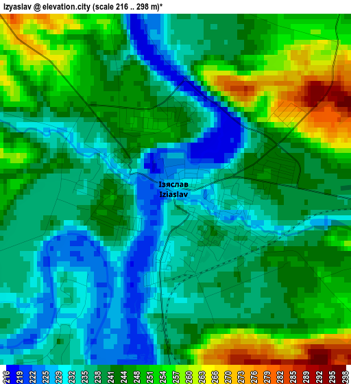
Below is the Elevation map of Izyaslav, which displays elevation range with different colors. Scale of the first map is from 216 to 298 m (709 to 978 ft) with average elevation of 242.3 meters (=795 ft) [note 1]
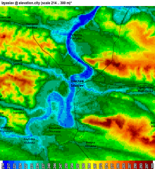
These maps also provides idea of topography and contour of this city, they are displayed at different zoom levels. More info about maps, scale and edge coordinates you can find below images.
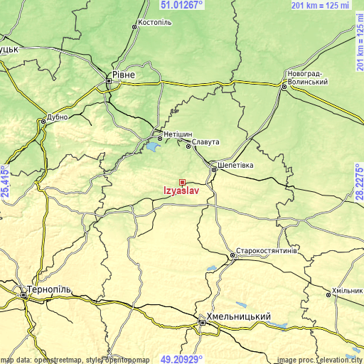
| \ | Map #1 | Map #2 | Topo.Map |
| Scale [m] | 216..298 m | 214..300 m | × |
| Scale [ft] | 709..978 ft | 702..984 ft | × |
| Average | 242.3 m = 795 ft | 250.1 m = 821 ft | × |
| Width | 6.27 km = 3.9 mi | 12.53 km = 7.8 mi | 200.5 km = 124.6 mi |
| Height | 6.27 km = 3.9 mi | 12.53 km = 7.8 mi | 200.5 km = 124.6 mi |
| ↑Max Latitude | 50.147639° | 50.175791° | 51.01267° |
| Latitude at center | 50.11947° | 50.11947° | 50.11947° |
| ↓Min Latitude | 50.091284° | 50.063082° | 49.20929° |
| ← Min Longitude | 26.777305° | 26.733359° | 25.415° |
| Longitude center | 26.82125° | 26.82125° | 26.82125° |
| →Max Longitude | 26.865195° | 26.909141° | 28.2275° |
Nearby cities:
Cities around Izyaslav sort by population:
• Shepetivka elevation 252 m
18.8 km,  66°
66°
• Starokostiantyniv 268 m
48.6 km,  145°
145°
• Slavuta 218 m
20.5 km,  8°
8°
• Netishyn 207 m
27.7 km,  332°
332°
• Polonne 233 m
49.2 km,  89°
89°
• Ostroh 219 m
32 km,  316°
316°
• Poninka 239 m
51.5 km,  81°
81°
• Novoselytsya 239 m
50.1 km,  96°
96°
• Antoniny 286 m
34.7 km,  173°
173°
• Shumsk 240 m
50.4 km,  270°
270°
• Teofipol 274 m
42.7 km,  222°
222°
• Lyakhovtsy 243 m
30.9 km,  245°
245°
Multilingual:
 En español:
Izyaslav elevación 231 m.
 En France:
Izyaslav élévation 231 m.
 Auf Deutsch:
Izyaslav höhe über dem Meeresspiegel ist 231 m.

Sources and notes:
- [note 1] Map square and city borders are not equal. Map elevation data is calculated only from area inside that square.
- [src 1] Elevation data from geonames database provided with same terms of usage.
- [src 2] The elevation map of Izyaslav is generated using elevation data from NASA's 3 arcsec (90m) resolution SRTM data.
- [src 3] Base (background) map © OpenStreetMap contributors tiles are generated by Geofabrik and OpenTopoMap.
Copyright & License:
This Izyaslav Elevation Map is licensed under CC BY-SA. You may reuse any part from this page, if you give a proper credit by linking to this URL:
 More info on terms of use page.