Kostyantynivka elevation
Kostyantynivka (Donetsk, Kostiantynivka Raion), Ukraine elevation is 87 meters and Kostyantynivka elevation in feet is 285 ft above sea level [src 1]. Kostyantynivka is a seat of a second-order administrative division (feature code) with elevation that is 70 meters (230 ft) smaller than average city elevation in Ukraine.
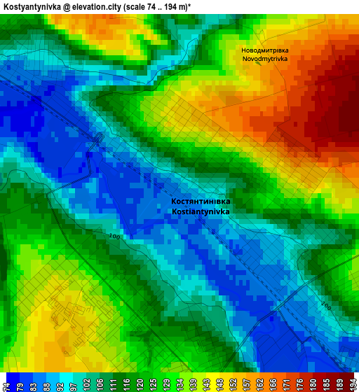
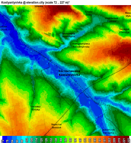
Below is the Elevation map of Kostyantynivka, which displays elevation range with different colors. Scale of the first map is from 74 to 194 m (243 to 636 ft) with average elevation of 119.5 meters (=392 ft) [note 1]
These maps also provides idea of topography and contour of this city, they are displayed at different zoom levels. More info about maps, scale and edge coordinates you can find below images.
| \ | Map #1 | Map #2 | Topo.Map |
| Scale [m] | 74..194 m | 72..227 m | × |
| Scale [ft] | 243..636 ft | 236..745 ft | × |
| Average | 119.5 m = 392 ft | 138.4 m = 454 ft | × |
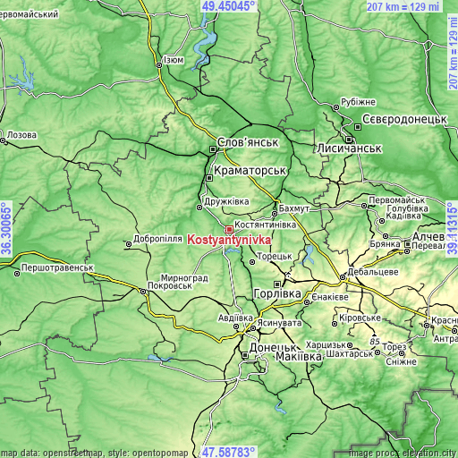
| Width | 6.47 km = 4 mi | 12.94 km = 8 mi | 207.1 km = 128.7 mi |
| Height | 6.47 km = 4 mi | 12.94 km = 8 mi | 207.1 km = 128.7 mi |
| ↑Max Latitude | 48.556795° | 48.585873° | 49.45045° |
| Latitude at center | 48.5277° | 48.5277° | 48.5277° |
| ↓Min Latitude | 48.498589° | 48.46946° | 47.58783° |
| ← Min Longitude | 37.662955° | 37.619009° | 36.30065° |
| Longitude center | 37.7069° | 37.7069° | 37.7069° |
| →Max Longitude | 37.750845° | 37.794791° | 39.11315° |
Nearby cities:
Cities around Kostyantynivka sort by population:
• Horlivka elevation 282 m
33.3 km,  129°
129°
• Kramators’k 74 m
24.4 km,  332°
332°
• Sloviansk 61 m
38.3 km,  350°
350°
• Bakhmut 102 m
22.8 km,  70°
70°
• Druzhkivka 101 m
16.1 km,  315°
315°
• Toretsk 200 m
17.7 km,  144°
144°
• Chasiv Yar 230 m
13.3 km,  56°
56°
• Soledar 82 m
32.8 km, 59°
• Svetlodarsk 181 m
39.5 km,  105°
105°
• Bilyts’ke 193 m
41 km,  250°
250°
• Shcherbynivka 101 m
16 km,  157°
157°
• Krasnotorka 72 m
21.4 km, 323°
Multilingual:
 En español:
Kostyantynivka elevación 87 m.
 En France:
Kostyantynivka élévation 87 m.
 Auf Deutsch:
Kostjantyniwka höhe über dem Meeresspiegel ist 87 m.

Sources and notes:
- [note 1] Map square and city borders are not equal. Map elevation data is calculated only from area inside that square.
- [src 1] Elevation data from geonames database provided with same terms of usage.
- [src 2] The elevation map of Kostyantynivka is generated using elevation data from NASA's 3 arcsec (90m) resolution SRTM data.
- [src 3] Base (background) map © OpenStreetMap contributors tiles are generated by Geofabrik and OpenTopoMap.
Copyright & License:
This Kostyantynivka Elevation Map is licensed under CC BY-SA. You may reuse any part from this page, if you give a proper credit by linking to this URL:
 More info on terms of use page.