Kozelets’ elevation
Kozelets’ (Chernihiv), Ukraine elevation is 112 meters and Kozelets’ elevation in feet is 367 ft above sea level [src 1]. Kozelets’ is a seat of a second-order administrative division (feature code) with elevation that is 45 meters (148 ft) smaller than average city elevation in Ukraine.
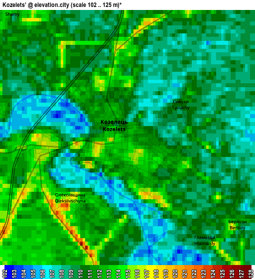
Below is the Elevation map of Kozelets’, which displays elevation range with different colors. Scale of the first map is from 102 to 125 m (335 to 410 ft) with average elevation of 110.1 meters (=361 ft) [note 1]
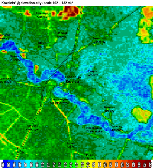
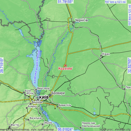
These maps also provides idea of topography and contour of this city, they are displayed at different zoom levels. More info about maps, scale and edge coordinates you can find below images.
| \ | Map #1 | Map #2 | Topo.Map |
| Scale [m] | 102..125 m | 102..132 m | × |
| Scale [ft] | 335..410 ft | 335..433 ft | × |
| Average | 110.1 m = 361 ft | 111.1 m = 365 ft | × |
| Width | 6.16 km = 3.8 mi | 12.32 km = 7.7 mi | 197.2 km = 122.5 mi |
| Height | 6.16 km = 3.8 mi | 12.32 km = 7.7 mi | 197.2 km = 122.5 mi |
| ↑Max Latitude | 50.941039° | 50.968722° | 51.79155° |
| Latitude at center | 50.91334° | 50.91334° | 50.91334° |
| ↓Min Latitude | 50.885624° | 50.857892° | 50.01824° |
| ← Min Longitude | 31.077455° | 31.033509° | 29.71515° |
| Longitude center | 31.1214° | 31.1214° | 31.1214° |
| →Max Longitude | 31.165345° | 31.209291° | 32.52765° |
Nearby cities:
Cities around Kozelets’ sort by population:
• Brovary elevation 130 m
49.2 km,  206°
206°
• Nosivka 121 m
32.4 km,  86°
86°
• Bobrovytsya 131 m
26.7 km,  133°
133°
• Velyka Dymerka 122 m
38.8 km,  203°
203°
• Desna 115 m
25.3 km,  273°
273°
• Oster 114 m
17.3 km,  283°
283°
• Trebukhiv 114 m
50.1 km, 197°
• Kobyzhcha 131 m
28.5 km,  109°
109°
• Semypolky 116 m
24.6 km, 212°
• Olyshivka 118 m
37.4 km,  23°
23°
• Pohreby 96 m
52.1 km,  220°
220°
• Pukhivka 97 m
44.1 km, 220°
Multilingual:
 En español:
Kozelets’ elevación 112 m.
 En France:
Kozelets’ élévation 112 m.
 Auf Deutsch:
Kozelets’ höhe über dem Meeresspiegel ist 112 m.

Sources and notes:
- [note 1] Map square and city borders are not equal. Map elevation data is calculated only from area inside that square.
- [src 1] Elevation data from geonames database provided with same terms of usage.
- [src 2] The elevation map of Kozelets’ is generated using elevation data from NASA's 3 arcsec (90m) resolution SRTM data.
- [src 3] Base (background) map © OpenStreetMap contributors tiles are generated by Geofabrik and OpenTopoMap.
Copyright & License:
This Kozelets’ Elevation Map is licensed under CC BY-SA. You may reuse any part from this page, if you give a proper credit by linking to this URL:
 More info on terms of use page.