Kulykiv elevation
Kulykiv (Lviv), Ukraine elevation is 214 meters and Kulykiv elevation in feet is 702 ft above sea level [src 1]. Kulykiv is a populated place (feature code) with elevation that is 57 meters (187 ft) bigger than average city elevation in Ukraine.
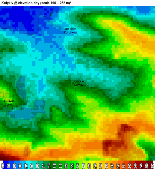
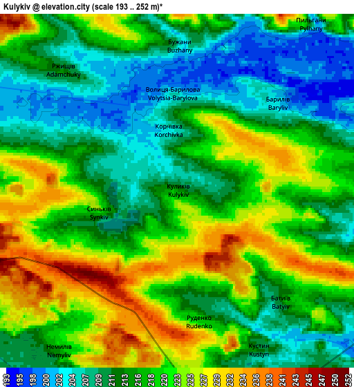
Below is the Elevation map of Kulykiv, which displays elevation range with different colors. Scale of the first map is from 196 to 252 m (643 to 827 ft) with average elevation of 217.3 meters (=713 ft) [note 1]
These maps also provides idea of topography and contour of this city, they are displayed at different zoom levels. More info about maps, scale and edge coordinates you can find below images.
| \ | Map #1 | Map #2 | Topo.Map |
| Scale [m] | 196..252 m | 193..252 m | × |
| Scale [ft] | 643..827 ft | 633..827 ft | × |
| Average | 217.3 m = 713 ft | 216.5 m = 710 ft | × |
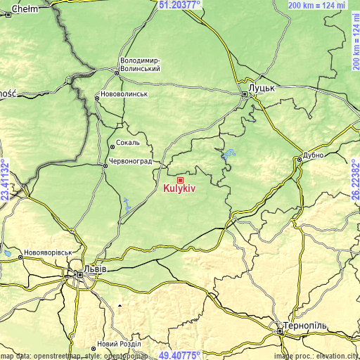
| Width | 6.24 km = 3.9 mi | 12.48 km = 7.8 mi | 199.7 km = 124.1 mi |
| Height | 6.24 km = 3.9 mi | 12.48 km = 7.8 mi | 199.7 km = 124.1 mi |
| ↑Max Latitude | 50.342294° | 50.370332° | 51.20377° |
| Latitude at center | 50.31424° | 50.31424° | 50.31424° |
| ↓Min Latitude | 50.286169° | 50.258082° | 49.40775° |
| ← Min Longitude | 24.773625° | 24.729679° | 23.41132° |
| Longitude center | 24.81757° | 24.81757° | 24.81757° |
| →Max Longitude | 24.861515° | 24.905461° | 26.22382° |
Nearby cities:
Cities around Kulykiv sort by population:
• Brody elevation 223 m
34.6 km,  136°
136°
• Sokal’ 198 m
41.9 km,  295°
295°
• Radyvyliv 221 m
37.3 km,  123°
123°
• Staryy Dobrotvir 201 m
32.6 km,  253°
253°
• Lopatyn 216 m
10.7 km,  168°
168°
• Berestechko 190 m
21.4 km,  76°
76°
• Olesko 232 m
39.5 km, 172°
• Bus’k 218 m
41.4 km,  200°
200°
• Kamianka-Buzka 215 m
40.8 km,  235°
235°
• Demydivka 206 m
38.9 km,  70°
70°
• Horokhiv 209 m
21.2 km,  349°
349°
• Radekhiv 227 m
12.9 km, 254°
Multilingual:
 En español:
Kulykiv elevación 214 m.
 En France:
Kulykiv élévation 214 m.


Sources and notes:
- [note 1] Map square and city borders are not equal. Map elevation data is calculated only from area inside that square.
- [src 1] Elevation data from geonames database provided with same terms of usage.
- [src 2] The elevation map of Kulykiv is generated using elevation data from NASA's 3 arcsec (90m) resolution SRTM data.
- [src 3] Base (background) map © OpenStreetMap contributors tiles are generated by Geofabrik and OpenTopoMap.
Copyright & License:
This Kulykiv Elevation Map is licensed under CC BY-SA. You may reuse any part from this page, if you give a proper credit by linking to this URL:
 More info on terms of use page.