Mizhhirya elevation
Mizhhirya (Transcarpathia, Mizhhirya Raion), Ukraine elevation is 452 meters and Mizhhirya elevation in feet is 1483 ft above sea level [src 1]. Mizhhirya is a seat of a second-order administrative division (feature code) with elevation that is 295 meters (968 ft) bigger than average city elevation in Ukraine.
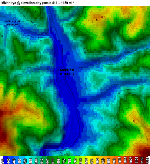
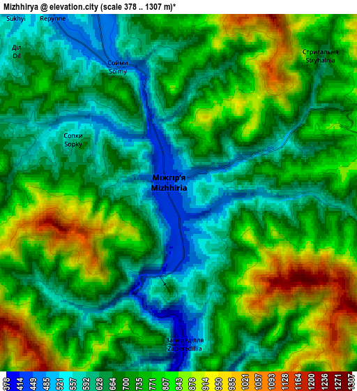
Below is the Elevation map of Mizhhirya, which displays elevation range with different colors. Scale of the first map is from 411 to 1159 m (1348 to 3802 ft) with average elevation of 626.6 meters (=2056 ft) [note 1]
These maps also provides idea of topography and contour of this city, they are displayed at different zoom levels. More info about maps, scale and edge coordinates you can find below images.
| \ | Map #1 | Map #2 | Topo.Map |
| Scale [m] | 411..1159 m | 378..1307 m | × |
| Scale [ft] | 1348..3802 ft | 1240..4288 ft | × |
| Average | 626.6 m = 2056 ft | 720.6 m = 2364 ft | × |
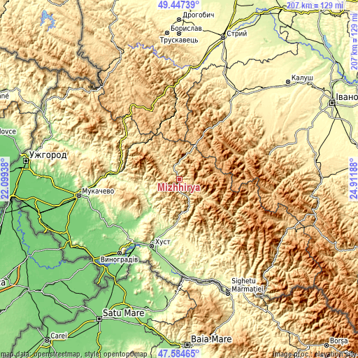
| Width | 6.47 km = 4 mi | 12.94 km = 8 mi | 207.1 km = 128.7 mi |
| Height | 6.47 km = 4 mi | 12.94 km = 8 mi | 207.1 km = 128.7 mi |
| ↑Max Latitude | 48.553677° | 48.582756° | 49.44739° |
| Latitude at center | 48.52458° | 48.52458° | 48.52458° |
| ↓Min Latitude | 48.495467° | 48.466337° | 47.58465° |
| ← Min Longitude | 23.461685° | 23.417739° | 22.09938° |
| Longitude center | 23.50563° | 23.50563° | 23.50563° |
| →Max Longitude | 23.549575° | 23.593521° | 24.91188° |
Nearby cities:
Cities around Mizhhirya sort by population:
• Dovhe elevation 172 m
24.4 km,  223°
223°
• Kolochava 550 m
17.6 km,  127°
127°
• Synevyr 630 m
9.8 km,  115°
115°
• Kushnytsya 227 m
20.5 km,  242°
242°
• Lypcha 207 m
30.7 km,  197°
197°
• Lysychovo 337 m
16.2 km,  258°
258°
• Bereznyky 313 m
21.1 km,  266°
266°
• Horinchovo 227 m
28.7 km,  190°
190°
• Berezovo 276 m
24 km, 185°
• Synevyrska Poliana 802 m
15.1 km,  63°
63°
• Verchnia Rozhanka 707 m
28.5 km,  1°
1°
• Pylypets 698 m
22.1 km,  312°
312°
Multilingual:
 En español:
Mizhhirya elevación 452 m.
 En France:
Mizhhirya élévation 452 m.
 Auf Deutsch:
Mizhhirya höhe über dem Meeresspiegel ist 452 m.

Sources and notes:
- [note 1] Map square and city borders are not equal. Map elevation data is calculated only from area inside that square.
- [src 1] Elevation data from geonames database provided with same terms of usage.
- [src 2] The elevation map of Mizhhirya is generated using elevation data from NASA's 3 arcsec (90m) resolution SRTM data.
- [src 3] Base (background) map © OpenStreetMap contributors tiles are generated by Geofabrik and OpenTopoMap.
Copyright & License:
This Mizhhirya Elevation Map is licensed under CC BY-SA. You may reuse any part from this page, if you give a proper credit by linking to this URL:
 More info on terms of use page.