Osypenko elevation
Osypenko (Zaporizhia), Ukraine elevation is 18 meters and Osypenko elevation in feet is 59 ft above sea level [src 1]. Osypenko is a populated place (feature code) with elevation that is 139 meters (456 ft) smaller than average city elevation in Ukraine.
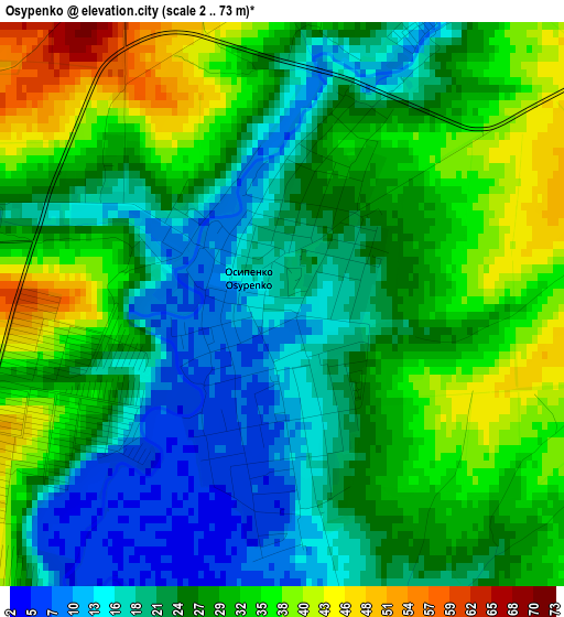
Below is the Elevation map of Osypenko, which displays elevation range with different colors. Scale of the first map is from 2 to 73 m (7 to 240 ft) with average elevation of 26.7 meters (=88 ft) [note 1]
These maps also provides idea of topography and contour of this city, they are displayed at different zoom levels. More info about maps, scale and edge coordinates you can find below images.
| \ | Map #1 | Map #2 | Topo.Map |
| Scale [m] | 2..73 m | 0..94 m | × |
| Scale [ft] | 7..240 ft | 0..308 ft | × |
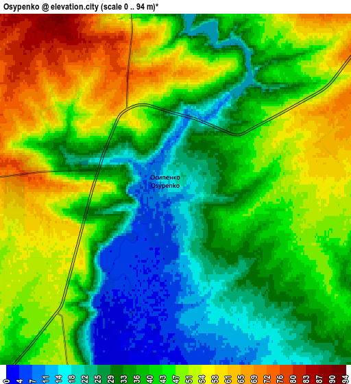
| Average | 26.7 m = 88 ft | 40.4 m = 133 ft | × |
| Width | 6.68 km = 4.2 mi | 13.35 km = 8.3 mi | 213.6 km = 132.7 mi |
| Height | 6.68 km = 4.2 mi | 13.35 km = 8.3 mi | 213.6 km = 132.7 mi |
| ↑Max Latitude | 46.943611° | 46.973604° | 47.86561° |
| Latitude at center | 46.9136° | 46.9136° | 46.9136° |
| ↓Min Latitude | 46.883573° | 46.853528° | 45.94437° |
| ← Min Longitude | 36.781355° | 36.737409° | 35.41905° |
| Longitude center | 36.8253° | 36.8253° | 36.8253° |
| →Max Longitude | 36.869245° | 36.913191° | 38.23155° |
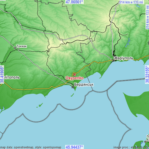
Nearby cities:
Cities around Osypenko sort by population:
• Berdyansk elevation 31 m
16.5 km,  187°
187°
• Prymors’k 13 m
41.6 km,  241°
241°
• Manhush 52 m
40.1 km,  66°
66°
• Kuybysheve 201 m
51.2 km,  344°
344°
• Staryy Krym 45 m
57.4 km,  61°
61°
• Yalta 32 m
34.5 km,  80°
80°
• Urzuf 8 m
20.8 km,  89°
89°
• Komysh-Zorya 230 m
47.1 km,  347°
347°
• Temriuk 143 m
41.2 km,  16°
16°
• Melekyne 1 m
43.9 km, 83°
• Rozivka 228 m
55.5 km, 19°
• Nikol's’ke 124 m
49.6 km,  49°
49°
Multilingual:
 En español:
Osypenko elevación 18 m.
 En France:
Osypenko élévation 18 m.


Sources and notes:
- [note 1] Map square and city borders are not equal. Map elevation data is calculated only from area inside that square.
- [src 1] Elevation data from geonames database provided with same terms of usage.
- [src 2] The elevation map of Osypenko is generated using elevation data from NASA's 3 arcsec (90m) resolution SRTM data.
- [src 3] Base (background) map © OpenStreetMap contributors tiles are generated by Geofabrik and OpenTopoMap.
Copyright & License:
This Osypenko Elevation Map is licensed under CC BY-SA. You may reuse any part from this page, if you give a proper credit by linking to this URL:
 More info on terms of use page.