Rudne elevation
Rudne (Lviv), Ukraine elevation is 311 meters and Rudne elevation in feet is 1020 ft above sea level [src 1]. Rudne is a populated place (feature code) with elevation that is 154 meters (505 ft) bigger than average city elevation in Ukraine.
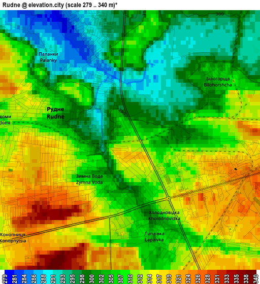
Below is the Elevation map of Rudne, which displays elevation range with different colors. Scale of the first map is from 279 to 340 m (915 to 1115 ft) with average elevation of 307.6 meters (=1009 ft) [note 1]
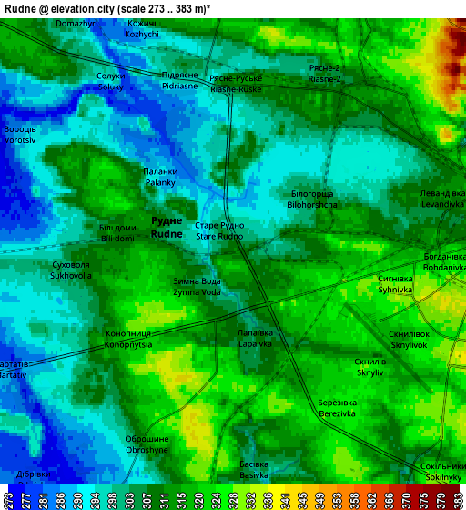
These maps also provides idea of topography and contour of this city, they are displayed at different zoom levels. More info about maps, scale and edge coordinates you can find below images.
| \ | Map #1 | Map #2 | Topo.Map |
| Scale [m] | 279..340 m | 273..383 m | × |
| Scale [ft] | 915..1115 ft | 896..1257 ft | × |
| Average | 307.6 m = 1009 ft | 308 m = 1010 ft | × |
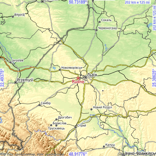
| Width | 6.3 km = 3.9 mi | 12.61 km = 7.8 mi | 201.7 km = 125.3 mi |
| Height | 6.3 km = 3.9 mi | 12.61 km = 7.8 mi | 201.7 km = 125.3 mi |
| ↑Max Latitude | 49.861667° | 49.889987° | 50.73189° |
| Latitude at center | 49.83333° | 49.83333° | 49.83333° |
| ↓Min Latitude | 49.804976° | 49.776606° | 48.91776° |
| ← Min Longitude | 23.856055° | 23.812109° | 22.49375° |
| Longitude center | 23.9° | 23.9° | 23.9° |
| →Max Longitude | 23.943945° | 23.987891° | 25.30625° |
Nearby cities:
Cities around Rudne sort by population:
• Lviv elevation 284 m
8.9 km,  86°
86°
• Horodok 280 m
18.9 km,  253°
253°
• Pustomyty 301 m
13.2 km,  175°
175°
• Dublyany 258 m
15.5 km,  59°
59°
• Ivano-Frankove 307 m
15.6 km,  308°
308°
• Shchyrets 260 m
20.4 km,  185°
185°
• Bryukhovychi 286 m
9 km,  28°
28°
• Obroshyne 302 m
6.1 km,  203°
203°
• Kulykiv 258 m
20.7 km,  38°
38°
• Sukhovolya 301 m
4.6 km,  257°
257°
• Solonka 318 m
11.7 km,  137°
137°
• Navaria 307 m
9.5 km,  168°
168°
Multilingual:
 En español:
Rudne elevación 311 m.
 En France:
Rudne élévation 311 m.


Sources and notes:
- [note 1] Map square and city borders are not equal. Map elevation data is calculated only from area inside that square.
- [src 1] Elevation data from geonames database provided with same terms of usage.
- [src 2] The elevation map of Rudne is generated using elevation data from NASA's 3 arcsec (90m) resolution SRTM data.
- [src 3] Base (background) map © OpenStreetMap contributors tiles are generated by Geofabrik and OpenTopoMap.
Copyright & License:
This Rudne Elevation Map is licensed under CC BY-SA. You may reuse any part from this page, if you give a proper credit by linking to this URL:
 More info on terms of use page.