Kulykiv elevation
Kulykiv (Lviv), Ukraine elevation is 258 meters and Kulykiv elevation in feet is 846 ft above sea level [src 1]. Kulykiv is a populated place (feature code) with elevation that is 101 meters (331 ft) bigger than average city elevation in Ukraine.
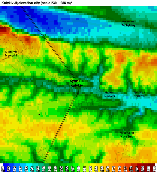
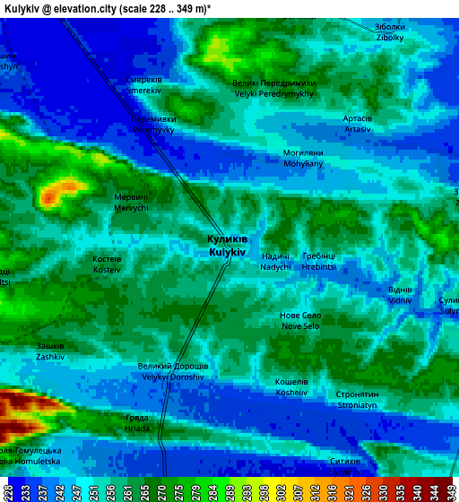
Below is the Elevation map of Kulykiv, which displays elevation range with different colors. Scale of the first map is from 230 to 288 m (755 to 945 ft) with average elevation of 254.9 meters (=836 ft) [note 1]
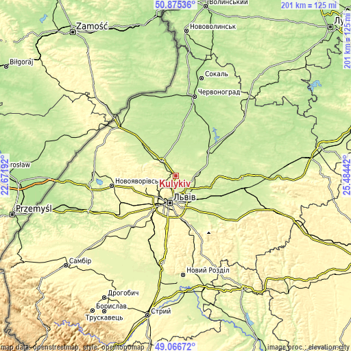
These maps also provides idea of topography and contour of this city, they are displayed at different zoom levels. More info about maps, scale and edge coordinates you can find below images.
| \ | Map #1 | Map #2 | Topo.Map |
| Scale [m] | 230..288 m | 228..349 m | × |
| Scale [ft] | 755..945 ft | 748..1145 ft | × |
| Average | 254.9 m = 836 ft | 253.4 m = 831 ft | × |
| Width | 6.28 km = 3.9 mi | 12.57 km = 7.8 mi | 201.1 km = 125 mi |
| Height | 6.28 km = 3.9 mi | 12.57 km = 7.8 mi | 201.1 km = 125 mi |
| ↑Max Latitude | 50.007791° | 50.036026° | 50.87536° |
| Latitude at center | 49.97954° | 49.97954° | 49.97954° |
| ↓Min Latitude | 49.951272° | 49.922988° | 49.06672° |
| ← Min Longitude | 24.034225° | 23.990279° | 22.67192° |
| Longitude center | 24.07817° | 24.07817° | 24.07817° |
| →Max Longitude | 24.122115° | 24.166061° | 25.48442° |
Nearby cities:
Cities around Kulykiv sort by population:
• Lviv elevation 284 m
16.2 km,  194°
194°
• Zhovkva 232 m
11.6 km,  319°
319°
• Dublyany 258 m
8.4 km,  175°
175°
• Ivano-Frankove 307 m
25.8 km,  255°
255°
• Rudne 311 m
20.7 km,  218°
218°
• Bryukhovychi 286 m
11.9 km,  225°
225°
• Sukhovolya 301 m
24.4 km, 224°
• Solonka 318 m
25.3 km, 191°
• Novyi Yarychiv 223 m
18.3 km,  117°
117°
• Hlyns'k 259 m
15.6 km,  305°
305°
• Verkhnyaya Belka 236 m
24.3 km,  138°
138°
• Kamianka-Buzka 215 m
23.7 km,  53°
53°
Multilingual:
 En español:
Kulykiv elevación 258 m.
 En France:
Kulykiv élévation 258 m.


Sources and notes:
- [note 1] Map square and city borders are not equal. Map elevation data is calculated only from area inside that square.
- [src 1] Elevation data from geonames database provided with same terms of usage.
- [src 2] The elevation map of Kulykiv is generated using elevation data from NASA's 3 arcsec (90m) resolution SRTM data.
- [src 3] Base (background) map © OpenStreetMap contributors tiles are generated by Geofabrik and OpenTopoMap.
Copyright & License:
This Kulykiv Elevation Map is licensed under CC BY-SA. You may reuse any part from this page, if you give a proper credit by linking to this URL:
 More info on terms of use page.