Snizhne elevation
Snizhne (Donetsk), Ukraine elevation is 290 meters and Snizhne elevation in feet is 951 ft above sea level [src 1]. Snizhne is a populated place (feature code) with elevation that is 133 meters (436 ft) bigger than average city elevation in Ukraine.
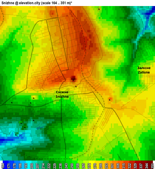
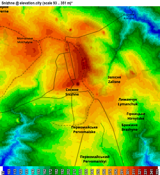
Below is the Elevation map of Snizhne, which displays elevation range with different colors. Scale of the first map is from 164 to 351 m (538 to 1152 ft) with average elevation of 262.4 meters (=861 ft) [note 1]
These maps also provides idea of topography and contour of this city, they are displayed at different zoom levels. More info about maps, scale and edge coordinates you can find below images.
| \ | Map #1 | Map #2 | Topo.Map |
| Scale [m] | 164..351 m | 93..351 m | × |
| Scale [ft] | 538..1152 ft | 305..1152 ft | × |
| Average | 262.4 m = 861 ft | 232.2 m = 762 ft | × |
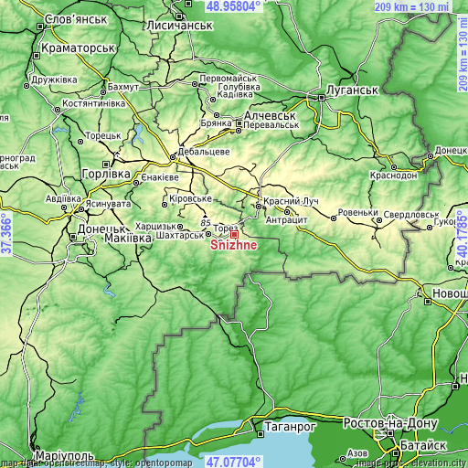
| Width | 6.54 km = 4.1 mi | 13.07 km = 8.1 mi | 209.1 km = 129.9 mi |
| Height | 6.54 km = 4.1 mi | 13.07 km = 8.1 mi | 209.1 km = 129.9 mi |
| ↑Max Latitude | 48.055502° | 48.084867° | 48.95804° |
| Latitude at center | 48.02612° | 48.02612° | 48.02612° |
| ↓Min Latitude | 47.996721° | 47.967306° | 47.07704° |
| ← Min Longitude | 38.728305° | 38.684359° | 37.366° |
| Longitude center | 38.77225° | 38.77225° | 38.77225° |
| →Max Longitude | 38.816195° | 38.860141° | 40.1785° |
Nearby cities:
Cities around Snizhne sort by population:
• Krasnyy Luch elevation 266 m
17.6 km,  44°
44°
• Shakhtars’k 227 m
25.1 km,  277°
277°
• Chystyakove 240 m
13.1 km, 276°
• Antratsyt 235 m
25.7 km,  67°
67°
• Kripens’kyy 189 m
22 km,  75°
75°
• Miusyns’k 97 m
11.3 km,  59°
59°
• Rozsypne 250 m
20 km,  313°
313°
• Stizhkivs’ke 257 m
22.9 km,  295°
295°
• Blahodatne 64 m
26.9 km,  232°
232°
• Dmytrivka 51 m
15.8 km,  129°
129°
• Krasnyy Kut 155 m
19.6 km,  5°
5°
• Zalesnoye 275 m
2.8 km, 78°
Multilingual:
 En español:
Snizhne elevación 290 m.
 En France:
Snizhne élévation 290 m.


Sources and notes:
- [note 1] Map square and city borders are not equal. Map elevation data is calculated only from area inside that square.
- [src 1] Elevation data from geonames database provided with same terms of usage.
- [src 2] The elevation map of Snizhne is generated using elevation data from NASA's 3 arcsec (90m) resolution SRTM data.
- [src 3] Base (background) map © OpenStreetMap contributors tiles are generated by Geofabrik and OpenTopoMap.
Copyright & License:
This Snizhne Elevation Map is licensed under CC BY-SA. You may reuse any part from this page, if you give a proper credit by linking to this URL:
 More info on terms of use page.