Svatove elevation
Svatove (Luhansk), Ukraine elevation is 70 meters and Svatove elevation in feet is 230 ft above sea level [src 1]. Svatove is a seat of a second-order administrative division (feature code) with elevation that is 87 meters (285 ft) smaller than average city elevation in Ukraine.
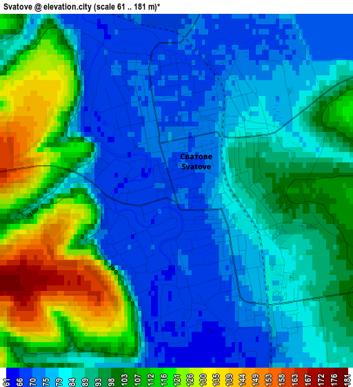
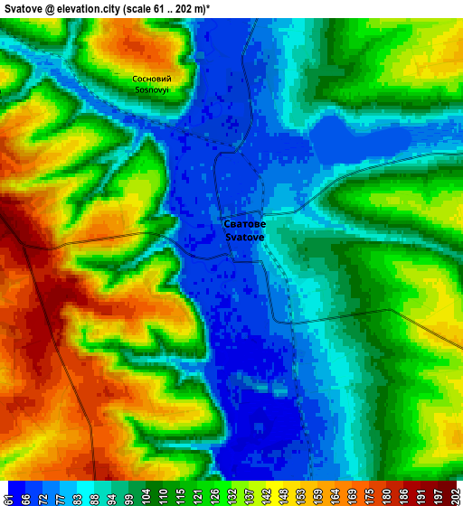
Below is the Elevation map of Svatove, which displays elevation range with different colors. Scale of the first map is from 61 to 181 m (200 to 594 ft) with average elevation of 90.9 meters (=298 ft) [note 1]
These maps also provides idea of topography and contour of this city, they are displayed at different zoom levels. More info about maps, scale and edge coordinates you can find below images.
| \ | Map #1 | Map #2 | Topo.Map |
| Scale [m] | 61..181 m | 61..202 m | × |
| Scale [ft] | 200..594 ft | 200..663 ft | × |
| Average | 90.9 m = 298 ft | 114.2 m = 375 ft | × |
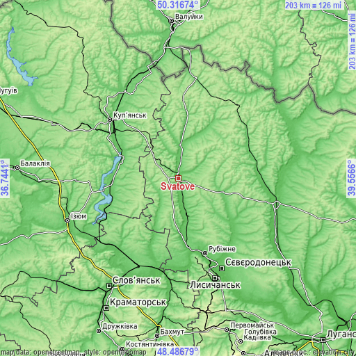
| Width | 6.36 km = 4 mi | 12.72 km = 7.9 mi | 203.5 km = 126.4 mi |
| Height | 6.36 km = 4 mi | 12.72 km = 7.9 mi | 203.5 km = 126.4 mi |
| ↑Max Latitude | 49.438874° | 49.467442° | 50.31674° |
| Latitude at center | 49.41029° | 49.41029° | 49.41029° |
| ↓Min Latitude | 49.381689° | 49.353072° | 48.48679° |
| ← Min Longitude | 38.106405° | 38.062459° | 36.7441° |
| Longitude center | 38.15035° | 38.15035° | 38.15035° |
| →Max Longitude | 38.194295° | 38.238241° | 39.5566° |
Nearby cities:
Cities around Svatove sort by population:
• Rubizhne elevation 73 m
47.3 km,  159°
159°
• Kupjansk 92 m
51 km,  310°
310°
• Kreminna 62 m
40.4 km,  173°
173°
• Kivsharivka 95 m
41.4 km, 306°
• Pryvillya 71 m
45.4 km, 165°
• Bilokurakyne 88 m
44.1 km,  71°
71°
• Borova 88 m
38.5 km,  264°
264°
• Nyzhnya Duvanka 79 m
19.5 km,  5°
5°
• Pavlivka 94 m
46 km,  61°
61°
• Novoselivka 103 m
50.2 km,  221°
221°
• Zarichne 71 m
45.9 km,  200°
200°
• Terny 76 m
37.9 km, 201°
Multilingual:
 En español:
Svatove elevación 70 m.
 En France:
Svatove élévation 70 m.


Sources and notes:
- [note 1] Map square and city borders are not equal. Map elevation data is calculated only from area inside that square.
- [src 1] Elevation data from geonames database provided with same terms of usage.
- [src 2] The elevation map of Svatove is generated using elevation data from NASA's 3 arcsec (90m) resolution SRTM data.
- [src 3] Base (background) map © OpenStreetMap contributors tiles are generated by Geofabrik and OpenTopoMap.
Copyright & License:
This Svatove Elevation Map is licensed under CC BY-SA. You may reuse any part from this page, if you give a proper credit by linking to this URL:
 More info on terms of use page.