Drofino elevation
Drofino (Republic of Crimea, Nizhnegorskiy rayon), Ukraine elevation is 62 meters and Drofino elevation in feet is 203 ft above sea level [src 1]. Drofino is a seat of a third-order administrative division (feature code) with elevation that is 95 meters (312 ft) smaller than average city elevation in Ukraine.
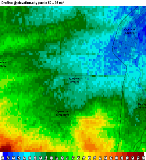
Below is the Elevation map of Drofino, which displays elevation range with different colors. Scale of the first map is from 50 to 95 m (164 to 312 ft) with average elevation of 65.4 meters (=215 ft) [note 1]
These maps also provides idea of topography and contour of this city, they are displayed at different zoom levels. More info about maps, scale and edge coordinates you can find below images.
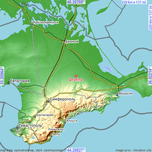
| \ | Map #1 | Topo.Map |
| Scale [m] | 50..95 m | × |
| Scale [ft] | 164..312 ft | × |
| Average | 65.4 m = 215 ft | × |
| Width | 6.88 km = 4.3 mi | 220 km = 136.7 mi |
| Height | 6.88 km = 4.3 mi | 220 km = 136.7 mi |
| ↑Max Latitude | 45.3172° | 46.26705° |
| Latitude at center | 45.28629° | 45.28629° |
| ↓Min Latitude | 45.255363° | 44.28827° |
| ← Min Longitude | 34.571945° | 33.20964° |
| Longitude center | 34.61589° | 34.61589° |
| →Max Longitude | 34.659835° | 36.02214° |
Nearby cities:
Cities around Drofino sort by population:
• Sadovoye elevation 53 m
3.9 km,  46°
46°
• Zhelyabovka 30 m
16.7 km,  41°
41°
• Prudy 87 m
8.5 km,  127°
127°
• Vishennoye 141 m
15.8 km,  185°
185°
• Zavetnoye 37 m
15.7 km,  73°
73°
• Naydenovka 100 m
13.2 km,  262°
262°
• Zybiny 81 m
6.1 km,  154°
154°
• Zernovoye 76 m
11.3 km,  291°
291°
• Zhemchuzhina 66 m
3.5 km,  111°
111°
• Kostochkovka 51 m
5.7 km, 52°
• Mel’nichnoye 158 m
18.2 km,  237°
237°
• Ivanovka 37 m
12.7 km, 39°
Multilingual:
 En español:
Drofino elevación 62 m.
 En France:
Drofino élévation 62 m.


Sources and notes:
- [note 1] Map square and city borders are not equal. Map elevation data is calculated only from area inside that square.
- [src 1] Elevation data from geonames database provided with same terms of usage.
- [src 2] The elevation map of Drofino is generated using elevation data from NASA's 3 arcsec (90m) resolution SRTM data.
- [src 3] Base (background) map © OpenStreetMap contributors tiles are generated by Geofabrik and OpenTopoMap.
Copyright & License:
This Drofino Elevation Map is licensed under CC BY-SA. You may reuse any part from this page, if you give a proper credit by linking to this URL:
 More info on terms of use page.