Kirando elevation
Kirando (Rukwa, Nkasi), Tanzania elevation is 773 meters and Kirando elevation in feet is 2536 ft above sea level [src 1]. Kirando is a populated place (feature code) with elevation that is 170 meters (558 ft) smaller than average city elevation in Tanzania.
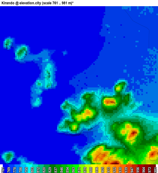
Below is the Elevation map of Kirando, which displays elevation range with different colors. Scale of the first map is from 761 to 981 m (2497 to 3219 ft) with average elevation of 786.4 meters (=2580 ft) [note 1]
These maps also provides idea of topography and contour of this city, they are displayed at different zoom levels. More info about maps, scale and edge coordinates you can find below images.
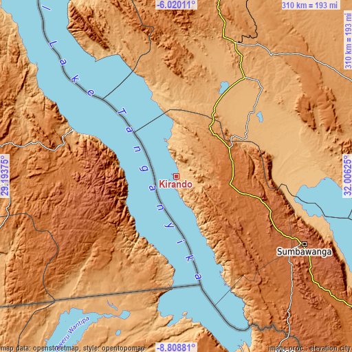
| \ | Map #1 | Map #2 | Topo.Map |
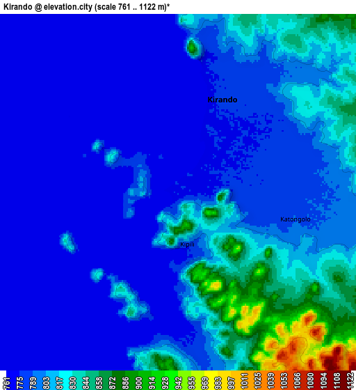
| Scale [m] | 761..981 m | 761..1122 m | × |
| Scale [ft] | 2497..3219 ft | 2497..3681 ft | × |
| Average | 786.4 m = 2580 ft | 798.6 m = 2620 ft | × |
| Width | 9.69 km = 6 mi | 19.38 km = 12 mi | 310.1 km = 192.7 mi |
| Height | 9.69 km = 6 mi | 19.38 km = 12 mi | 310.1 km = 192.7 mi |
| ↑Max Latitude | -7.37309° | -7.329506° | -6.02011° |
| Latitude at center | -7.41667° | -7.41667° | -7.41667° |
| ↓Min Latitude | -7.460245° | -7.503817° | -8.80881° |
| ← Min Longitude | 30.556055° | 30.512109° | 29.19375° |
| Longitude center | 30.6° | 30.6° | 30.6° |
| →Max Longitude | 30.643945° | 30.687891° | 32.00625° |
Nearby cities:
Cities around Kirando sort by population:
• Sumbawanga elevation 1833 m
127.6 km,  118°
118°
• Mpanda 1100 m
130.1 km,  23°
23°
• Nguruka 1081 m
261.2 km,  10°
10°
• Namanyere 1531 m
50.8 km,  102°
102°
• Uvinza 996 m
258.2 km,  354°
354°
• Matai 1706 m
140.9 km,  134°
134°
• Chala 1765 m
75.8 km, 104°
• Laela 1564 m
204.5 km, 128°
• Usevia 928 m
78.2 km,  63°
63°
• Karema 777 m
68.6 km,  344°
344°
• Inyonga 1177 m
179.6 km, 64°
• Nkove 813 m
65.4 km,  155°
155°
Multilingual:
 En español:
Kirando elevación 773 m.
 En France:
Kirando élévation 773 m.


Sources and notes:
- [note 1] Map square and city borders are not equal. Map elevation data is calculated only from area inside that square.
- [src 1] Elevation data from geonames database provided with same terms of usage.
- [src 2] The elevation map of Kirando is generated using elevation data from NASA's 3 arcsec (90m) resolution SRTM data.
- [src 3] Base (background) map © OpenStreetMap contributors tiles are generated by Geofabrik and OpenTopoMap.
Copyright & License:
This Kirando Elevation Map is licensed under CC BY-SA. You may reuse any part from this page, if you give a proper credit by linking to this URL:
 More info on terms of use page.