Mwaya elevation
Mwaya (Mbeya, Kyela), Tanzania elevation is 479 meters and Mwaya elevation in feet is 1572 ft above sea level [src 1]. Mwaya is a populated place (feature code) with elevation that is 464 meters (1522 ft) smaller than average city elevation in Tanzania.
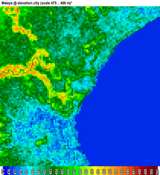
Below is the Elevation map of Mwaya, which displays elevation range with different colors. Scale of the first map is from 475 to 496 m (1558 to 1627 ft) with average elevation of 480 meters (=1575 ft) [note 1]
These maps also provides idea of topography and contour of this city, they are displayed at different zoom levels. More info about maps, scale and edge coordinates you can find below images.
| \ | Map #1 | Map #2 | Topo.Map |
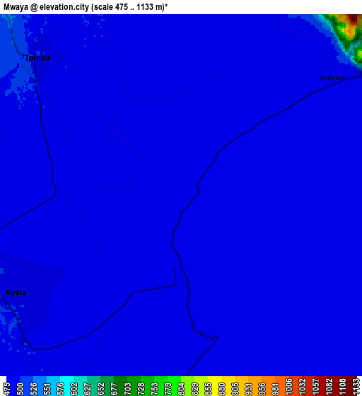
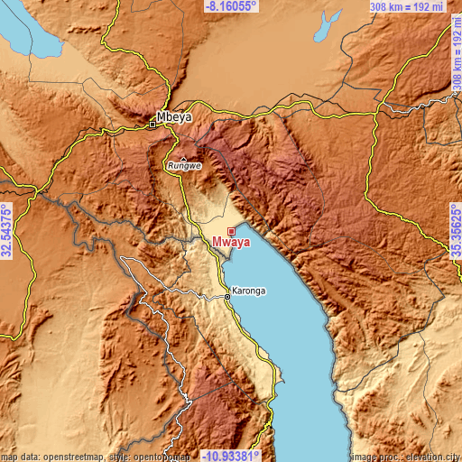
| Scale [m] | 475..496 m | 475..1133 m | × |
| Scale [ft] | 1558..1627 ft | 1558..3717 ft | × |
| Average | 480 m = 1575 ft | 486.1 m = 1595 ft | × |
| Width | 9.64 km = 6 mi | 19.27 km = 12 mi | 308.4 km = 191.6 mi |
| Height | 9.64 km = 6 mi | 19.27 km = 12 mi | 308.4 km = 191.6 mi |
| ↑Max Latitude | -9.506661° | -9.463316° | -8.16055° |
| Latitude at center | -9.55° | -9.55° | -9.55° |
| ↓Min Latitude | -9.593334° | -9.636662° | -10.93381° |
| ← Min Longitude | 33.906055° | 33.862109° | 32.54375° |
| Longitude center | 33.95° | 33.95° | 33.95° |
| →Max Longitude | 33.993945° | 34.037891° | 35.35625° |
Nearby cities:
Cities around Mwaya sort by population:
• Katumba elevation 1387 m
50.8 km,  313°
313°
• Kyela 498 m
11.6 km,  251°
251°
• Tukuyu 1431 m
46.9 km,  315°
315°
• Chimala 1143 m
77.6 km,  6°
6°
• Kiwira 1360 m
61.4 km, 313°
• Ipinda 490 m
9.2 km, 323°
• Mlangali 1739 m
67.3 km,  112°
112°
• Masoko 887 m
32.6 km, 317°
• Ulenje 1929 m
74.6 km,  336°
336°
• Matamba 2088 m
63 km,  1°
1°
• Kandete 1578 m
47.4 km, 339°
• Ilembo 1954 m
70.5 km,  298°
298°
Multilingual:
 En español:
Mwaya elevación 479 m.
 En France:
Mwaya élévation 479 m.


Sources and notes:
- [note 1] Map square and city borders are not equal. Map elevation data is calculated only from area inside that square.
- [src 1] Elevation data from geonames database provided with same terms of usage.
- [src 2] The elevation map of Mwaya is generated using elevation data from NASA's 3 arcsec (90m) resolution SRTM data.
- [src 3] Base (background) map © OpenStreetMap contributors tiles are generated by Geofabrik and OpenTopoMap.
Copyright & License:
This Mwaya Elevation Map is licensed under CC BY-SA. You may reuse any part from this page, if you give a proper credit by linking to this URL:
 More info on terms of use page.