Naberera elevation
Naberera (Manyara, Simanjiro), Tanzania elevation is 1430 meters and Naberera elevation in feet is 4692 ft above sea level [src 1]. Naberera is a populated place (feature code) with elevation that is 487 meters (1598 ft) bigger than average city elevation in Tanzania.
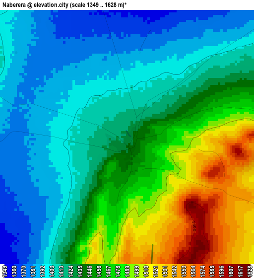
Below is the Elevation map of Naberera, which displays elevation range with different colors. Scale of the first map is from 1349 to 1628 m (4426 to 5341 ft) with average elevation of 1438.1 meters (=4718 ft) [note 1]
These maps also provides idea of topography and contour of this city, they are displayed at different zoom levels. More info about maps, scale and edge coordinates you can find below images.
| \ | Map #1 | Map #2 | Topo.Map |
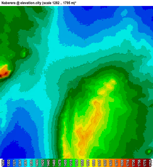
| Scale [m] | 1349..1628 m | 1282..1795 m | × |
| Scale [ft] | 4426..5341 ft | 4206..5889 ft | × |
| Average | 1438.1 m = 4718 ft | 1419.9 m = 4658 ft | × |
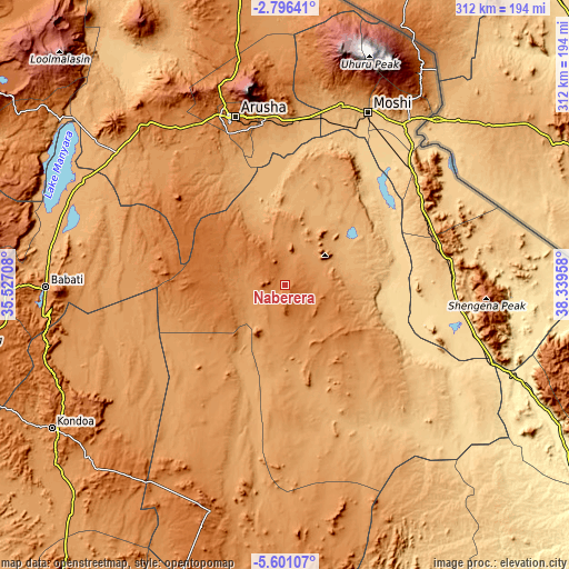
| Width | 9.75 km = 6.1 mi | 19.49 km = 12.1 mi | 311.8 km = 193.7 mi |
| Height | 9.75 km = 6.1 mi | 19.49 km = 12.1 mi | 311.9 km = 193.8 mi |
| ↑Max Latitude | -4.156171° | -4.112341° | -2.79641° |
| Latitude at center | -4.2° | -4.2° | -4.2° |
| ↓Min Latitude | -4.243826° | -4.28765° | -5.60107° |
| ← Min Longitude | 36.889385° | 36.845439° | 35.52708° |
| Longitude center | 36.93333° | 36.93333° | 36.93333° |
| →Max Longitude | 36.977275° | 37.021221° | 38.33958° |
Nearby cities:
Cities around Naberera sort by population:
• Arusha elevation 1415 m
96.7 km,  343°
343°
• Merelani 916 m
71.1 km,  4°
4°
• Usa River 1197 m
93.1 km,  354°
354°
• Same 867 m
90 km,  80°
80°
• Mbuguni 921 m
70.4 km, 1°
• Lembeni 979 m
88.8 km,  58°
58°
• Nkoaranga 1644 m
97.5 km, 351°
• Poli 1644 m
97.5 km, 351°
• Makanya 681 m
101.5 km,  100°
100°
• Mwembe 1009 m
101.8 km,  86°
86°
• Kwakoa 775 m
99.4 km, 60°
• Kirya 659 m
68.7 km, 62°
Multilingual:
 En español:
Naberera elevación 1430 m.
 En France:
Naberera élévation 1430 m.
 Auf Deutsch:
Naberera höhe über dem Meeresspiegel ist 1430 m.

Sources and notes:
- [note 1] Map square and city borders are not equal. Map elevation data is calculated only from area inside that square.
- [src 1] Elevation data from geonames database provided with same terms of usage.
- [src 2] The elevation map of Naberera is generated using elevation data from NASA's 3 arcsec (90m) resolution SRTM data.
- [src 3] Base (background) map © OpenStreetMap contributors tiles are generated by Geofabrik and OpenTopoMap.
Copyright & License:
This Naberera Elevation Map is licensed under CC BY-SA. You may reuse any part from this page, if you give a proper credit by linking to this URL:
 More info on terms of use page.