Hengchun elevation
Hengchun (Taiwan, Pingtung), Taiwan elevation is 25 meters and Hengchun elevation in feet is 82 ft above sea level [src 1]. Hengchun is a seat of a third-order administrative division (feature code) with elevation that is 54 meters (177 ft) smaller than average city elevation in Taiwan.
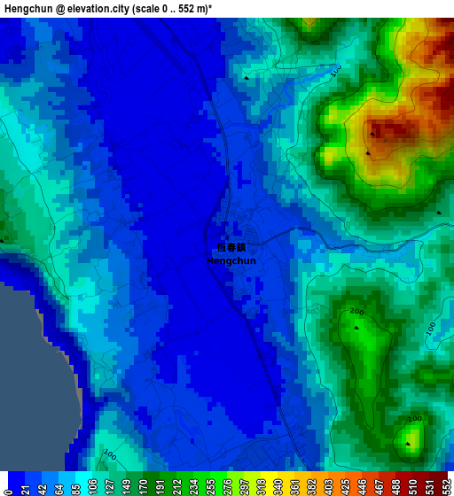
Below is the Elevation map of Hengchun, which displays elevation range with different colors. Scale of the first map is from 0 to 552 m (0 to 1811 ft) with average elevation of 93.7 meters (=307 ft) [note 1]
These maps also provides idea of topography and contour of this city, they are displayed at different zoom levels. More info about maps, scale and edge coordinates you can find below images.
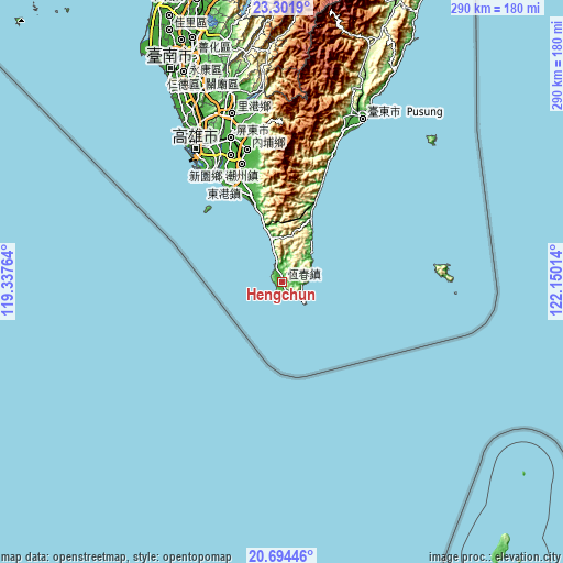
| \ | Map #1 | Map #2 | Topo.Map |
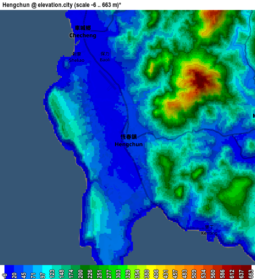
| Scale [m] | 0..552 m | -6..663 m | × |
| Scale [ft] | 0..1811 ft | -20..2175 ft | × |
| Average | 93.7 m = 307 ft | 113.7 m = 373 ft | × |
| Width | 9.06 km = 5.6 mi | 18.12 km = 11.3 mi | 289.9 km = 180.1 mi |
| Height | 9.06 km = 5.6 mi | 18.12 km = 11.3 mi | 289.9 km = 180.1 mi |
| ↑Max Latitude | 22.044908° | 22.085635° | 23.3019° |
| Latitude at center | 22.00417° | 22.00417° | 22.00417° |
| ↓Min Latitude | 21.96342° | 21.922658° | 20.69446° |
| ← Min Longitude | 120.699945° | 120.655999° | 119.33764° |
| Longitude center | 120.74389° | 120.74389° | 120.74389° |
| →Max Longitude | 120.787835° | 120.831781° | 122.15014° |
Nearby cities:
Cities around Hengchun sort by population:
• Kaohsiung elevation 9 m
81.2 km,  326°
326°
• Tainan 26 m
122.5 km, 333°
• Taitung City 19 m
93.4 km,  26°
26°
• Donggang 8 m
59.6 km, 329°
• Yujing 67 m
127.9 km,  346°
346°
• Pizitou 38 m
167.5 km, 349°
• Taibao 11 m
167.2 km, 345°
• Jiayi Shi 45 m
166.8 km, 349°
• Xinying 19 m
151.5 km,  342°
342°
• Taitung 20 m
93.6 km, 26°
• Fengshan 19 m
79.6 km, 330°
• Pingtung 32 m
78.7 km, 340°
Multilingual:
 En español:
Hengchun elevación 25 m.
 En France:
Hengchun élévation 25 m.


Sources and notes:
- [note 1] Map square and city borders are not equal. Map elevation data is calculated only from area inside that square.
- [src 1] Elevation data from geonames database provided with same terms of usage.
- [src 2] The elevation map of Hengchun is generated using elevation data from NASA's 3 arcsec (90m) resolution SRTM data.
- [src 3] Base (background) map © OpenStreetMap contributors tiles are generated by Geofabrik and OpenTopoMap.
Copyright & License:
This Hengchun Elevation Map is licensed under CC BY-SA. You may reuse any part from this page, if you give a proper credit by linking to this URL:
 More info on terms of use page.