Erdek elevation
Erdek (Balıkesir), Turkey elevation is 28 meters and Erdek elevation in feet is 92 ft above sea level [src 1]. Erdek is a seat of a second-order administrative division (feature code) with elevation that is 695 meters (2280 ft) smaller than average city elevation in Turkey.
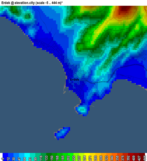
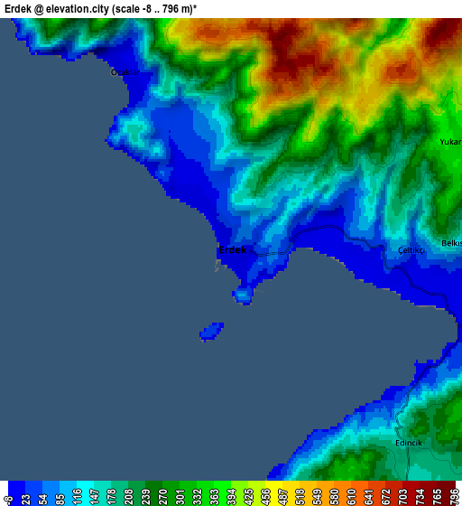
Below is the Elevation map of Erdek, which displays elevation range with different colors. Scale of the first map is from -5 to 444 m (-16 to 1457 ft) with average elevation of 90.2 meters (=296 ft) [note 1]
These maps also provides idea of topography and contour of this city, they are displayed at different zoom levels. More info about maps, scale and edge coordinates you can find below images.
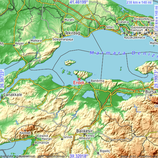
| \ | Map #1 | Map #2 | Topo.Map |
| Scale [m] | -5..444 m | -8..796 m | × |
| Scale [ft] | -16..1457 ft | -26..2612 ft | × |
| Average | 90.2 m = 296 ft | 235.5 m = 773 ft | × |
| Width | 7.44 km = 4.6 mi | 14.88 km = 9.2 mi | 238.1 km = 147.9 mi |
| Height | 7.44 km = 4.6 mi | 14.88 km = 9.2 mi | 238.1 km = 147.9 mi |
| ↑Max Latitude | 40.433058° | 40.466499° | 41.46199° |
| Latitude at center | 40.3996° | 40.3996° | 40.3996° |
| ↓Min Latitude | 40.366125° | 40.332634° | 39.32018° |
| ← Min Longitude | 27.749535° | 27.705589° | 26.38723° |
| Longitude center | 27.79348° | 27.79348° | 27.79348° |
| →Max Longitude | 27.837425° | 27.881371° | 29.19973° |
Nearby cities:
Cities around Erdek sort by population:
• Bandırma elevation 40 m
16.4 km,  108°
108°
• Gönen 40 m
34.8 km,  199°
199°
• Manyas 55 m
42 km,  159°
159°
• Marmara 22 m
28.9 km,  315°
315°
• Karabiga 9 m
41.5 km,  270°
270°
• Aksakal 54 m
38.6 km,  136°
136°
• Tütüncü 87 m
37.5 km,  189°
189°
• Sinekçi 66 m
35.8 km,  246°
246°
• Şevketiye 152 m
34.3 km,  172°
172°
• Sarıköy 36 m
27.1 km,  218°
218°
• Buğdaylı 121 m
20.2 km, 185°
• Edincik 185 m
8.6 km, 137°
Multilingual:
 En español:
Erdek elevación 28 m.
 En France:
Erdek élévation 28 m.


Sources and notes:
- [note 1] Map square and city borders are not equal. Map elevation data is calculated only from area inside that square.
- [src 1] Elevation data from geonames database provided with same terms of usage.
- [src 2] The elevation map of Erdek is generated using elevation data from NASA's 3 arcsec (90m) resolution SRTM data.
- [src 3] Base (background) map © OpenStreetMap contributors tiles are generated by Geofabrik and OpenTopoMap.
Copyright & License:
This Erdek Elevation Map is licensed under CC BY-SA. You may reuse any part from this page, if you give a proper credit by linking to this URL:
 More info on terms of use page.