Köseköy elevation
Köseköy (Kocaeli), Turkey elevation is 15 meters and Köseköy elevation in feet is 49 ft above sea level [src 1]. Köseköy is a populated place (feature code) with elevation that is 708 meters (2323 ft) smaller than average city elevation in Turkey.
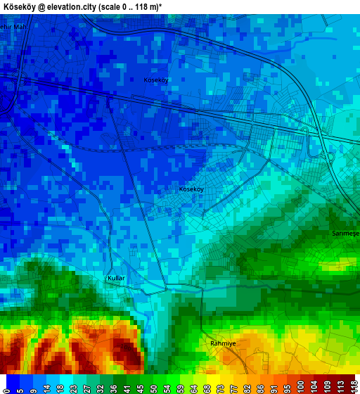
Below is the Elevation map of Köseköy, which displays elevation range with different colors. Scale of the first map is from 0 to 118 m (0 to 387 ft) with average elevation of 26 meters (=85 ft) [note 1]
These maps also provides idea of topography and contour of this city, they are displayed at different zoom levels. More info about maps, scale and edge coordinates you can find below images.
| \ | Map #1 | Map #2 | Topo.Map |
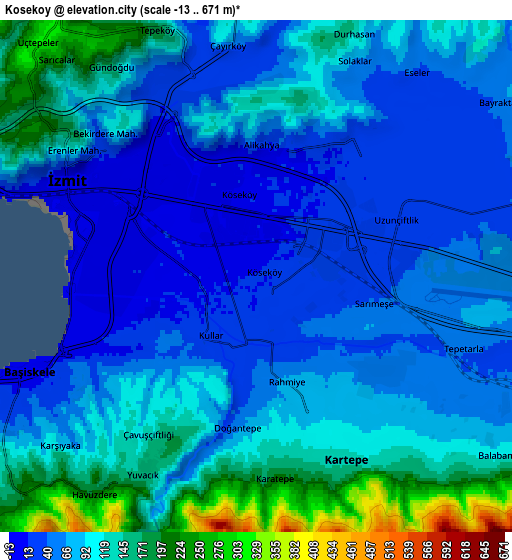
| Scale [m] | 0..118 m | -13..671 m | × |
| Scale [ft] | 0..387 ft | -43..2201 ft | × |
| Average | 26 m = 85 ft | 89.1 m = 292 ft | × |
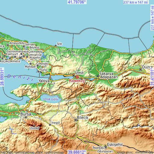
| Width | 7.4 km = 4.6 mi | 14.81 km = 9.2 mi | 236.9 km = 147.2 mi |
| Height | 7.4 km = 4.6 mi | 14.81 km = 9.2 mi | 236.9 km = 147.2 mi |
| ↑Max Latitude | 40.773408° | 40.806679° | 41.79706° |
| Latitude at center | 40.74012° | 40.74012° | 40.74012° |
| ↓Min Latitude | 40.706815° | 40.673494° | 39.66612° |
| ← Min Longitude | 29.961615° | 29.917669° | 28.59931° |
| Longitude center | 30.00556° | 30.00556° | 30.00556° |
| →Max Longitude | 30.049505° | 30.093451° | 31.41181° |
Nearby cities:
Cities around Köseköy sort by population:
• İzmit elevation 95 m
7 km,  293°
293°
• Derince 42 m
16.2 km,  276°
276°
• Körfez 57 m
19 km, 279°
• Gölcük 19 m
12 km,  249°
249°
• İhsaniye 71 m
15.4 km, 249°
• Kullar 19 m
2.2 km,  217°
217°
• Bahçecik 268 m
11.1 km, 223°
• Yuvacık 166 m
6.6 km,  209°
209°
• Karşıyaka 112 m
7.5 km,  226°
226°
• Akmeşe 184 m
20.3 km,  53°
53°
• Değirmendere 17 m
19.1 km,  263°
263°
• Büyükderbent 50 m
9.9 km,  111°
111°
Multilingual:
 En español:
Köseköy elevación 15 m.
 En France:
Köseköy élévation 15 m.


Sources and notes:
- [note 1] Map square and city borders are not equal. Map elevation data is calculated only from area inside that square.
- [src 1] Elevation data from geonames database provided with same terms of usage.
- [src 2] The elevation map of Köseköy is generated using elevation data from NASA's 3 arcsec (90m) resolution SRTM data.
- [src 3] Base (background) map © OpenStreetMap contributors tiles are generated by Geofabrik and OpenTopoMap.
Copyright & License:
This Köseköy Elevation Map is licensed under CC BY-SA. You may reuse any part from this page, if you give a proper credit by linking to this URL:
 More info on terms of use page.