Lapseki elevation
Lapseki (Canakkale), Turkey elevation is 24 meters and Lapseki elevation in feet is 79 ft above sea level [src 1]. Lapseki is a seat of a second-order administrative division (feature code) with elevation that is 699 meters (2293 ft) smaller than average city elevation in Turkey.
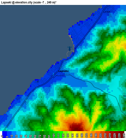
Below is the Elevation map of Lapseki, which displays elevation range with different colors. Scale of the first map is from -7 to 249 m (-23 to 817 ft) with average elevation of 63.1 meters (=207 ft) [note 1]
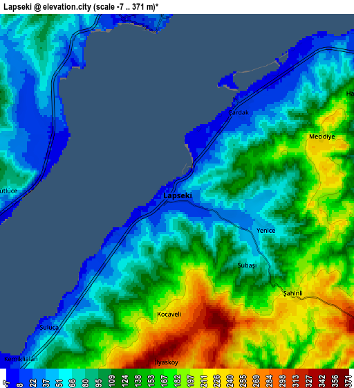
These maps also provides idea of topography and contour of this city, they are displayed at different zoom levels. More info about maps, scale and edge coordinates you can find below images.
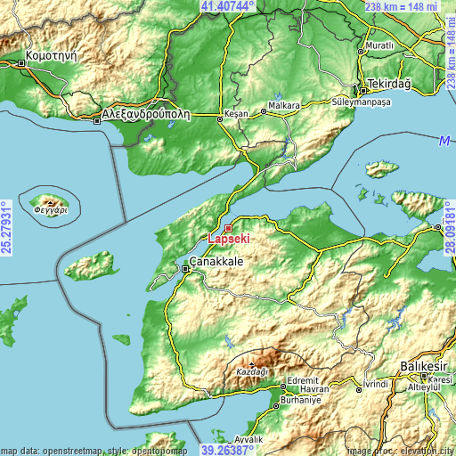
| \ | Map #1 | Map #2 | Topo.Map |
| Scale [m] | -7..249 m | -7..371 m | × |
| Scale [ft] | -23..817 ft | -23..1217 ft | × |
| Average | 63.1 m = 207 ft | 118.5 m = 389 ft | × |
| Width | 7.45 km = 4.6 mi | 14.9 km = 9.3 mi | 238.3 km = 148.1 mi |
| Height | 7.45 km = 4.6 mi | 14.9 km = 9.3 mi | 238.3 km = 148.1 mi |
| ↑Max Latitude | 40.377655° | 40.411124° | 41.40744° |
| Latitude at center | 40.34417° | 40.34417° | 40.34417° |
| ↓Min Latitude | 40.310668° | 40.277149° | 39.26387° |
| ← Min Longitude | 26.641615° | 26.597669° | 25.27931° |
| Longitude center | 26.68556° | 26.68556° | 26.68556° |
| →Max Longitude | 26.729505° | 26.773451° | 28.09181° |
Nearby cities:
Cities around Lapseki sort by population:
• Çanakkale elevation 12 m
31.2 km,  227°
227°
• Gelibolu 29 m
7.5 km,  350°
350°
• Eceabat 9 m
33 km,  237°
237°
• Bakacak 42 m
37.1 km,  114°
114°
• Gündoğdu 46 m
35.7 km,  104°
104°
• Mecidiye 38 m
35 km,  339°
339°
• Balıklıçeşme 68 m
33.8 km, 96°
• Kirazlı 382 m
33.7 km,  177°
177°
• Merkez 11 m
32.8 km,  223°
223°
• Beyçayırı 462 m
22.5 km,  116°
116°
• Bolayır 100 m
20 km,  17°
17°
• Umurbey 112 m
14 km,  208°
208°
Multilingual:
 En español:
Lapseki elevación 24 m.
 En France:
Lapseki élévation 24 m.


Sources and notes:
- [note 1] Map square and city borders are not equal. Map elevation data is calculated only from area inside that square.
- [src 1] Elevation data from geonames database provided with same terms of usage.
- [src 2] The elevation map of Lapseki is generated using elevation data from NASA's 3 arcsec (90m) resolution SRTM data.
- [src 3] Base (background) map © OpenStreetMap contributors tiles are generated by Geofabrik and OpenTopoMap.
Copyright & License:
This Lapseki Elevation Map is licensed under CC BY-SA. You may reuse any part from this page, if you give a proper credit by linking to this URL:
 More info on terms of use page.