Antalya elevation
Antalya, Turkey elevation is 61 meters and Antalya elevation in feet is 200 ft above sea level [src 1]. Antalya is a seat of a first-order administrative division (feature code) with elevation that is 662 meters (2172 ft) smaller than average city elevation in Turkey.
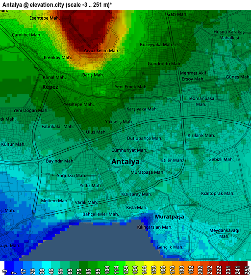
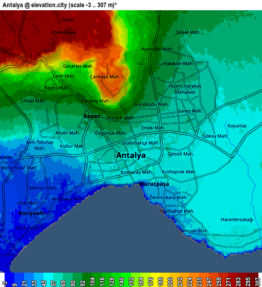
Below is the Elevation map of Antalya, which displays elevation range with different colors. Scale of the first map is from -3 to 251 m (-10 to 823 ft) with average elevation of 72.5 meters (=238 ft) [note 1]
These maps also provides idea of topography and contour of this city, they are displayed at different zoom levels. More info about maps, scale and edge coordinates you can find below images.
| \ | Map #1 | Map #2 | Topo.Map |
| Scale [m] | -3..251 m | -3..307 m | × |
| Scale [ft] | -10..823 ft | -10..1007 ft | × |
| Average | 72.5 m = 238 ft | 91.7 m = 301 ft | × |
| Width | 7.81 km = 4.9 mi | 15.63 km = 9.7 mi | 250 km = 155.3 mi |
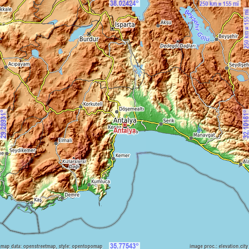
| Height | 7.81 km = 4.9 mi | 15.63 km = 9.7 mi | 250 km = 155.3 mi |
| ↑Max Latitude | 36.943251° | 36.978365° | 38.02424° |
| Latitude at center | 36.90812° | 36.90812° | 36.90812° |
| ↓Min Latitude | 36.872973° | 36.83781° | 35.77543° |
| ← Min Longitude | 30.651615° | 30.607669° | 29.28931° |
| Longitude center | 30.69556° | 30.69556° | 30.69556° |
| →Max Longitude | 30.739505° | 30.783451° | 32.10181° |
Nearby cities:
Cities around Antalya sort by population:
• Muratpaşa elevation 53 m
6.4 km,  106°
106°
• Belek 8 m
32.4 km,  98°
98°
• Serik 28 m
35.9 km,  88°
88°
• Göynük 53 m
30.5 km,  205°
205°
• Kumköy 3 m
23 km, 97°
• Dağ 797 m
35.9 km,  331°
331°
• Gebiz 58 m
30.6 km,  44°
44°
• Döşemealtı 303 m
15.2 km, 327°
• Aksu 63 m
14.5 km,  69°
69°
• Çakırlar 45 m
12.6 km,  251°
251°
• Konyaaltı 15 m
7.4 km,  231°
231°
• Kepez 62 m
1.4 km,  51°
51°
Multilingual:
 En español:
Antalya elevación 61 m.
 En France:
Antalya élévation 61 m.


Sources and notes:
- [note 1] Map square and city borders are not equal. Map elevation data is calculated only from area inside that square.
- [src 1] Elevation data from geonames database provided with same terms of usage.
- [src 2] The elevation map of Antalya is generated using elevation data from NASA's 3 arcsec (90m) resolution SRTM data.
- [src 3] Base (background) map © OpenStreetMap contributors tiles are generated by Geofabrik and OpenTopoMap.
Copyright & License:
This Antalya Elevation Map is licensed under CC BY-SA. You may reuse any part from this page, if you give a proper credit by linking to this URL:
 More info on terms of use page.