İbradı elevation
İbradı (Antalya), Turkey elevation is 1031 meters and İbradı elevation in feet is 3383 ft above sea level [src 1]. İbradı is a seat of a second-order administrative division (feature code) with elevation that is 308 meters (1010 ft) bigger than average city elevation in Turkey.
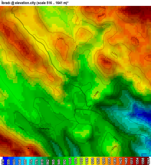
Below is the Elevation map of İbradı, which displays elevation range with different colors. Scale of the first map is from 516 to 1641 m (1693 to 5384 ft) with average elevation of 1126.8 meters (=3697 ft) [note 1]
These maps also provides idea of topography and contour of this city, they are displayed at different zoom levels. More info about maps, scale and edge coordinates you can find below images.
| \ | Map #1 | Map #2 | Topo.Map |
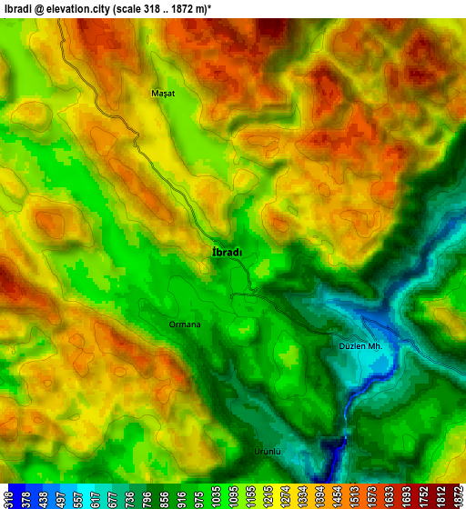
| Scale [m] | 516..1641 m | 318..1872 m | × |
| Scale [ft] | 1693..5384 ft | 1043..6142 ft | × |
| Average | 1126.8 m = 3697 ft | 1151.3 m = 3777 ft | × |
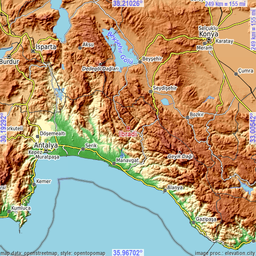
| Width | 7.79 km = 4.8 mi | 15.59 km = 9.7 mi | 249.4 km = 155 mi |
| Height | 7.79 km = 4.8 mi | 15.59 km = 9.7 mi | 249.4 km = 155 mi |
| ↑Max Latitude | 37.131983° | 37.167011° | 38.21026° |
| Latitude at center | 37.09694° | 37.09694° | 37.09694° |
| ↓Min Latitude | 37.06188° | 37.026805° | 35.96702° |
| ← Min Longitude | 31.555225° | 31.511279° | 30.19292° |
| Longitude center | 31.59917° | 31.59917° | 31.59917° |
| →Max Longitude | 31.643115° | 31.687061° | 33.00542° |
Nearby cities:
Cities around İbradı sort by population:
• Manavgat elevation 9 m
37.2 km,  201°
201°
• Akseki 1105 m
17.8 km,  107°
107°
• Side 15 m
41.2 km,  206°
206°
• Derebucak 1229 m
33.7 km,  346°
346°
• Evrenseki 23 m
36 km,  217°
217°
• Kızılağaç 18 m
41.1 km,  187°
187°
• Gencek 1433 m
39.5 km, 353°
• Taşağıl 86 m
37.6 km,  238°
238°
• Beşkonak 141 m
35.9 km,  278°
278°
• Güzelsu 1191 m
32.1 km,  134°
134°
• Geriş 922 m
19.1 km,  141°
141°
• Cevizli 1101 m
18.3 km,  52°
52°
Multilingual:
 En español:
İbradı elevación 1031 m.
 En France:
İbradı élévation 1031 m.


Sources and notes:
- [note 1] Map square and city borders are not equal. Map elevation data is calculated only from area inside that square.
- [src 1] Elevation data from geonames database provided with same terms of usage.
- [src 2] The elevation map of İbradı is generated using elevation data from NASA's 3 arcsec (90m) resolution SRTM data.
- [src 3] Base (background) map © OpenStreetMap contributors tiles are generated by Geofabrik and OpenTopoMap.
Copyright & License:
This İbradı Elevation Map is licensed under CC BY-SA. You may reuse any part from this page, if you give a proper credit by linking to this URL:
 More info on terms of use page.