Burhaniye elevation
Burhaniye (Balıkesir), Turkey elevation is 21 meters and Burhaniye elevation in feet is 69 ft above sea level [src 1]. Burhaniye is a seat of a second-order administrative division (feature code) with elevation that is 702 meters (2303 ft) smaller than average city elevation in Turkey.
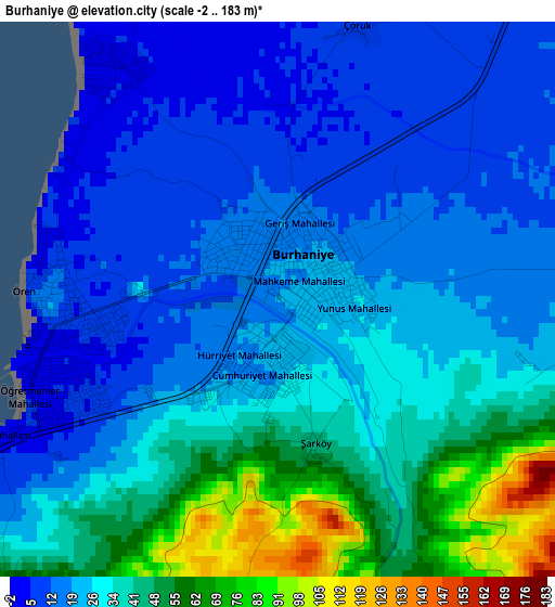
Below is the Elevation map of Burhaniye, which displays elevation range with different colors. Scale of the first map is from -2 to 183 m (-7 to 600 ft) with average elevation of 29.6 meters (=97 ft) [note 1]
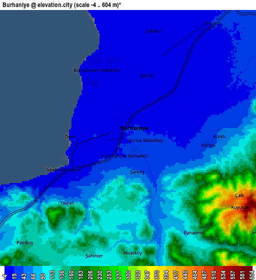
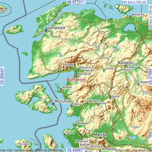
These maps also provides idea of topography and contour of this city, they are displayed at different zoom levels. More info about maps, scale and edge coordinates you can find below images.
| \ | Map #1 | Map #2 | Topo.Map |
| Scale [m] | -2..183 m | -4..604 m | × |
| Scale [ft] | -7..600 ft | -13..1982 ft | × |
| Average | 29.6 m = 97 ft | 78.7 m = 258 ft | × |
| Width | 7.54 km = 4.7 mi | 15.08 km = 9.4 mi | 241.3 km = 149.9 mi |
| Height | 7.54 km = 4.7 mi | 15.08 km = 9.4 mi | 241.3 km = 149.9 mi |
| ↑Max Latitude | 39.534311° | 39.568195° | 40.57701° |
| Latitude at center | 39.50041° | 39.50041° | 39.50041° |
| ↓Min Latitude | 39.466493° | 39.432559° | 38.40687° |
| ← Min Longitude | 26.928745° | 26.884799° | 25.56644° |
| Longitude center | 26.97269° | 26.97269° | 26.97269° |
| →Max Longitude | 27.016635° | 27.060581° | 28.37894° |
Nearby cities:
Cities around Burhaniye sort by population:
• Ayvalık elevation 63 m
31.3 km,  229°
229°
• Edremit 30 m
11.5 km,  22°
22°
• Altınoluk 120 m
22 km,  293°
293°
• Havran 42 m
12.6 km,  59°
59°
• Gömeç 16 m
16.7 km,  222°
222°
• Kalkım 232 m
40.3 km,  30°
30°
• Turanlı 232 m
39.1 km,  129°
129°
• Altınova 15 m
35.2 km,  206°
206°
• Evciler 242 m
35.1 km,  330°
330°
• Korucu 384 m
33.9 km,  95°
95°
• Küçükkuyu 14 m
32 km,  279°
279°
• Kozak 500 m
29.5 km,  159°
159°
Multilingual:
 En español:
Burhaniye elevación 21 m.
 En France:
Burhaniye élévation 21 m.
 Auf Deutsch:
Burhaniye höhe über dem Meeresspiegel ist 21 m.

Sources and notes:
- [note 1] Map square and city borders are not equal. Map elevation data is calculated only from area inside that square.
- [src 1] Elevation data from geonames database provided with same terms of usage.
- [src 2] The elevation map of Burhaniye is generated using elevation data from NASA's 3 arcsec (90m) resolution SRTM data.
- [src 3] Base (background) map © OpenStreetMap contributors tiles are generated by Geofabrik and OpenTopoMap.
Copyright & License:
This Burhaniye Elevation Map is licensed under CC BY-SA. You may reuse any part from this page, if you give a proper credit by linking to this URL:
 More info on terms of use page.