Gülnar elevation
Gülnar (Mersin), Turkey elevation is 977 meters and Gülnar elevation in feet is 3205 ft above sea level [src 1]. Gülnar is a seat of a second-order administrative division (feature code) with elevation that is 254 meters (833 ft) bigger than average city elevation in Turkey.
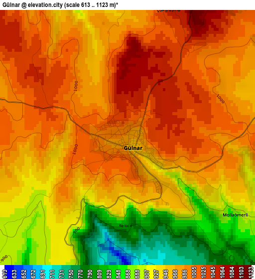
Below is the Elevation map of Gülnar, which displays elevation range with different colors. Scale of the first map is from 613 to 1123 m (2011 to 3684 ft) with average elevation of 958.6 meters (=3145 ft) [note 1]
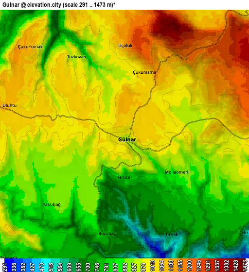
These maps also provides idea of topography and contour of this city, they are displayed at different zoom levels. More info about maps, scale and edge coordinates you can find below images.
| \ | Map #1 | Map #2 | Topo.Map |
| Scale [m] | 613..1123 m | 291..1473 m | × |
| Scale [ft] | 2011..3684 ft | 955..4833 ft | × |
| Average | 958.6 m = 3145 ft | 942 m = 3091 ft | × |
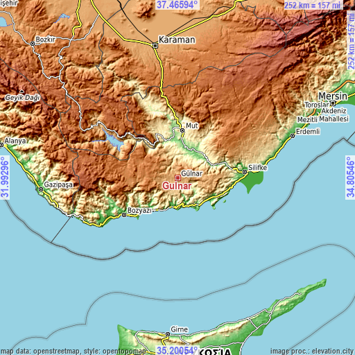
| Width | 7.87 km = 4.9 mi | 15.74 km = 9.8 mi | 251.9 km = 156.5 mi |
| Height | 7.87 km = 4.9 mi | 15.74 km = 9.8 mi | 251.9 km = 156.5 mi |
| ↑Max Latitude | 36.37687° | 36.412244° | 37.46594° |
| Latitude at center | 36.34148° | 36.34148° | 36.34148° |
| ↓Min Latitude | 36.306074° | 36.270652° | 35.20054° |
| ← Min Longitude | 33.355265° | 33.311319° | 31.99296° |
| Longitude center | 33.39921° | 33.39921° | 33.39921° |
| →Max Longitude | 33.443155° | 33.487101° | 34.80546° |
Nearby cities:
Cities around Gülnar sort by population:
• Silifke elevation 17 m
48.1 km,  85°
85°
• Anamur 28 m
58.5 km,  239°
239°
• Mut 311 m
33.8 km,  6°
6°
• Bozyazı 7 m
47.1 km, 236°
• Ermenek 1312 m
56.2 km,  306°
306°
• Aydıncık 29 m
23.1 km,  197°
197°
• Akdere 120 m
33.4 km,  109°
109°
• Kırobası 1410 m
59.5 km,  44°
44°
• Kazancı 1143 m
51.3 km,  290°
290°
• Taşucu 3 m
43.3 km, 92°
• Sarıkavak 747 m
34.4 km, 39°
• Ovacık 43 m
23.6 km,  143°
143°
Multilingual:
 En español:
Gülnar elevación 977 m.
 En France:
Gülnar élévation 977 m.


Sources and notes:
- [note 1] Map square and city borders are not equal. Map elevation data is calculated only from area inside that square.
- [src 1] Elevation data from geonames database provided with same terms of usage.
- [src 2] The elevation map of Gülnar is generated using elevation data from NASA's 3 arcsec (90m) resolution SRTM data.
- [src 3] Base (background) map © OpenStreetMap contributors tiles are generated by Geofabrik and OpenTopoMap.
Copyright & License:
This Gülnar Elevation Map is licensed under CC BY-SA. You may reuse any part from this page, if you give a proper credit by linking to this URL:
 More info on terms of use page.